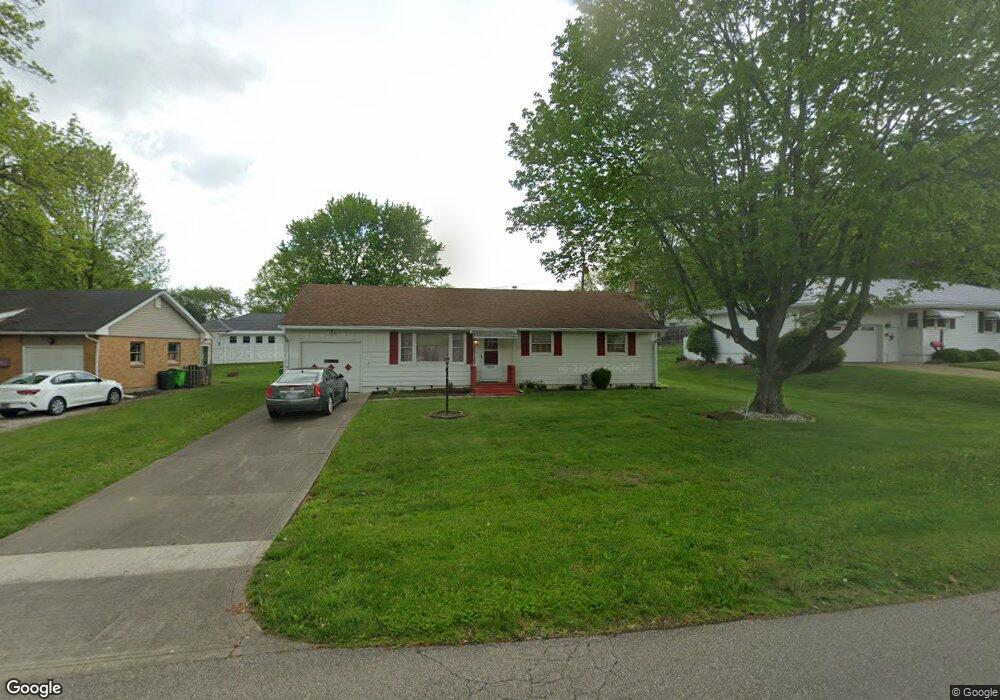
1820 Adams St Coshocton, OH 43812
Estimated Value: $140,473 - $172,000
3
Beds
2
Baths
1,032
Sq Ft
$154/Sq Ft
Est. Value
About This Home
This home is located at 1820 Adams St, Coshocton, OH 43812 and is currently estimated at $158,868, approximately $153 per square foot. 1820 Adams St is a home located in Coshocton County with nearby schools including Coshocton High School, Coshocton Opportunity School, and Sacred Heart Elementary School.
Ownership History
Date
Name
Owned For
Owner Type
Purchase Details
Closed on
May 25, 2006
Sold by
Cornelius David E and Cornelius Patricia A
Bought by
Dryer Darlene H
Current Estimated Value
Home Financials for this Owner
Home Financials are based on the most recent Mortgage that was taken out on this home.
Original Mortgage
$79,110
Outstanding Balance
$46,495
Interest Rate
6.66%
Mortgage Type
New Conventional
Estimated Equity
$112,373
Purchase Details
Closed on
Jun 14, 2004
Sold by
Cornelius David E
Bought by
Cornelius Family Trust
Purchase Details
Closed on
Oct 15, 2003
Sold by
Ott Jeri Lee
Bought by
Cornelius David E
Purchase Details
Closed on
Mar 19, 1993
Sold by
Croft Virginia L
Bought by
Ott Jeri Lee
Create a Home Valuation Report for This Property
The Home Valuation Report is an in-depth analysis detailing your home's value as well as a comparison with similar homes in the area
Home Values in the Area
Average Home Value in this Area
Purchase History
| Date | Buyer | Sale Price | Title Company |
|---|---|---|---|
| Dryer Darlene H | $21,750 | Fidelity Title Coshocton | |
| Cornelius Family Trust | -- | -- | |
| Cornelius David E | $72,500 | -- | |
| Ott Jeri Lee | $64,000 | -- |
Source: Public Records
Mortgage History
| Date | Status | Borrower | Loan Amount |
|---|---|---|---|
| Open | Dryer Darlene H | $79,110 |
Source: Public Records
Tax History Compared to Growth
Tax History
| Year | Tax Paid | Tax Assessment Tax Assessment Total Assessment is a certain percentage of the fair market value that is determined by local assessors to be the total taxable value of land and additions on the property. | Land | Improvement |
|---|---|---|---|---|
| 2024 | $1,689 | $40,910 | $8,790 | $32,120 |
| 2023 | $1,689 | $30,426 | $6,440 | $23,986 |
| 2022 | $1,450 | $30,426 | $6,440 | $23,986 |
| 2021 | $1,452 | $30,426 | $6,440 | $23,986 |
| 2020 | $1,512 | $30,675 | $6,276 | $24,399 |
| 2019 | $1,530 | $30,675 | $6,276 | $24,399 |
| 2018 | $1,387 | $30,675 | $6,276 | $24,399 |
| 2017 | $1,292 | $25,186 | $5,593 | $19,593 |
| 2016 | $1,239 | $25,186 | $5,593 | $19,593 |
| 2015 | $623 | $25,186 | $5,593 | $19,593 |
| 2014 | $1,104 | $24,094 | $5,593 | $18,501 |
Source: Public Records
Map
Nearby Homes