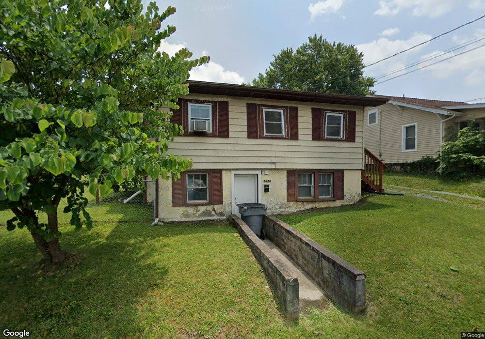
1820 Broad St Bristol, TN 37620
Estimated Value: $101,000 - $189,000
3
Beds
3
Baths
2,080
Sq Ft
$67/Sq Ft
Est. Value
About This Home
This home is located at 1820 Broad St, Bristol, TN 37620 and is currently estimated at $140,139, approximately $67 per square foot. 1820 Broad St is a home located in Sullivan County with nearby schools including Anderson Elementary School, Vance Middle School, and Tennessee High School.
Ownership History
Date
Name
Owned For
Owner Type
Purchase Details
Closed on
Jan 29, 2018
Sold by
Deal William A and Deal Gail H
Bought by
Hill Brittney Lynn and Gibson Crystal Gatle
Current Estimated Value
Home Financials for this Owner
Home Financials are based on the most recent Mortgage that was taken out on this home.
Original Mortgage
$58,000
Outstanding Balance
$16,173
Interest Rate
3.94%
Mortgage Type
Unknown
Estimated Equity
$123,966
Purchase Details
Closed on
Nov 15, 1986
Purchase Details
Closed on
Nov 14, 1986
Create a Home Valuation Report for This Property
The Home Valuation Report is an in-depth analysis detailing your home's value as well as a comparison with similar homes in the area
Home Values in the Area
Average Home Value in this Area
Purchase History
| Date | Buyer | Sale Price | Title Company |
|---|---|---|---|
| Hill Brittney Lynn | $58,000 | None Available | |
| -- | $30,200 | -- | |
| -- | $30,200 | -- |
Source: Public Records
Mortgage History
| Date | Status | Borrower | Loan Amount |
|---|---|---|---|
| Open | Hill Brittney Lynn | $58,000 |
Source: Public Records
Tax History Compared to Growth
Tax History
| Year | Tax Paid | Tax Assessment Tax Assessment Total Assessment is a certain percentage of the fair market value that is determined by local assessors to be the total taxable value of land and additions on the property. | Land | Improvement |
|---|---|---|---|---|
| 2024 | -- | $28,800 | $5,280 | $23,520 |
| 2023 | $1,265 | $28,800 | $5,280 | $23,520 |
| 2022 | $1,265 | $28,800 | $5,280 | $23,520 |
| 2021 | $1,265 | $28,800 | $5,280 | $23,520 |
| 2020 | $655 | $28,800 | $5,280 | $23,520 |
| 2019 | $1,206 | $25,480 | $5,280 | $20,200 |
| 2018 | $1,201 | $25,480 | $5,280 | $20,200 |
| 2017 | $1,201 | $25,480 | $5,280 | $20,200 |
| 2016 | $1,224 | $25,360 | $5,280 | $20,080 |
| 2014 | $1,155 | $25,349 | $0 | $0 |
Source: Public Records
Map
Nearby Homes
- 1614 Broad St
- 1443 Windsor Ave
- 2000 Euclid Ave
- 60 Peters St
- 1224 Shelby St
- 1227 Shelby St
- 311 12th St
- 1057 Moorland Ave
- 000 Hemlock Dr
- 1216 Norway St
- 1724 & 1728 Euclid Ave
- 420 Douglas St
- 2121 2123 Randolph St
- 2177 Randolph St
- 461 Douglas St
- 1020 Hill St
- 728 Randolph St
- 2412,14,16 Bradley St
- 2241 Bradley St
- 460 Vance St
- 1822 Broad St
- 1816 Broad St
- 1814 Broad St
- 1824 Broad St
- 1812 Broad St
- 1805 Anderson St
- 1826 Broad St
- 1807 Anderson St
- 1817 Broad St
- 1801 Anderson St
- 1809 Anderson St
- 1821 Broad St
- 1828 Broad St
- 1823 Broad St
- 1808 Broad St
- 1811 Anderson St
- 1825 Broad St
- 1834 Broad St
- 1719 Anderson St
- 1717 Anderson St