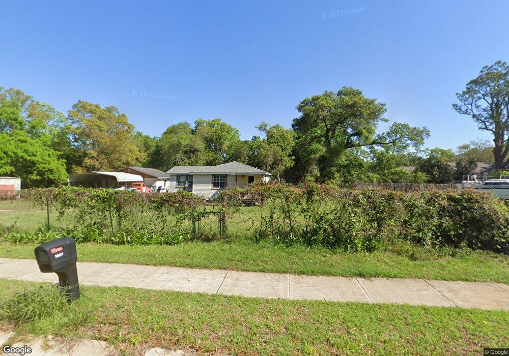
1820 Cairo St Pensacola, FL 32507
Warrington NeighborhoodEstimated Value: $140,000 - $181,000
--
Bed
1
Bath
1,518
Sq Ft
$111/Sq Ft
Est. Value
About This Home
This home is located at 1820 Cairo St, Pensacola, FL 32507 and is currently estimated at $168,891, approximately $111 per square foot. 1820 Cairo St is a home located in Escambia County with nearby schools including Navy Point Elementary School, Jim C. Bailey Middle School, and Escambia High School.
Ownership History
Date
Name
Owned For
Owner Type
Purchase Details
Closed on
May 27, 2005
Sold by
Burns Stephanie L and Burns Scott E
Bought by
Shipman Robert B and Shipman Beverly M
Current Estimated Value
Purchase Details
Closed on
May 12, 2000
Sold by
Cyr Darlene J and Ellena John E
Bought by
Burns Stephanie L and Burns Scott E
Home Financials for this Owner
Home Financials are based on the most recent Mortgage that was taken out on this home.
Original Mortgage
$39,000
Interest Rate
8.2%
Mortgage Type
New Conventional
Create a Home Valuation Report for This Property
The Home Valuation Report is an in-depth analysis detailing your home's value as well as a comparison with similar homes in the area
Home Values in the Area
Average Home Value in this Area
Purchase History
| Date | Buyer | Sale Price | Title Company |
|---|---|---|---|
| Shipman Robert B | $75,000 | First American Title Ins Co | |
| Burns Stephanie L | $60,000 | -- |
Source: Public Records
Mortgage History
| Date | Status | Borrower | Loan Amount |
|---|---|---|---|
| Previous Owner | Burns Stephanie L | $39,000 |
Source: Public Records
Tax History Compared to Growth
Tax History
| Year | Tax Paid | Tax Assessment Tax Assessment Total Assessment is a certain percentage of the fair market value that is determined by local assessors to be the total taxable value of land and additions on the property. | Land | Improvement |
|---|---|---|---|---|
| 2024 | $568 | $73,703 | -- | -- |
| 2023 | $568 | $71,557 | $0 | $0 |
| 2022 | $563 | $69,473 | $0 | $0 |
| 2021 | $570 | $67,450 | $0 | $0 |
| 2020 | $564 | $66,519 | $0 | $0 |
| 2019 | $560 | $65,024 | $0 | $0 |
| 2018 | $563 | $63,812 | $0 | $0 |
| 2017 | $566 | $62,500 | $0 | $0 |
| 2016 | $567 | $61,215 | $0 | $0 |
| 2015 | $547 | $60,790 | $0 | $0 |
| 2014 | $536 | $60,308 | $0 | $0 |
Source: Public Records
Map
Nearby Homes
- 1111 Polk Ave
- 1002 Polk Ave
- 9880 North St
- 1100 Blk Wayne Ave
- 902 Decatur Ave
- 907 Colbert Ave
- 7621 Old Hickory Dr
- 1285 Mills Ave
- 7600 Old Hickory Dr
- Palm A Exterior Plan at Ellie's Cove
- 1400 Maritime Dr
- Palm B Interior Plan at Ellie's Cove
- 1302 Leeway Dr
- 1300 Leeway Dr
- 1310 Leeway Dr
- 1308 Leeway Dr
- 1306 Leeway Dr
- 1304 Leeway Dr
- 714 Paulding Ave
- 619 W Sunset Ave
- 1140 Gordon Ave
- 1120 Gordon Ave Unit B
- 1120 Gordon Ave Unit A & B
- 1120 Gordon Ave
- 0 Cairo St
- 1000 Gordon Ave
- 1816 Cairo St
- 1107 Polk Ave
- 1196 Gordon Ave
- 0 Gordon St Unit 610228
- 0 Gordon St Unit 613886
- 0 Gordon St Unit 353021
- 0 Gordon St Unit 358568
- 0 Gordon St Unit 388991
- 0 Gordon St Unit 408920
- 0 Gordon St Unit 455815
- 0 Gordon St Unit 458355
- 0 Gordon St Unit 461522
- 0 Gordon St Unit 480008
- 0 Gordon St Unit 509996