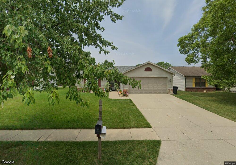
1820 Starks Cir Lafayette, IN 47909
Bridge Water NeighborhoodEstimated Value: $224,000 - $249,000
Studio
--
Bath
1,125
Sq Ft
$211/Sq Ft
Est. Value
About This Home
This home is located at 1820 Starks Cir, Lafayette, IN 47909 and is currently estimated at $237,280, approximately $210 per square foot. 1820 Starks Cir is a home located in Tippecanoe County with nearby schools including Amelia Earhart Elementary School, Lafayette Tecumseh Junior High School, and Sunnyside Intermediate School.
Ownership History
Date
Name
Owned For
Owner Type
Purchase Details
Closed on
May 31, 2018
Sold by
Thieme & Adair Llc
Bought by
Mckinley Tamla
Current Estimated Value
Home Financials for this Owner
Home Financials are based on the most recent Mortgage that was taken out on this home.
Original Mortgage
$118,316
Outstanding Balance
$104,920
Interest Rate
5.7%
Mortgage Type
FHA
Estimated Equity
$132,360
Purchase Details
Closed on
Dec 30, 2011
Sold by
Adair Richard G
Bought by
Thieme & Adair Llc
Purchase Details
Closed on
Nov 19, 2002
Sold by
Thieme & Adair Llc
Bought by
Adair Richard G
Create a Home Valuation Report for This Property
The Home Valuation Report is an in-depth analysis detailing your home's value as well as a comparison with similar homes in the area
Home Values in the Area
Average Home Value in this Area
Purchase History
| Date | Buyer | Sale Price | Title Company |
|---|---|---|---|
| Mckinley Tamla | -- | None Available | |
| Thieme & Adair Llc | -- | None Available | |
| Adair Richard G | -- | -- |
Source: Public Records
Mortgage History
| Date | Status | Borrower | Loan Amount |
|---|---|---|---|
| Open | Mckinley Tamla | $118,316 |
Source: Public Records
Tax History
| Year | Tax Paid | Tax Assessment Tax Assessment Total Assessment is a certain percentage of the fair market value that is determined by local assessors to be the total taxable value of land and additions on the property. | Land | Improvement |
|---|---|---|---|---|
| 2025 | $1,726 | $196,800 | $43,000 | $153,800 |
| 2024 | $1,726 | $181,900 | $43,000 | $138,900 |
| 2023 | $1,542 | $167,300 | $43,000 | $124,300 |
| 2022 | $1,145 | $124,800 | $18,000 | $106,800 |
| 2021 | $1,070 | $117,700 | $18,000 | $99,700 |
| 2020 | $900 | $108,400 | $18,000 | $90,400 |
| 2019 | $806 | $102,700 | $18,000 | $84,700 |
| 2018 | $764 | $99,500 | $18,000 | $81,500 |
| 2017 | $797 | $98,500 | $18,000 | $80,500 |
| 2016 | $1,950 | $97,510 | $18,000 | $79,510 |
| 2014 | $1,826 | $91,300 | $18,000 | $73,300 |
| 2013 | $1,780 | $89,000 | $18,000 | $71,000 |
Source: Public Records
Map
Nearby Homes
- 1940 Honeybrook Way
- 3526 Canterbury Dr
- 3345 Chaucer Dr
- 982 Southernview Dr S
- 3225 Pipers Glen Dr
- 3108 Tanager Dr
- 3928 Gate Rd
- 110 S Rickover Cir
- 116 Coldbrook Dr
- 3501 Joallen Ln
- 3113 Fairwood Dr
- 1712 Wolfson Way
- 2417 Shasta Dr
- 1045 Southlea Dr
- 3017 Fairwood Dr
- 4100 Homerton St
- 3917 John Adams Rd
- 60 Inca Ct
- 3435 Coventry Ln
- 18 Kohl Ct
- 1824 Starks Cir
- 1816 Starks Cir
- 1828 Starks Cir
- 1813 Starks Cir
- 1817 Starks Cir
- 1809 Starks Cir
- 1832 Starks Cir
- 1808 Starks Cir
- 1906 Chamberlin Dr
- 1836 Starks Cir
- 1422 N Newsom Ct
- 1804 Starks Cir
- 1825 Starks Cir
- 1910 Chamberlin Dr
- 1430 N Newsom Ct
- 1901 Chamberlin Dr
- 3119 Thomas Dr
- 3117 Thomas Dr
- 1800 Starks Cir
- 1418 N Newsom Ct
Your Personal Tour Guide
Ask me questions while you tour the home.