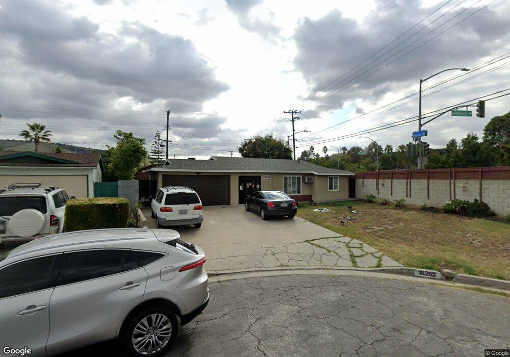
18202 Galatina St Rowland Heights, CA 91748
Estimated Value: $707,000 - $796,000
3
Beds
2
Baths
1,088
Sq Ft
$693/Sq Ft
Est. Value
About This Home
This home is located at 18202 Galatina St, Rowland Heights, CA 91748 and is currently estimated at $754,118, approximately $693 per square foot. 18202 Galatina St is a home located in Los Angeles County with nearby schools including Rowland Elementary School, Alvarado Intermediate School, and John A. Rowland High School.
Ownership History
Date
Name
Owned For
Owner Type
Purchase Details
Closed on
Sep 27, 2016
Sold by
Sabillo Brian and Ochoada Arnulfo N
Bought by
Sabillo Brian and Ochoada Arnulfo N
Current Estimated Value
Purchase Details
Closed on
Jan 14, 2016
Sold by
Mandel Frank L and Mandel Indra S
Bought by
Sabillo Brian and Ochoada Arnulfo N
Home Financials for this Owner
Home Financials are based on the most recent Mortgage that was taken out on this home.
Original Mortgage
$369,000
Outstanding Balance
$293,665
Interest Rate
3.98%
Mortgage Type
New Conventional
Estimated Equity
$460,453
Purchase Details
Closed on
Aug 19, 1993
Sold by
Apistar Andres T and Apistar Veronica Palencia
Bought by
Mandel Frank L and Mandel Indra S
Create a Home Valuation Report for This Property
The Home Valuation Report is an in-depth analysis detailing your home's value as well as a comparison with similar homes in the area
Home Values in the Area
Average Home Value in this Area
Purchase History
| Date | Buyer | Sale Price | Title Company |
|---|---|---|---|
| Sabillo Brian | -- | None Available | |
| Sabillo Brian | $410,000 | Old Republic Title Company | |
| Mandel Frank L | -- | -- |
Source: Public Records
Mortgage History
| Date | Status | Borrower | Loan Amount |
|---|---|---|---|
| Open | Sabillo Brian | $369,000 |
Source: Public Records
Tax History Compared to Growth
Tax History
| Year | Tax Paid | Tax Assessment Tax Assessment Total Assessment is a certain percentage of the fair market value that is determined by local assessors to be the total taxable value of land and additions on the property. | Land | Improvement |
|---|---|---|---|---|
| 2025 | $6,202 | $485,350 | $388,283 | $97,067 |
| 2024 | $6,202 | $475,834 | $380,670 | $95,164 |
| 2023 | $5,995 | $466,505 | $373,206 | $93,299 |
| 2022 | $5,863 | $457,359 | $365,889 | $91,470 |
| 2021 | $5,767 | $448,392 | $358,715 | $89,677 |
| 2019 | $5,594 | $435,094 | $348,076 | $87,018 |
| 2018 | $5,362 | $426,563 | $341,251 | $85,312 |
| 2016 | $2,957 | $218,555 | $135,442 | $83,113 |
| 2015 | $2,911 | $215,273 | $133,408 | $81,865 |
| 2014 | $2,910 | $211,057 | $130,795 | $80,262 |
Source: Public Records
Map
Nearby Homes
- 18239 Villa Clara St
- 18220 Gallineta St
- 2474 Patrician View Ave
- 2426 Batson Ave
- 18536 Mescal St
- 2306 Doubletree Ln
- 2010 La Cueva Dr
- 18225 Camino Bello Unit 4
- 18131 Camino Bello Unit 4
- 2330 Donosa Dr
- 18138 Via Amorosa Unit 4
- 2503 Donosa Dr
- 2521 Doubletree Ln
- 1902 Jellick Ave
- 1808 Via Entrada
- 17834 Calle Los Arboles
- 2048 Calle Bogota
- 18654 Del Bonita St
- 17712 Nearbank Dr
- 1948 Calle Bogota
- 18208 Galatina St
- 18207 Mescalero St Unit 1/2
- 18207 Mescalero St
- 18213 Mescalero St
- 18214 Galatina St
- 18221 Mescalero St
- 18207 Galatina St
- 18213 Galatina St
- 18220 Galatina St
- 18195 Galatina St Unit 4A
- 18195 Galatina St Unit 2A
- 18195 Galatina St Unit 1A
- 18227 Mescalero St
- 0 Patthfinder Rd Wellesley Rd Unit P626941
- 9999 Call St
- 8272 Pathfinder and Welledly`
- 0 Walk Unit R1006063
- 0 Vac Vic Avenue C8 212 Stw Unit Y1104420
- 17936 E
- 18625 -186 Railroad St