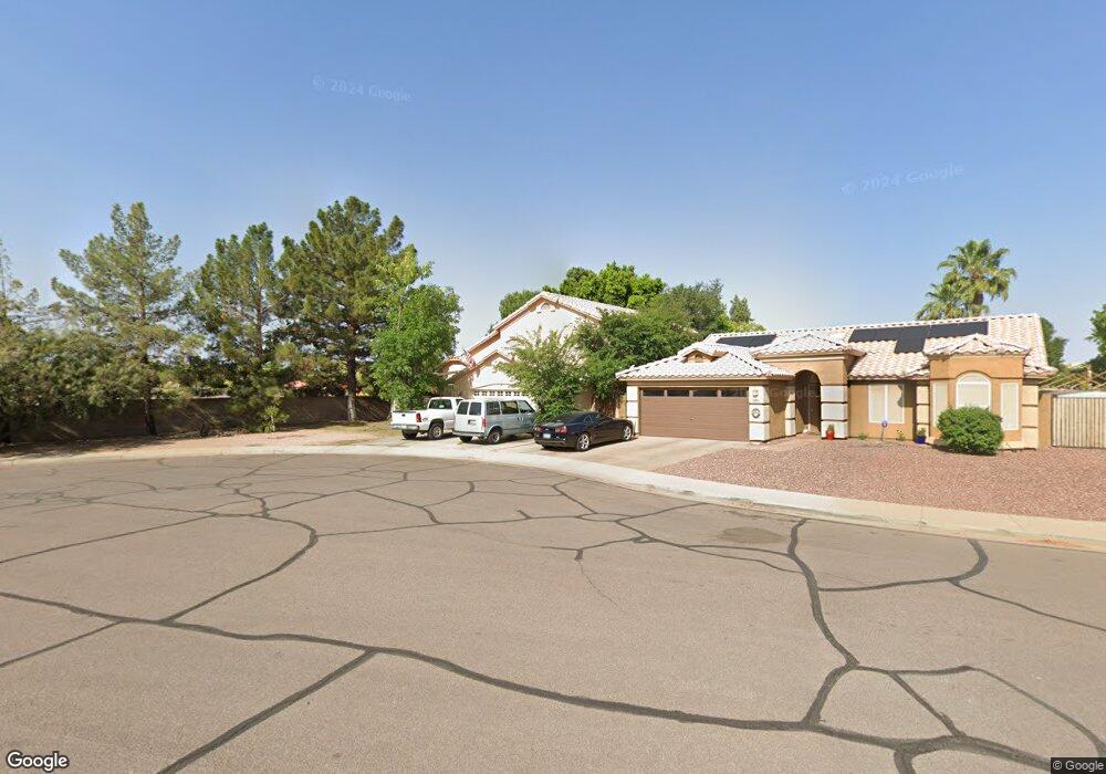
18206 N 85th Dr Peoria, AZ 85382
Arrowhead NeighborhoodEstimated Value: $434,388 - $539,000
--
Bed
4
Baths
2,109
Sq Ft
$238/Sq Ft
Est. Value
About This Home
This home is located at 18206 N 85th Dr, Peoria, AZ 85382 and is currently estimated at $502,847, approximately $238 per square foot. 18206 N 85th Dr is a home located in Maricopa County with nearby schools including Apache Elementary School, Sunrise Mountain High School, and Sonoran Science Academy-Peoria.
Ownership History
Date
Name
Owned For
Owner Type
Purchase Details
Closed on
Aug 9, 2023
Sold by
Neuer Francis W and Neuer Cheryl A
Bought by
Neuer Family Trust and Neuer
Current Estimated Value
Purchase Details
Closed on
Dec 20, 1996
Sold by
Neuer Cecelia A
Bought by
Neuer Francis W and Neuer Cheryl Ann
Home Financials for this Owner
Home Financials are based on the most recent Mortgage that was taken out on this home.
Original Mortgage
$32,000
Interest Rate
7.59%
Mortgage Type
Seller Take Back
Purchase Details
Closed on
Dec 19, 1996
Sold by
Neuer Francis W and Neuer Cheryl Ann
Bought by
Powers Daniel W and Powers Karen R
Home Financials for this Owner
Home Financials are based on the most recent Mortgage that was taken out on this home.
Original Mortgage
$32,000
Interest Rate
7.59%
Mortgage Type
Seller Take Back
Create a Home Valuation Report for This Property
The Home Valuation Report is an in-depth analysis detailing your home's value as well as a comparison with similar homes in the area
Home Values in the Area
Average Home Value in this Area
Purchase History
| Date | Buyer | Sale Price | Title Company |
|---|---|---|---|
| Neuer Family Trust | -- | None Listed On Document | |
| Neuer Francis W | -- | Security Title | |
| Powers Daniel W | $40,000 | Security Title |
Source: Public Records
Mortgage History
| Date | Status | Borrower | Loan Amount |
|---|---|---|---|
| Previous Owner | Powers Daniel W | $32,000 |
Source: Public Records
Tax History Compared to Growth
Tax History
| Year | Tax Paid | Tax Assessment Tax Assessment Total Assessment is a certain percentage of the fair market value that is determined by local assessors to be the total taxable value of land and additions on the property. | Land | Improvement |
|---|---|---|---|---|
| 2025 | $1,658 | $21,504 | -- | -- |
| 2024 | $1,678 | $20,480 | -- | -- |
| 2023 | $1,678 | $34,500 | $6,900 | $27,600 |
| 2022 | $1,643 | $26,580 | $5,310 | $21,270 |
| 2021 | $1,755 | $24,580 | $4,910 | $19,670 |
| 2020 | $1,773 | $24,380 | $4,870 | $19,510 |
| 2019 | $1,717 | $21,160 | $4,230 | $16,930 |
| 2018 | $1,650 | $19,860 | $3,970 | $15,890 |
| 2017 | $1,652 | $18,310 | $3,660 | $14,650 |
| 2016 | $1,606 | $17,350 | $3,470 | $13,880 |
| 2015 | $1,526 | $16,060 | $3,210 | $12,850 |
Source: Public Records
Map
Nearby Homes
- 18227 N 85th Dr
- 8478 W Grovers Ave
- 8331 W Fullam St
- 17857 N 85th Ln
- 8370 W Audrey Ln
- 8332 W Troy St
- 8720 W Willowbrook Dr
- 8529 W Rockwood Dr
- 8517 W Rockwood Dr
- 17980 N 88th Ave
- 8449 W Rockwood Dr
- 18729 N 84th Dr
- 18229 N 89th Dr
- 8402 W Rosemonte Dr
- 18830 N 83rd Ln
- 8939 W Villa Rita Dr
- 8546 W Wescott Dr
- 8502 W Kimberly Way
- 17781 N 89th Ln
- 8333 W Wescott Dr
- 18208 N 85th Dr
- 8530 W John Cabot Rd
- 18210 N 85th Dr
- 8538 W John Cabot Rd
- 18212 N 85th Dr
- 18205 N 85th Dr
- 18201 N 85th Dr
- 8546 W John Cabot Rd
- 18207 N 85th Dr
- 18203 N 85th Dr
- 18209 N 85th Dr
- 18214 N 85th Dr
- 18211 N 85th Dr
- 8554 W John Cabot Rd
- 18213 N 85th Dr
- 18216 N 85th Dr
- 18215 N 85th Dr
- 18217 N 85th Dr
- 8421 W Fullam St
- 8418 W Fullam St