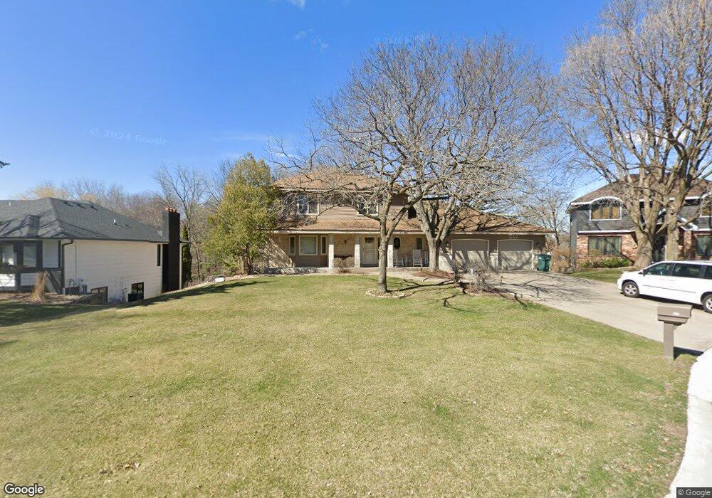
1821 127th Ln NW Coon Rapids, MN 55448
Estimated Value: $458,000 - $523,000
5
Beds
4
Baths
2,292
Sq Ft
$214/Sq Ft
Est. Value
About This Home
This home is located at 1821 127th Ln NW, Coon Rapids, MN 55448 and is currently estimated at $490,384, approximately $213 per square foot. 1821 127th Ln NW is a home located in Anoka County with nearby schools including Lucile Bruner Elementary School, Morris Bye Elementary School, and Laughlin Junior/Senior High School.
Ownership History
Date
Name
Owned For
Owner Type
Purchase Details
Closed on
Jul 20, 2001
Sold by
Perreault Chad M and Perreault Laurie J
Bought by
Grimmer Raymond A and Grimmer Jeanine R
Current Estimated Value
Purchase Details
Closed on
May 28, 1998
Sold by
Turnbull Douglas C
Bought by
Perreault Chad M and Perreault Laurie J
Create a Home Valuation Report for This Property
The Home Valuation Report is an in-depth analysis detailing your home's value as well as a comparison with similar homes in the area
Home Values in the Area
Average Home Value in this Area
Purchase History
| Date | Buyer | Sale Price | Title Company |
|---|---|---|---|
| Grimmer Raymond A | $254,900 | -- | |
| Perreault Chad M | $210,000 | -- |
Source: Public Records
Tax History Compared to Growth
Tax History
| Year | Tax Paid | Tax Assessment Tax Assessment Total Assessment is a certain percentage of the fair market value that is determined by local assessors to be the total taxable value of land and additions on the property. | Land | Improvement |
|---|---|---|---|---|
| 2025 | $4,997 | $484,000 | $94,500 | $389,500 |
| 2024 | $4,997 | $464,700 | $91,400 | $373,300 |
| 2023 | $4,577 | $455,700 | $75,600 | $380,100 |
| 2022 | $4,442 | $461,600 | $75,600 | $386,000 |
| 2021 | $4,305 | $395,900 | $58,800 | $337,100 |
| 2020 | $4,181 | $375,500 | $58,800 | $316,700 |
| 2019 | $4,032 | $350,700 | $58,800 | $291,900 |
| 2018 | $3,990 | $329,300 | $0 | $0 |
| 2017 | $3,619 | $316,000 | $0 | $0 |
| 2016 | $3,701 | $283,200 | $0 | $0 |
| 2015 | $3,598 | $283,200 | $52,500 | $230,700 |
| 2014 | -- | $240,200 | $37,200 | $203,000 |
Source: Public Records
Map
Nearby Homes
- 12759 Ibis St NW
- 1930 127th Cir NW
- 12554 Grouse St NW
- 1520 129th Ave NW
- 1593 126th Ln NW
- 1687 131st Ln NW
- 12760 Raven St NW
- 12796 Bluebird St NW
- 1450 126th Ln NW
- 12365 Jay St NW
- 2147 125th Ln NW
- 1776 133rd Ave NW
- 1625 124th Ave NW
- 2068 124th Ln NW
- 12463 Drake St NW
- 1234 128th Cir NW
- 13416 Swallow St NW
- 1727 121st Ln NW
- 13519 Partridge Cir NW
- 2675 128th Ave NW
- 1813 127th Ln NW
- 1829 127th Ln NW
- 1778 128th Ave NW
- 1837 127th Ln NW
- 1784 128th Ave NW
- 1805 127th Ln NW
- 1770 128th Ave NW
- 1828 127th Ln NW
- 1820 127th Ln NW
- 1812 127th Ln NW
- 1800 128th Ave NW
- 1836 127th Ln NW
- 1754 128th Ave NW
- 1845 127th Ln NW
- 1816 128th Ave NW
- 1916 128th Ave NW
- 12736 Ibis St NW
- 1738 128th Ave NW
- 1918 128th Ave NW
- 12855 Jay St NW