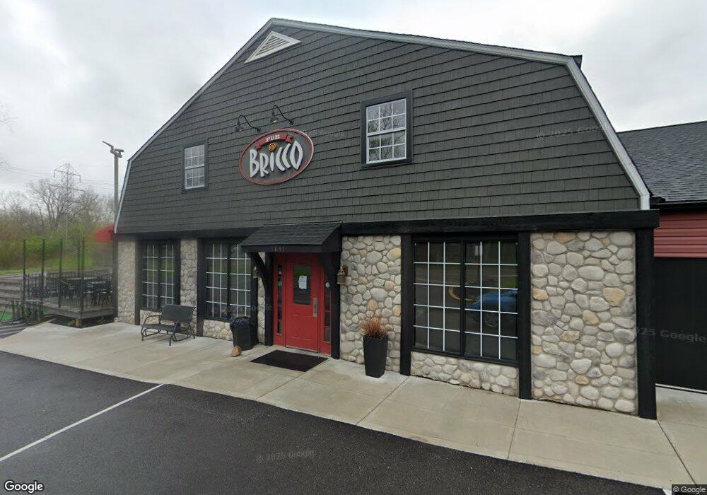
1821 1841 Merriman Rd Akron, OH 44313
Merriman Valley NeighborhoodEstimated Value: $774,468
--
Bed
4
Baths
11,278
Sq Ft
$69/Sq Ft
Est. Value
About This Home
This home is located at 1821 1841 Merriman Rd, Akron, OH 44313 and is currently estimated at $774,468, approximately $68 per square foot. 1821 1841 Merriman Rd is a home located in Summit County with nearby schools including King Community Learning Center, Our Lady Of The Elms Elementary School, and Immaculate Heart Of Mary School.
Ownership History
Date
Name
Owned For
Owner Type
Purchase Details
Closed on
Oct 31, 2022
Sold by
Mac Development Co Inc
Bought by
J-Rs Commercial Properties
Current Estimated Value
Purchase Details
Closed on
Oct 27, 2022
Sold by
Mac Development Co Inc
Bought by
J-Rs Commercial Properties
Purchase Details
Closed on
Sep 23, 1994
Sold by
Lock 22 Ltd
Bought by
Mac Dev Co Inc
Create a Home Valuation Report for This Property
The Home Valuation Report is an in-depth analysis detailing your home's value as well as a comparison with similar homes in the area
Home Values in the Area
Average Home Value in this Area
Purchase History
| Date | Buyer | Sale Price | Title Company |
|---|---|---|---|
| J-Rs Commercial Properties | $658,000 | Northstar Title Services | |
| J-Rs Commercial Properties | $658,000 | Northstar Title Services | |
| Mac Dev Co Inc | $600,000 | -- |
Source: Public Records
Tax History Compared to Growth
Tax History
| Year | Tax Paid | Tax Assessment Tax Assessment Total Assessment is a certain percentage of the fair market value that is determined by local assessors to be the total taxable value of land and additions on the property. | Land | Improvement |
|---|---|---|---|---|
| 2025 | $17,408 | $181,675 | $42,879 | $138,796 |
| 2024 | $17,408 | $181,675 | $42,879 | $138,796 |
| 2023 | $17,745 | $181,675 | $42,879 | $138,796 |
| 2022 | $17,745 | $181,675 | $42,879 | $138,796 |
| 2021 | $17,767 | $181,675 | $42,879 | $138,796 |
| 2020 | $15,319 | $181,680 | $42,880 | $138,800 |
| 2019 | $15,464 | $140,690 | $21,730 | $118,960 |
| 2018 | $15,245 | $140,690 | $21,730 | $118,960 |
| 2017 | $15,609 | $140,690 | $21,730 | $118,960 |
| 2016 | $15,609 | $147,820 | $22,870 | $124,950 |
| 2015 | $15,609 | $147,820 | $22,870 | $124,950 |
| 2014 | $15,439 | $147,820 | $22,870 | $124,950 |
| 2013 | $14,832 | $137,290 | $19,440 | $117,850 |
Source: Public Records
Map
Nearby Homes
- 1057 Kevin Dr
- 1047 Kevin Dr
- 1054 Karen Dr
- 1058 Middlecoff Dr
- 1029 Karen Dr
- 994 Ellsworth Dr
- 1047 Terrell Dr
- 1393 Waters Edge Dr Unit 26C
- Nassau Cove Plan at Riverwood Valley
- 1484 Waters Edge Dr Unit 2A
- 850 Cliffside Dr
- 1423 Shanabrook Dr
- 1134 Bean Ln
- 1122 Bean Ln
- 1113 Bean Ln
- 2021 Akron Peninsula Rd
- 746 Cliffside Cir
- 1561 Treetop Trail Unit B
- 1541 Treetop Trail Unit B
- 1722 Treetop Trail Unit 15
- 1827 Merriman Rd
- 1824 Merriman Rd
- 1818 Merriman Rd
- 1208 Weathervane Ln
- 1800 Merriman Rd
- 1387 Barcelona Dr
- 1393 Barcelona Dr
- 1381 Barcelona Dr
- 1399 Barcelona Dr
- 1377 Barcelona Dr
- 1403 Barcelona Dr
- 1371 Barcelona Dr
- 1409 Barcelona Dr
- 1365 Barcelona Dr
- 1236 Weathervane Ln Unit 222
- 1236 Weathervane Ln Unit 350
- 1236 Weathervane Ln Unit 370
- 1236 Weathervane Ln Unit 340
- 1236 Weathervane Ln Unit 320
- 1236 Weathervane Ln Unit 330