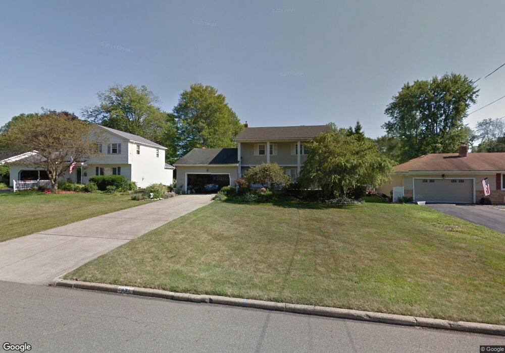
1821 Alverne Dr Youngstown, OH 44514
Estimated Value: $214,000 - $272,000
4
Beds
2
Baths
1,884
Sq Ft
$130/Sq Ft
Est. Value
About This Home
This home is located at 1821 Alverne Dr, Youngstown, OH 44514 and is currently estimated at $245,861, approximately $130 per square foot. 1821 Alverne Dr is a home located in Mahoning County with nearby schools including Poland Union Elementary School, Poland Middle School, and Poland Seminary High School.
Ownership History
Date
Name
Owned For
Owner Type
Purchase Details
Closed on
Jun 25, 2024
Sold by
Walker Velma M
Bought by
Rodland Nicholas and Rodland Sara
Current Estimated Value
Home Financials for this Owner
Home Financials are based on the most recent Mortgage that was taken out on this home.
Original Mortgage
$160,000
Outstanding Balance
$157,927
Interest Rate
6.94%
Mortgage Type
New Conventional
Estimated Equity
$87,934
Purchase Details
Closed on
Nov 5, 1986
Bought by
Walker Velma M
Create a Home Valuation Report for This Property
The Home Valuation Report is an in-depth analysis detailing your home's value as well as a comparison with similar homes in the area
Home Values in the Area
Average Home Value in this Area
Purchase History
| Date | Buyer | Sale Price | Title Company |
|---|---|---|---|
| Rodland Nicholas | $200,000 | None Listed On Document | |
| Rodland Nicholas | $200,000 | None Listed On Document | |
| Walker Velma M | -- | -- |
Source: Public Records
Mortgage History
| Date | Status | Borrower | Loan Amount |
|---|---|---|---|
| Open | Rodland Nicholas | $160,000 | |
| Closed | Rodland Nicholas | $160,000 |
Source: Public Records
Tax History Compared to Growth
Tax History
| Year | Tax Paid | Tax Assessment Tax Assessment Total Assessment is a certain percentage of the fair market value that is determined by local assessors to be the total taxable value of land and additions on the property. | Land | Improvement |
|---|---|---|---|---|
| 2024 | $2,887 | $65,410 | $9,280 | $56,130 |
| 2023 | $2,884 | $65,410 | $9,280 | $56,130 |
| 2022 | $2,358 | $46,860 | $9,520 | $37,340 |
| 2021 | $2,362 | $46,860 | $9,520 | $37,340 |
| 2020 | $2,371 | $46,860 | $9,520 | $37,340 |
| 2019 | $2,239 | $41,100 | $8,350 | $32,750 |
| 2018 | $2,093 | $41,100 | $8,350 | $32,750 |
| 2017 | $2,280 | $41,100 | $8,350 | $32,750 |
| 2016 | $2,499 | $46,410 | $9,890 | $36,520 |
| 2015 | $2,451 | $46,410 | $9,890 | $36,520 |
| 2014 | $2,459 | $46,410 | $9,890 | $36,520 |
| 2013 | $2,431 | $46,410 | $9,890 | $36,520 |
Source: Public Records
Map
Nearby Homes
- 1827 Alverne Dr
- 1804 Alverne Dr
- 1738 Island Dr
- 1894 Lealand Ave
- 1859 Mathews Rd
- 2035 Woodward Ave
- 1890 Mathews Rd
- 0 Mathews Rd Unit 5149232
- 0 Mathews Rd Unit 5143059
- 34 Venloe Dr
- 43 Venloe Dr
- 0 Oles Ave
- 0 Woodlawn Ave
- 5710 Youngstown Poland Rd
- 2128 Lyon Blvd
- 2153 Lyon Blvd
- 1841 Wingate Rd
- 2295 Bel Aire Ln
- 928 Edenridge Dr
- 1919 Wingate Rd
- 1815 Alverne Dr
- 1833 Alverne Dr
- 1811 Alverne Dr
- 1839 Alverne Dr
- 1805 Alverne Dr
- 1820 Alverne Dr
- 1832 Alverne Dr
- 1810 Alverne Dr
- 1845 Alverne Dr
- 1801 Alverne Dr
- 1838 Alverne Dr
- 1851 Alverne Dr
- 1797 Alverne Dr
- 1844 Alverne Dr
- 1800 Alverne Dr
- VL Alverne Dr
- 136 Island Dr
- 142 Island Dr
- 148 Island Dr
- 1850 Alverne Dr