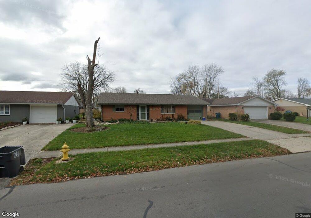
1821 Latham Ave Lima, OH 45805
Westgate NeighborhoodEstimated Value: $131,000 - $143,862
3
Beds
2
Baths
1,292
Sq Ft
$107/Sq Ft
Est. Value
About This Home
This home is located at 1821 Latham Ave, Lima, OH 45805 and is currently estimated at $137,966, approximately $106 per square foot. 1821 Latham Ave is a home located in Allen County with nearby schools including Heritage Elementary School, Lima West Middle School, and Lima North Middle School.
Ownership History
Date
Name
Owned For
Owner Type
Purchase Details
Closed on
Jun 6, 2022
Sold by
Ward Deanna M
Bought by
Ward Darrin E
Current Estimated Value
Home Financials for this Owner
Home Financials are based on the most recent Mortgage that was taken out on this home.
Original Mortgage
$76,700
Outstanding Balance
$72,865
Interest Rate
5.09%
Mortgage Type
New Conventional
Estimated Equity
$65,101
Purchase Details
Closed on
Nov 25, 2002
Sold by
Kelley Steven K
Bought by
Ward Darrin E and Ward Deanna M
Home Financials for this Owner
Home Financials are based on the most recent Mortgage that was taken out on this home.
Original Mortgage
$72,500
Interest Rate
6.08%
Mortgage Type
New Conventional
Purchase Details
Closed on
Jul 9, 1992
Bought by
Kelley George K
Create a Home Valuation Report for This Property
The Home Valuation Report is an in-depth analysis detailing your home's value as well as a comparison with similar homes in the area
Home Values in the Area
Average Home Value in this Area
Purchase History
| Date | Buyer | Sale Price | Title Company |
|---|---|---|---|
| Ward Darrin E | -- | Reeves And Sherrick Co | |
| Ward Darrin E | $77,500 | -- | |
| Kelley George K | $52,900 | -- |
Source: Public Records
Mortgage History
| Date | Status | Borrower | Loan Amount |
|---|---|---|---|
| Open | Ward Darrin E | $76,700 | |
| Previous Owner | Ward Darrin E | $72,500 |
Source: Public Records
Tax History
| Year | Tax Paid | Tax Assessment Tax Assessment Total Assessment is a certain percentage of the fair market value that is determined by local assessors to be the total taxable value of land and additions on the property. | Land | Improvement |
|---|---|---|---|---|
| 2024 | $1,202 | $33,050 | $6,130 | $26,920 |
| 2023 | $1,014 | $23,950 | $4,450 | $19,500 |
| 2022 | $1,019 | $23,950 | $4,450 | $19,500 |
| 2021 | $1,078 | $23,950 | $4,450 | $19,500 |
| 2020 | $1,103 | $21,810 | $4,270 | $17,540 |
| 2019 | $1,103 | $21,810 | $4,270 | $17,540 |
| 2018 | $1,075 | $21,810 | $4,270 | $17,540 |
| 2017 | $1,067 | $20,970 | $4,270 | $16,700 |
| 2016 | $1,076 | $20,970 | $4,270 | $16,700 |
| 2015 | $1,101 | $20,970 | $4,270 | $16,700 |
| 2014 | $999 | $19,150 | $4,520 | $14,630 |
| 2013 | $972 | $19,150 | $4,520 | $14,630 |
Source: Public Records
Map
Nearby Homes
- 3 Poulston Place
- 1753 Leland Ave
- 705 Cornell Dr
- 102 Charwood Dr
- 1605 Hazel Ave
- 1600 Leland Ave
- 1918 Oakland Pkwy
- 1407 Latham Ave
- 1716 Oakland Pkwy
- 275 N Dale Dr
- 1607 W Wayne St
- 1517 Allentown Rd
- 1245 Latham Ave
- 1730 Homeward Ave
- 1541 Oakland Pkwy
- 2201 W High St
- 1508 Oakland Pkwy
- 00 Homeward Ave
- 1015 N Cole St
- 1580 W Robb Ave
Your Personal Tour Guide
Ask me questions while you tour the home.