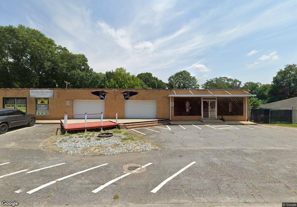
1821 S Mcduffie St Anderson, SC 29624
--
Bed
--
Bath
5,916
Sq Ft
--
Built
About This Home
This home is located at 1821 S Mcduffie St, Anderson, SC 29624. 1821 S Mcduffie St is a home located in Anderson County with nearby schools including Varennes Elementary School, McCants Middle School, and T.L. Hanna High School.
Ownership History
Date
Name
Owned For
Owner Type
Purchase Details
Closed on
Sep 25, 2025
Sold by
Sierputowski Phillip and Sierputowski Sandra D
Bought by
Property Network Llc
Purchase Details
Closed on
May 24, 2012
Sold by
First Federal Bank
Bought by
Sierputowski Phillip and Sierputowski Sandra D
Purchase Details
Closed on
Feb 22, 2008
Sold by
Gaillard E Lamar
Bought by
Fuller Lacy
Home Financials for this Owner
Home Financials are based on the most recent Mortgage that was taken out on this home.
Original Mortgage
$117,000
Interest Rate
5.85%
Mortgage Type
Commercial
Create a Home Valuation Report for This Property
The Home Valuation Report is an in-depth analysis detailing your home's value as well as a comparison with similar homes in the area
Home Values in the Area
Average Home Value in this Area
Purchase History
| Date | Buyer | Sale Price | Title Company |
|---|---|---|---|
| Property Network Llc | $50,000 | None Listed On Document | |
| Sierputowski Phillip | $55,000 | -- | |
| First Federal Bank | -- | -- | |
| Fuller Lacy | $92,500 | Attorney |
Source: Public Records
Mortgage History
| Date | Status | Borrower | Loan Amount |
|---|---|---|---|
| Previous Owner | Fuller Lacy | $117,000 |
Source: Public Records
Tax History Compared to Growth
Tax History
| Year | Tax Paid | Tax Assessment Tax Assessment Total Assessment is a certain percentage of the fair market value that is determined by local assessors to be the total taxable value of land and additions on the property. | Land | Improvement |
|---|---|---|---|---|
| 2024 | $2,358 | $8,820 | $1,240 | $7,580 |
| 2023 | $2,358 | $8,820 | $1,240 | $7,580 |
| 2022 | $2,298 | $8,820 | $1,240 | $7,580 |
| 2021 | $2,078 | $6,390 | $500 | $5,890 |
| 2020 | $2,048 | $6,390 | $500 | $5,890 |
| 2019 | $2,048 | $6,390 | $500 | $5,890 |
| 2018 | $2,020 | $6,390 | $500 | $5,890 |
| 2017 | -- | $6,390 | $500 | $5,890 |
| 2016 | $1,880 | $6,070 | $460 | $5,610 |
| 2015 | $1,900 | $6,070 | $460 | $5,610 |
| 2014 | $1,872 | $6,070 | $460 | $5,610 |
Source: Public Records
Map
Nearby Homes
- 1709 Lyndon Ave
- 1609 Lyndon Ave
- 1616 Meadowbrook Cir
- 1619 Nardin Ave
- 1609 S Mcduffie St
- 421 Valentine St
- 302 Fallstaff St
- 1510 S Fant St
- 6 Herring Ave
- 1502 Nardin Ave
- 1413 S Mcduffie St
- 1411 S Mcduffie St
- 406 Cleveland Ave
- 16 N Prince St
- 513 Cleveland Ave
- 1606 S Murray Avenue Extension
- 329 Sherman Dr
- 306 Broyles St
- 1308 Roadway St
- 519 Thomas St
- 1823 S Mcduffie St
- 1712 Lyndon Ave
- 1710 Lyndon Ave
- 303 Newton Ln
- 1703 S Mcduffie St
- 1708 Lyndon Ave
- 302 Newton Ln
- 401 Newton Ln
- 1701 S Mcduffie St
- 304 Newton Ln
- 1711 Lyndon Ave
- 1906 S Mcduffie St
- 402 Newton Ln
- 403 Newton Ln
- 1908 S Mcduffie St
- 1621 S Mcduffie St
- 1707 Lyndon Ave
- 404 Newton Ln
- 206 Ray St
- 1911 S Mcduffie St