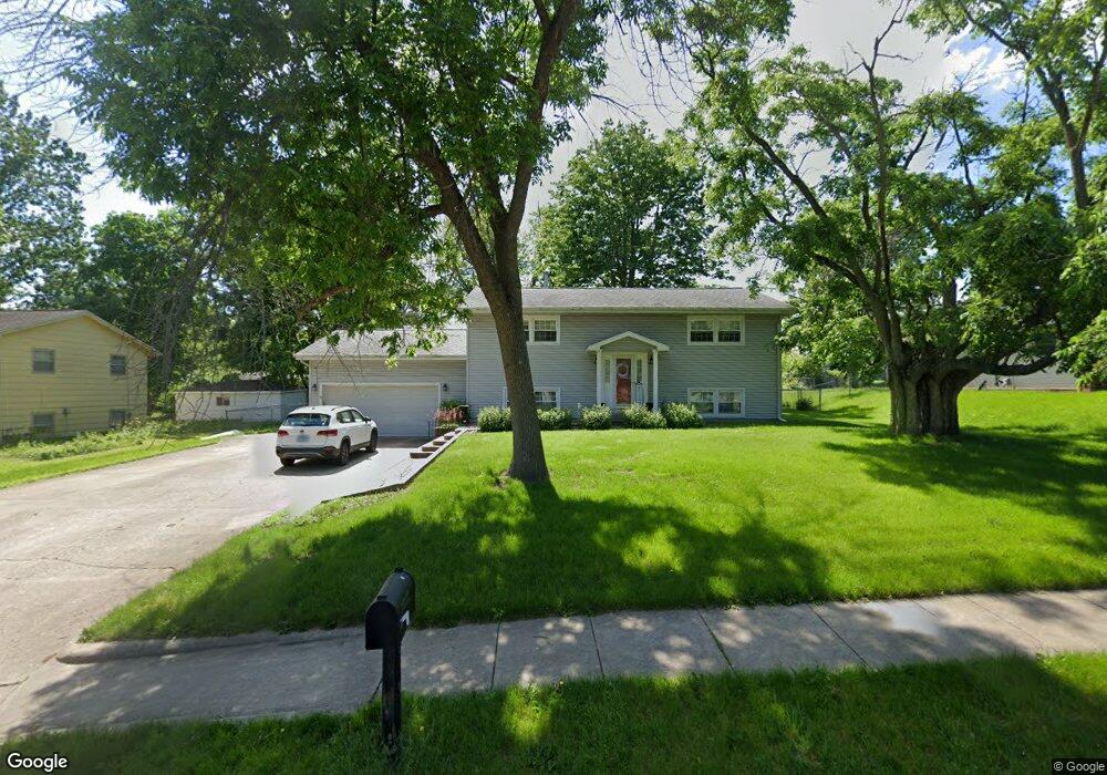
1822 University Dr Charleston, IL 61920
Estimated Value: $188,748 - $239,000
4
Beds
3
Baths
2,240
Sq Ft
$98/Sq Ft
Est. Value
About This Home
This home is located at 1822 University Dr, Charleston, IL 61920 and is currently estimated at $220,437, approximately $98 per square foot. 1822 University Dr is a home located in Coles County with nearby schools including Charleston High School, Charleston Christian Academy, and Charleston Christian Academy High School.
Ownership History
Date
Name
Owned For
Owner Type
Purchase Details
Closed on
Jun 18, 2008
Sold by
Inyart John S and Inyart Lucille E
Bought by
Rennels Darrell E and Rennels Holly C
Current Estimated Value
Home Financials for this Owner
Home Financials are based on the most recent Mortgage that was taken out on this home.
Original Mortgage
$132,050
Outstanding Balance
$28,810
Interest Rate
6.05%
Mortgage Type
New Conventional
Estimated Equity
$191,627
Create a Home Valuation Report for This Property
The Home Valuation Report is an in-depth analysis detailing your home's value as well as a comparison with similar homes in the area
Home Values in the Area
Average Home Value in this Area
Purchase History
| Date | Buyer | Sale Price | Title Company |
|---|---|---|---|
| Rennels Darrell E | $139,000 | None Available |
Source: Public Records
Mortgage History
| Date | Status | Borrower | Loan Amount |
|---|---|---|---|
| Open | Rennels Darrell E | $132,050 |
Source: Public Records
Tax History Compared to Growth
Tax History
| Year | Tax Paid | Tax Assessment Tax Assessment Total Assessment is a certain percentage of the fair market value that is determined by local assessors to be the total taxable value of land and additions on the property. | Land | Improvement |
|---|---|---|---|---|
| 2024 | $3,528 | $51,468 | $6,421 | $45,047 |
| 2023 | $3,431 | $47,003 | $5,864 | $41,139 |
| 2022 | $3,430 | $46,226 | $5,767 | $40,459 |
| 2021 | $3,535 | $44,363 | $5,535 | $38,828 |
| 2020 | $3,291 | $42,620 | $8,899 | $33,721 |
| 2019 | $3,219 | $41,135 | $8,589 | $32,546 |
| 2018 | $3,184 | $41,135 | $8,589 | $32,546 |
| 2017 | $3,142 | $41,135 | $8,589 | $32,546 |
| 2016 | $3,056 | $40,460 | $8,589 | $31,871 |
| 2015 | $3,155 | $40,460 | $8,589 | $31,871 |
| 2014 | $3,155 | $40,460 | $8,589 | $31,871 |
| 2013 | $3,155 | $40,460 | $8,589 | $31,871 |
Source: Public Records
Map
Nearby Homes
- 1807 Reynolds Dr
- 9 Orchard Dr
- 1528 Division St
- 1742 Mccomb St
- 942 E St
- 929 Reynolds Dr
- 2139 Douglas St
- 124 Polk Ave
- 2327 Ellington Place
- 606 Greenbrier Ct
- 1035 Woodberry Ln
- 934 2nd St
- 405 Cedar Dr
- 1071 Woodberry Ln
- 507 Taft Ave
- 1103 & 1105 6th St
- 8 W Harrison Ave
- 0 Timberlake Lot 17 Estates
- 800 Division St
- 1011 6th St
- 1828 University Dr
- 1816 University Dr
- 511 Ashby Dr
- 513 Ashby Dr
- 515 Ashby Dr
- 505 Ashby Dr
- 1804 University Dr
- 507 Ashby Dr
- 1809 University Dr
- 1815 University Dr
- 529 Ashby Dr
- 1710 University Dr
- 524 Ashby Dr
- 520 Ashby Dr
- 514 Ashby Dr
- 1709 University Dr
- 531 Ashby Dr
- 532 Ashby Dr
- 512 Ashby Dr
- 504 W Grant Ave