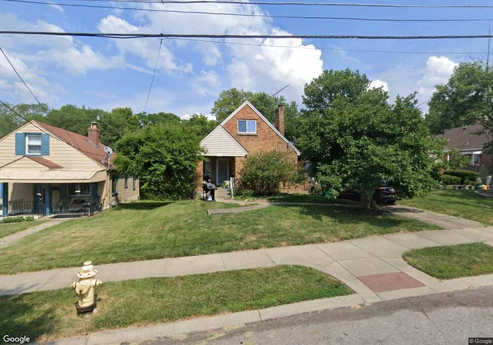
1824 1st Ave Cincinnati, OH 45205
West Price Hill NeighborhoodEstimated Value: $50,000 - $155,000
3
Beds
1
Bath
1,140
Sq Ft
$76/Sq Ft
Est. Value
About This Home
This home is located at 1824 1st Ave, Cincinnati, OH 45205 and is currently estimated at $87,000, approximately $76 per square foot. 1824 1st Ave is a home located in Hamilton County with nearby schools including Carson School, Gilbert A. Dater High School, and Western Hills High School.
Ownership History
Date
Name
Owned For
Owner Type
Purchase Details
Closed on
May 27, 2025
Sold by
Price Hill Will
Bought by
Roberts Authur La Renzo and Smith Rachel Dawn
Current Estimated Value
Purchase Details
Closed on
Jan 8, 2019
Sold by
Will Price Hill
Bought by
Roberts Authur La Renzo and Smith Rachel Dawn
Home Financials for this Owner
Home Financials are based on the most recent Mortgage that was taken out on this home.
Original Mortgage
$47,476
Interest Rate
4.7%
Mortgage Type
Land Contract Argmt. Of Sale
Purchase Details
Closed on
Dec 21, 2017
Sold by
Dean Edward G and Dean Sandra D
Bought by
Will Price Hill
Purchase Details
Closed on
Oct 22, 2010
Sold by
Dean Edward G and Dean Mark W
Bought by
Dean Edward G and Dean Sandra D
Purchase Details
Closed on
Jul 18, 2006
Sold by
Dean Patricia A and Dean Edward G
Bought by
Dean Edward G and Dean Patricia A
Create a Home Valuation Report for This Property
The Home Valuation Report is an in-depth analysis detailing your home's value as well as a comparison with similar homes in the area
Home Values in the Area
Average Home Value in this Area
Purchase History
| Date | Buyer | Sale Price | Title Company |
|---|---|---|---|
| Roberts Authur La Renzo | $47,476 | None Listed On Document | |
| Roberts Authur La Renzo | $47,476 | None Listed On Document | |
| Roberts Authur La Renzo | $47,476 | None Available | |
| Will Price Hill | $30,000 | None Available | |
| Dean Edward G | -- | None Available | |
| Dean Edward G | -- | None Available |
Source: Public Records
Mortgage History
| Date | Status | Borrower | Loan Amount |
|---|---|---|---|
| Previous Owner | Roberts Authur La Renzo | $47,476 |
Source: Public Records
Tax History
| Year | Tax Paid | Tax Assessment Tax Assessment Total Assessment is a certain percentage of the fair market value that is determined by local assessors to be the total taxable value of land and additions on the property. | Land | Improvement |
|---|---|---|---|---|
| 2025 | $1,937 | $30,388 | $4,785 | $25,603 |
| 2024 | $1,934 | $30,388 | $4,785 | $25,603 |
| 2023 | $1,937 | $30,388 | $4,785 | $25,603 |
| 2022 | $753 | $10,501 | $4,757 | $5,744 |
| 2021 | $736 | $10,501 | $4,757 | $5,744 |
| 2020 | $739 | $10,501 | $4,757 | $5,744 |
| 2019 | $131 | $10,501 | $4,323 | $6,178 |
| 2018 | $656 | $17,616 | $4,323 | $13,293 |
| 2017 | $303 | $17,616 | $4,323 | $13,293 |
| 2016 | $719 | $19,058 | $4,617 | $14,441 |
| 2015 | $656 | $19,058 | $4,617 | $14,441 |
| 2014 | $662 | $19,058 | $4,617 | $14,441 |
| 2013 | $844 | $21,659 | $5,247 | $16,412 |
Source: Public Records
Map
Nearby Homes
- 4000 Akochia Ave
- 2024 Sunset Ave
- 1440 Manss Ave
- 1705 Wyoming Ave
- 1710 Wyoming Ave
- 1634 Dewey Ave
- 1318 Beech Ave
- 3906 W Liberty St
- 1613 Wyoming Ave
- 4033 W Liberty St
- 1812 Quebec Rd
- 3744 Mayfield Ave
- 3742 Mayfield Ave
- 1222 Dewey Ave
- 1242 Ross Ave
- 2403 Glenway Ave
- 2084 Queen City Ave
- 2044 Queen City Ave
- 2504 Forthmann Place
- 2507 Forthmann Place