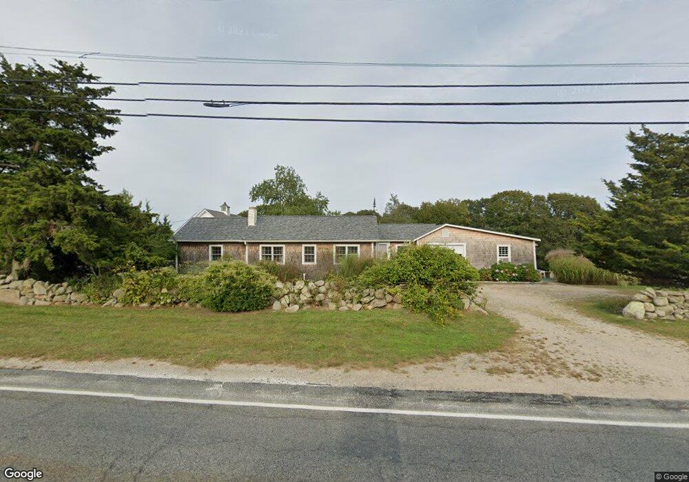
1824 Main Rd Westport Point, MA 02791
Westport Point NeighborhoodEstimated Value: $965,000 - $1,257,000
3
Beds
--
Bath
1,788
Sq Ft
$643/Sq Ft
Est. Value
About This Home
This home is located at 1824 Main Rd, Westport Point, MA 02791 and is currently estimated at $1,149,469, approximately $642 per square foot. 1824 Main Rd is a home with nearby schools including Alice A. Macomber Primary School, Westport Elementary School, and Westport Middle-High School.
Ownership History
Date
Name
Owned For
Owner Type
Purchase Details
Closed on
Oct 30, 2000
Sold by
Bennett Lawrence W
Bought by
Baker Janet P and Malabre Richard C
Current Estimated Value
Create a Home Valuation Report for This Property
The Home Valuation Report is an in-depth analysis detailing your home's value as well as a comparison with similar homes in the area
Home Values in the Area
Average Home Value in this Area
Purchase History
| Date | Buyer | Sale Price | Title Company |
|---|---|---|---|
| Baker Janet P | $300,000 | -- | |
| Baker Janet P | $300,000 | -- |
Source: Public Records
Mortgage History
| Date | Status | Borrower | Loan Amount |
|---|---|---|---|
| Open | Baker Janet P | $385,500 | |
| Closed | Baker Janet P | $80,000 | |
| Closed | Baker Janet P | $240,000 |
Source: Public Records
Tax History Compared to Growth
Tax History
| Year | Tax Paid | Tax Assessment Tax Assessment Total Assessment is a certain percentage of the fair market value that is determined by local assessors to be the total taxable value of land and additions on the property. | Land | Improvement |
|---|---|---|---|---|
| 2025 | $8,015 | $1,075,900 | $686,800 | $389,100 |
| 2024 | $7,608 | $984,200 | $600,400 | $383,800 |
| 2023 | $7,230 | $886,000 | $537,300 | $348,700 |
| 2022 | $5,601 | $777,300 | $480,700 | $296,600 |
| 2021 | $5,601 | $649,800 | $418,900 | $230,900 |
| 2020 | $4,586 | $544,000 | $402,600 | $141,400 |
| 2019 | $4,326 | $523,100 | $384,100 | $139,000 |
| 2018 | $4,042 | $494,700 | $391,500 | $103,200 |
| 2017 | $3,928 | $492,800 | $391,500 | $101,300 |
| 2016 | $3,855 | $487,300 | $391,500 | $95,800 |
| 2015 | $3,839 | $484,100 | $404,000 | $80,100 |
Source: Public Records
Map
Nearby Homes
- 1881 Main Rd
- 1749 Main Rd
- 1702J Drift Rd
- 1702 Drift Rd
- 1580 Main Rd
- 1346 Main Rd Unit B
- 99 Sylvia Ln
- 19 Seabury Ln
- 189 Brayton Point Rd
- 255 John Dyer Rd
- 225 Hixbridge Rd
- 304 Brayton Point Rd
- 920 Drift Rd
- 238-242 E Beach Rd
- 17 Quail Trail
- 245 John Dyer Rd
- Lot 2 Horseneck Rd
- 101 Adamsville Rd
- 837 Main Rd
- 2 Slades Farm Ln
- 1818 Main Rd
- 1823 Main Rd
- 1831 Main Rd
- 1814 Main Rd
- 1834 Main Rd
- 1819 Main Rd
- 1847 Main Rd
- 1847 Main Rd Unit VAC RENTAL
- 1847 Main Rd Unit WINTER RENT
- 1815 Main Rd
- 1835 Main Rd
- 1835 Main Rd
- 1835 Main Road U: Summer Rental
- 1838 Main Rd
- 1809 Main Rd Unit WINTER RENT
- 1809 Main Rd
- 1809 Main Rd Unit A
- 1813 Main Rd
- 1806 Main Rd
- 1846 Main Rd