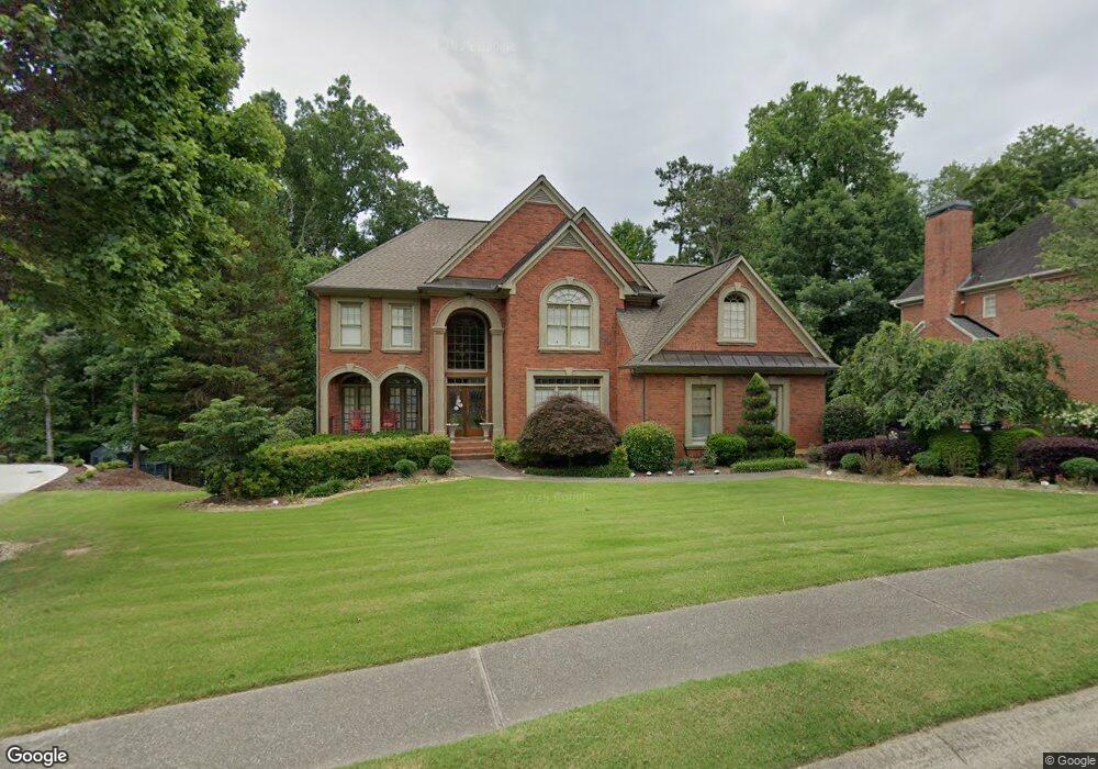
1824 Pemberton Place Unit II Marietta, GA 30062
East Cobb NeighborhoodEstimated Value: $1,039,000 - $1,297,000
4
Beds
3
Baths
3,998
Sq Ft
$299/Sq Ft
Est. Value
About This Home
This home is located at 1824 Pemberton Place Unit II, Marietta, GA 30062 and is currently estimated at $1,194,478, approximately $298 per square foot. 1824 Pemberton Place Unit II is a home located in Cobb County with nearby schools including Mount Bethel Elementary School, Dodgen Middle School, and Walton High School.
Ownership History
Date
Name
Owned For
Owner Type
Purchase Details
Closed on
Mar 4, 2020
Sold by
Madanoglu Melih
Bought by
Madanoglu Melih and Madanoglu Gulsevim Kinali
Current Estimated Value
Purchase Details
Closed on
Jun 1, 1998
Sold by
Jeffery Stephen P and Jeffery Delphine
Bought by
Aaronson Andrew B and Aaronson Julie
Home Financials for this Owner
Home Financials are based on the most recent Mortgage that was taken out on this home.
Original Mortgage
$227,150
Outstanding Balance
$44,538
Interest Rate
7.14%
Mortgage Type
New Conventional
Estimated Equity
$1,149,940
Create a Home Valuation Report for This Property
The Home Valuation Report is an in-depth analysis detailing your home's value as well as a comparison with similar homes in the area
Home Values in the Area
Average Home Value in this Area
Purchase History
| Date | Buyer | Sale Price | Title Company |
|---|---|---|---|
| Madanoglu Melih | -- | None Available | |
| Aaronson Andrew B | $422,600 | -- |
Source: Public Records
Mortgage History
| Date | Status | Borrower | Loan Amount |
|---|---|---|---|
| Open | Aaronson Andrew B | $227,150 |
Source: Public Records
Tax History Compared to Growth
Tax History
| Year | Tax Paid | Tax Assessment Tax Assessment Total Assessment is a certain percentage of the fair market value that is determined by local assessors to be the total taxable value of land and additions on the property. | Land | Improvement |
|---|---|---|---|---|
| 2025 | $10,246 | $366,232 | $90,000 | $276,232 |
| 2024 | $10,253 | $366,232 | $90,000 | $276,232 |
| 2023 | $9,783 | $369,564 | $90,000 | $279,564 |
| 2022 | $9,681 | $336,812 | $82,000 | $254,812 |
| 2021 | $8,987 | $305,136 | $84,000 | $221,136 |
| 2020 | $8,515 | $305,136 | $84,000 | $221,136 |
| 2019 | $8,052 | $284,000 | $72,000 | $212,000 |
| 2018 | $8,052 | $284,000 | $72,000 | $212,000 |
| 2017 | $7,774 | $288,588 | $72,000 | $216,588 |
| 2016 | $7,015 | $254,000 | $72,000 | $182,000 |
| 2015 | $7,189 | $254,000 | $72,000 | $182,000 |
| 2014 | $7,462 | $263,524 | $0 | $0 |
Source: Public Records
Map
Nearby Homes
- 4599 Lasalle Ct Unit 8A
- 4780 Waterhaven Bend
- 2082 Kinsmon Dr
- 4789 Waterhaven Bend
- 4804 Dalhousie Place NE
- 2100 Stone Hollow Ct
- 1961 Fields Pond Dr
- 4580 Roswell Rd
- 4871 Karls Gate Dr
- 1804 Shelburne Ridge
- 2281 Fox Hound Pkwy
- 1929 Fields Pond Glen
- 4586 Hunting Hound Ln
- 2269 Chimney Springs Dr
- 5122 Timber Ridge Rd
- 2066 Old Forge Way
- 4255 Green Ridge Dr
- 0 Converse Ct Unit 7499957
- 0 Converse Ct Unit 7484493
- 0 Converse Ct Unit 7418319
- 0 Converse Ct Unit 7288646
- 0 Converse Ct Unit 7088893
- 0 Converse Ct Unit 8348227
- 0 Converse Ct Unit 7365102
- 1828 Pemberton Place
- 4790 Converse Ct
- 4790 Converse Ct Unit U1, 2, 2a
- 1820 Pemberton Place
- 4792 Converse Ct
- 4789 Converse Ct
- 1821 Pemberton Place
- 1825 Pemberton Place Unit 2
- 1816 Pemberton Place Unit 2
- 1832 Pemberton Place Unit 2
- 0 Pemberton Place Unit 8370438
- 0 Pemberton Place Unit 8855026
- 0 Pemberton Place Unit 8756904