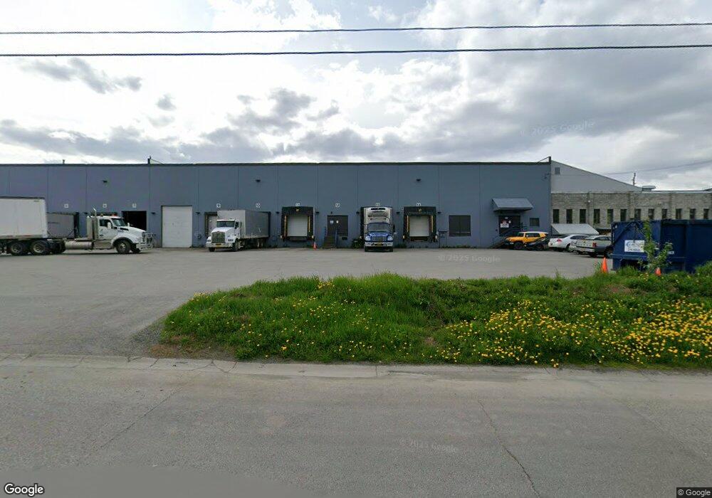
1824 Ship Ave Anchorage, AK 99501
Mountain View Neighborhood
Studio
--
Bath
31,040
Sq Ft
0.98
Acres
About This Home
This home is located at 1824 Ship Ave, Anchorage, AK 99501. 1824 Ship Ave is a home located in Anchorage Municipality with nearby schools including William Tyson Elementary School, Clark Middle School, and Bettye Davis East Anchorage High School.
Ownership History
Date
Name
Owned For
Owner Type
Purchase Details
Closed on
May 29, 2020
Sold by
Ship Avenue Investors Llc
Bought by
Tallak Holdings Llc
Home Financials for this Owner
Home Financials are based on the most recent Mortgage that was taken out on this home.
Original Mortgage
$9,030,000
Outstanding Balance
$8,019,327
Interest Rate
3.3%
Mortgage Type
Commercial
Create a Home Valuation Report for This Property
The Home Valuation Report is an in-depth analysis detailing your home's value as well as a comparison with similar homes in the area
Home Values in the Area
Average Home Value in this Area
Purchase History
| Date | Buyer | Sale Price | Title Company |
|---|---|---|---|
| Tallak Holdings Llc | -- | None Available |
Source: Public Records
Mortgage History
| Date | Status | Borrower | Loan Amount |
|---|---|---|---|
| Open | Tallak Holdings Llc | $9,030,000 |
Source: Public Records
Tax History
| Year | Tax Paid | Tax Assessment Tax Assessment Total Assessment is a certain percentage of the fair market value that is determined by local assessors to be the total taxable value of land and additions on the property. | Land | Improvement |
|---|---|---|---|---|
| 2025 | $50,167 | $3,531,500 | $430,100 | $3,101,400 |
| 2024 | $50,167 | $3,107,300 | $430,100 | $2,677,200 |
| 2023 | $50,760 | $2,980,600 | $430,100 | $2,550,500 |
| 2022 | $47,938 | $2,846,700 | $434,000 | $2,412,700 |
| 2021 | $52,085 | $2,890,400 | $434,000 | $2,456,400 |
| 2020 | $48,969 | $2,880,500 | $425,500 | $2,455,000 |
| 2019 | $47,802 | $2,921,900 | $417,200 | $2,504,700 |
| 2018 | $46,532 | $2,837,300 | $417,200 | $2,420,100 |
| 2017 | $43,671 | $2,788,700 | $417,200 | $2,371,500 |
| 2016 | $38,777 | $2,828,900 | $417,200 | $2,411,700 |
| 2015 | $38,777 | $2,733,700 | $417,200 | $2,316,500 |
| 2014 | $38,777 | $2,654,500 | $417,200 | $2,237,300 |
Source: Public Records
Map
Nearby Homes
- 595 E 4th Ave
- 101 E 4th Ave
- 1140 E 4th Ave
- 1215 Northpointe Bluff Dr
- 1091 Northpointe Bluff Dr
- 890 Orca St
- 624 Karluk St
- 793 Station Ln Unit A13
- 769 Station Ln Unit A11
- 729 Station Ln Unit A7
- 725 Station Ln Unit A6
- 730 Dogwood St
- 3216 Tarwater Ave
- 000 E 8th Ave
- 628 Gambell St
- 3341 Tarwater Ave
- 1403 Nelchina St
- 1118 Ingra St
- 837 E 11th Ave
- 417 Taylor St
- 1848 Ship Ave Unit B
- 1800 Ship Ave
- 1800 Viking Dr
- L23 B2 Spar Ave
- L5A B1 Spar Ave
- 1825 Ship Ave
- 1849 Ship Ave
- 311 N Sitka St
- 1813 E 1st Ave
- 1725 E 1st Ave
- L7A&8 Viking Dr
- L7A8 Viking Dr
- 1930 Spar Ave
- 1704 Ship Ave Unit 1456
- 1704 Ship Ave Unit 1A
- 1704 Ship Ave
- 1706 Ship Ave
- 410 N Sitka St
- 2021 Spar Ave
- NHN Rivers St
Your Personal Tour Guide
Ask me questions while you tour the home.