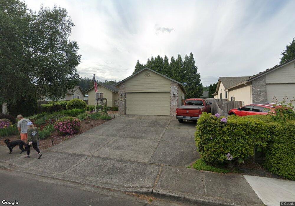
1825 Rhododendron Dr Woodland, WA 98674
Estimated Value: $475,975 - $596,000
3
Beds
2
Baths
1,840
Sq Ft
$297/Sq Ft
Est. Value
About This Home
This home is located at 1825 Rhododendron Dr, Woodland, WA 98674 and is currently estimated at $546,994, approximately $297 per square foot. 1825 Rhododendron Dr is a home located in Cowlitz County with nearby schools including Woodland High School.
Ownership History
Date
Name
Owned For
Owner Type
Purchase Details
Closed on
Feb 16, 2022
Sold by
Yinger John W and Yinger Arlene R
Bought by
Yinger John W
Current Estimated Value
Purchase Details
Closed on
Apr 11, 2005
Sold by
Solomon Phyllis J
Bought by
Schoenlein Matthew A and Schoenlein Erin K
Home Financials for this Owner
Home Financials are based on the most recent Mortgage that was taken out on this home.
Original Mortgage
$180,595
Interest Rate
5.77%
Mortgage Type
Fannie Mae Freddie Mac
Create a Home Valuation Report for This Property
The Home Valuation Report is an in-depth analysis detailing your home's value as well as a comparison with similar homes in the area
Home Values in the Area
Average Home Value in this Area
Purchase History
| Date | Buyer | Sale Price | Title Company |
|---|---|---|---|
| Yinger John W | $15,444 | None Listed On Document | |
| Schoenlein Matthew A | $190,100 | Cowlitz County Title |
Source: Public Records
Mortgage History
| Date | Status | Borrower | Loan Amount |
|---|---|---|---|
| Previous Owner | Schoenlein Matthew A | $180,595 |
Source: Public Records
Tax History Compared to Growth
Tax History
| Year | Tax Paid | Tax Assessment Tax Assessment Total Assessment is a certain percentage of the fair market value that is determined by local assessors to be the total taxable value of land and additions on the property. | Land | Improvement |
|---|---|---|---|---|
| 2024 | $4,260 | $433,090 | $59,400 | $373,690 |
| 2023 | $4,008 | $422,850 | $59,400 | $363,450 |
| 2022 | $3,682 | $403,550 | $59,400 | $344,150 |
| 2021 | $3,717 | $348,890 | $54,000 | $294,890 |
| 2020 | $3,299 | $326,860 | $54,000 | $272,860 |
| 2019 | $2,834 | $285,239 | $54,000 | $231,239 |
| 2018 | $2,935 | $282,950 | $54,000 | $228,950 |
| 2017 | $2,463 | $252,340 | $54,000 | $198,340 |
| 2016 | $2,265 | $219,160 | $50,000 | $169,160 |
| 2015 | $2,261 | $198,010 | $50,000 | $148,010 |
| 2013 | -- | $171,850 | $56,560 | $115,290 |
Source: Public Records
Map
Nearby Homes
- 336 York St
- 284 Gun Club Rd
- 369 Gun Club Rd Unit 48
- 369 Gun Club Rd Unit 101
- 369 Gun Club Rd Unit 70
- 369 Gun Club Rd Unit 53
- 369 Gun Club Rd Unit 117
- 369 Gun Club Rd Unit 114
- 1786 Clatsop St
- 1833 Hawthorne Ct
- 2216 Statesman Dr Unit Lot 46
- 2210 Statesman Dr Unit 44
- 1850 Heartwood Dr
- 1986 Meadowood Loop
- 1776 Clover Ln
- 3060 Spruce Ave
- 3040 Spruce Ave
- 2185 Dahlia St
- 2229 Ash St Unit Lot 83
- 605 Gun Club Rd
- 1845 Rhododendron Dr
- 1805 Rhododendron Dr
- 1930 Whitetail Ln
- 1940 Whitetail Ln
- 1865 Rhododendron Dr
- 1920 Whitetail Ln
- 1840 Rhododendron Dr
- 397 Maple St
- 390 Maple St
- 1950 Whitetail Ln
- 1917 Whitetail Ln
- 1875 Rhododendron Dr
- 393 Maple St
- 395 Pine St
- 1960 Whitetail Ln
- 386 Maple St
- 1945 Whitetail Ln
- 1955 Whitetail Ln
- 1915 Rhododendron Dr
- 385 Maple St