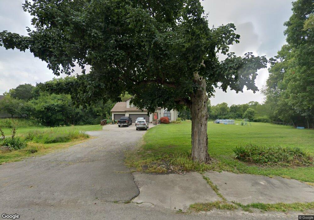
1825 S Tecumseh Rd Springfield, OH 45502
Estimated Value: $435,000 - $477,617
4
Beds
3
Baths
2,429
Sq Ft
$187/Sq Ft
Est. Value
About This Home
This home is located at 1825 S Tecumseh Rd, Springfield, OH 45502 and is currently estimated at $454,404, approximately $187 per square foot. 1825 S Tecumseh Rd is a home located in Clark County with nearby schools including Greenon Elementary School, Greenon Jr. High School, and Greenon High School.
Ownership History
Date
Name
Owned For
Owner Type
Purchase Details
Closed on
Jul 20, 2007
Sold by
Burley Scott
Bought by
Bailey William C and Bailey Tonya M
Current Estimated Value
Home Financials for this Owner
Home Financials are based on the most recent Mortgage that was taken out on this home.
Original Mortgage
$190,000
Interest Rate
6.76%
Mortgage Type
Purchase Money Mortgage
Create a Home Valuation Report for This Property
The Home Valuation Report is an in-depth analysis detailing your home's value as well as a comparison with similar homes in the area
Home Values in the Area
Average Home Value in this Area
Purchase History
| Date | Buyer | Sale Price | Title Company |
|---|---|---|---|
| Bailey William C | $265,000 | Ohio Real Estate Title |
Source: Public Records
Mortgage History
| Date | Status | Borrower | Loan Amount |
|---|---|---|---|
| Closed | Bailey William C | $190,000 |
Source: Public Records
Tax History Compared to Growth
Tax History
| Year | Tax Paid | Tax Assessment Tax Assessment Total Assessment is a certain percentage of the fair market value that is determined by local assessors to be the total taxable value of land and additions on the property. | Land | Improvement |
|---|---|---|---|---|
| 2024 | $6,202 | $118,280 | $29,380 | $88,900 |
| 2023 | $6,202 | $118,280 | $29,380 | $88,900 |
| 2022 | $6,196 | $118,280 | $29,380 | $88,900 |
| 2021 | $5,064 | $85,710 | $21,290 | $64,420 |
| 2020 | $5,077 | $85,710 | $21,290 | $64,420 |
| 2019 | $5,146 | $85,710 | $21,290 | $64,420 |
| 2018 | $4,832 | $78,690 | $19,520 | $59,170 |
| 2017 | $4,844 | $78,684 | $19,516 | $59,168 |
| 2016 | $4,223 | $78,684 | $19,516 | $59,168 |
| 2015 | $3,927 | $70,554 | $17,742 | $52,812 |
| 2014 | $3,935 | $70,554 | $17,742 | $52,812 |
| 2013 | $3,463 | $70,554 | $17,742 | $52,812 |
Source: Public Records
Map
Nearby Homes
- 5520 Old Lower Valley Park
- 2600 Brookdale Dr
- 5177 Outerview Dr
- 4341 Lone Wolf Ave
- 4311 Lone Wolf Ave
- 3072 Fowler Rd
- 68 Skyline Dr
- 5540 Broadway Rd
- 111 Fay Dr
- 5822 Broadway Rd
- 5095 W National Rd
- 96 Eastwood Dr
- 1810 Old Mill Rd
- 4904 Alpha Rd
- 1616 Crest Dr
- 32 Helmer Cir
- 245 Gordon Rd
- 3000 Rebert Pike
- 169 E Main St
- 5171 New Carlisle Pike
- 1857 S Tecumseh Rd
- 1822 S Tecumseh Rd
- 1743 S Tecumseh Rd
- 1891 S Tecumseh Rd
- 1925 S Tecumseh Rd
- 1924 S Tecumseh Rd
- 1862 S Tecumseh Rd
- 1945 S Tecumseh Rd
- 5411 Harshman Rd
- 1794 Snyderville Rd
- 1661 S Tecumseh Rd
- 1980 Snyderville Rd
- 1984 S Tecumseh Rd
- 1985 S Tecumseh Rd
- 1700 Snyderville Rd
- 1550 S Tecumseh Rd
- 1791 Snyderville Rd
- 1833 Snyderville Rd
- 5420 Wynn Rd
- 1837 Snyderville Rd