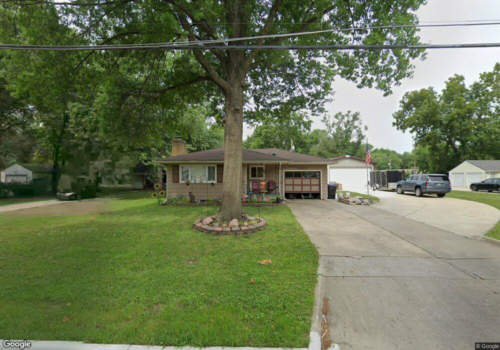
1825 SW Seabrook Ave Topeka, KS 66604
West Topeka NeighborhoodEstimated Value: $185,000 - $222,938
3
Beds
3
Baths
1,540
Sq Ft
$136/Sq Ft
Est. Value
About This Home
This home is located at 1825 SW Seabrook Ave, Topeka, KS 66604 and is currently estimated at $209,985, approximately $136 per square foot. 1825 SW Seabrook Ave is a home located in Shawnee County with nearby schools including Whitson Elementary School, Marjorie French Middle School, and Topeka West High School.
Ownership History
Date
Name
Owned For
Owner Type
Purchase Details
Closed on
Jun 27, 2012
Sold by
Tillotson David W and Tillotson Lisa M
Bought by
Tillotson David W and Tillotson Lisa M
Current Estimated Value
Purchase Details
Closed on
May 3, 2012
Sold by
Mccabe Robert G and Mccabe Carrie L
Bought by
Tillotson David W and Tillotson Lisa M
Create a Home Valuation Report for This Property
The Home Valuation Report is an in-depth analysis detailing your home's value as well as a comparison with similar homes in the area
Home Values in the Area
Average Home Value in this Area
Purchase History
| Date | Buyer | Sale Price | Title Company |
|---|---|---|---|
| Tillotson David W | -- | Kansas Secured Title | |
| Tillotson David W | -- | None Available |
Source: Public Records
Tax History Compared to Growth
Tax History
| Year | Tax Paid | Tax Assessment Tax Assessment Total Assessment is a certain percentage of the fair market value that is determined by local assessors to be the total taxable value of land and additions on the property. | Land | Improvement |
|---|---|---|---|---|
| 2025 | $2,950 | $24,357 | -- | -- |
| 2023 | $2,950 | $19,596 | $0 | $0 |
| 2022 | $2,543 | $17,040 | $0 | $0 |
| 2021 | $2,326 | $14,817 | $0 | $0 |
| 2020 | $2,188 | $14,110 | $0 | $0 |
| 2019 | $2,157 | $13,833 | $0 | $0 |
| 2018 | $2,095 | $13,431 | $0 | $0 |
| 2017 | $2,058 | $13,167 | $0 | $0 |
| 2014 | $2,078 | $13,167 | $0 | $0 |
Source: Public Records
Map
Nearby Homes
- 4230 SW 19th St
- 4221 SW 17th St
- 3900 SW Holly Ln
- 4200 SW Stratford Rd
- 4401 SW Connemara Ln
- 4405 SW Connemara Ln
- 3636 SW Stratford Rd
- 1625 SW Lakeside Dr
- 2028 SW Stone Ave
- 1944 SW Quivira Dr
- 1421 SW Mcalister Ave
- 1533 SW Stratford Rd
- 2012 SW Westwood Dr
- 1274 SW Indian Trail Ct
- 3516 SW Avalon Ln
- 1520 SW Oakley Ave
- 2401 SW James St
- 3405 SW Huntoon St
- 3100 SW Canterbury Ln
- 2124 SW Meadow Ln
- 1819 SW Seabrook Ave
- 1827 SW Seabrook Ave
- 1809 SW Seabrook Ave
- 1829 SW Seabrook Ave
- 1831 SW Seabrook Ave
- 1820 SW Moundview Dr
- 1826 SW Moundview Dr
- 1828 SW Moundview Dr
- 1805 SW Seabrook Ave
- 1830 SW Moundview Dr
- 1816 SW Moundview Dr
- 1832 SW Moundview Dr
- 1806 SW Moundview Dr
- 1835 SW Seabrook Ave
- 1830 SW Seabrook Ave
- 1820 SW Seabrook Ave
- 1832 SW Seabrook Ave
- 1801 SW Seabrook Ave
- 1836 SW Seabrook Ave
- 1808 SW Seabrook Ave