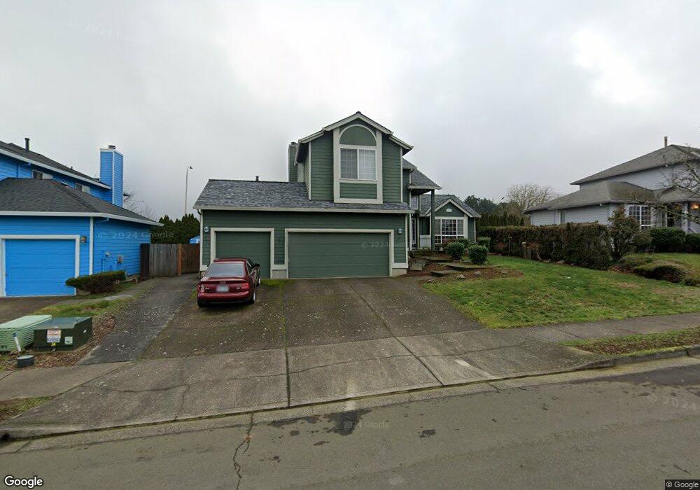
1826 SW Northstar Loop Troutdale, OR 97060
Town Center NeighborhoodEstimated Value: $551,000 - $635,000
3
Beds
4
Baths
2,238
Sq Ft
$265/Sq Ft
Est. Value
About This Home
This home is located at 1826 SW Northstar Loop, Troutdale, OR 97060 and is currently estimated at $593,369, approximately $265 per square foot. 1826 SW Northstar Loop is a home located in Multnomah County with nearby schools including Woodland Elementary School, Walt Morey Middle School, and Reynolds High School.
Ownership History
Date
Name
Owned For
Owner Type
Purchase Details
Closed on
Oct 29, 2007
Sold by
Schwanz Kim E
Bought by
Taylor William M and Taylor Julia E
Current Estimated Value
Home Financials for this Owner
Home Financials are based on the most recent Mortgage that was taken out on this home.
Original Mortgage
$341,923
Outstanding Balance
$213,130
Interest Rate
6.27%
Mortgage Type
VA
Estimated Equity
$380,239
Purchase Details
Closed on
Apr 26, 1996
Sold by
Cherry Ridge Ltd Partnership
Bought by
Schwanz Kim E and Schwanz Debbie S
Home Financials for this Owner
Home Financials are based on the most recent Mortgage that was taken out on this home.
Original Mortgage
$171,360
Interest Rate
7.84%
Mortgage Type
VA
Create a Home Valuation Report for This Property
The Home Valuation Report is an in-depth analysis detailing your home's value as well as a comparison with similar homes in the area
Home Values in the Area
Average Home Value in this Area
Purchase History
| Date | Buyer | Sale Price | Title Company |
|---|---|---|---|
| Taylor William M | $331,000 | Multiple | |
| Schwanz Kim E | $168,000 | Chicago Title |
Source: Public Records
Mortgage History
| Date | Status | Borrower | Loan Amount |
|---|---|---|---|
| Open | Taylor William M | $341,923 | |
| Previous Owner | Schwanz Kim E | $171,360 |
Source: Public Records
Tax History Compared to Growth
Tax History
| Year | Tax Paid | Tax Assessment Tax Assessment Total Assessment is a certain percentage of the fair market value that is determined by local assessors to be the total taxable value of land and additions on the property. | Land | Improvement |
|---|---|---|---|---|
| 2025 | $6,093 | $331,030 | -- | -- |
| 2024 | $5,757 | $321,390 | -- | -- |
| 2023 | $5,757 | $312,030 | $0 | $0 |
| 2022 | $5,470 | $302,950 | $0 | $0 |
| 2021 | $5,344 | $294,130 | $0 | $0 |
| 2020 | $4,999 | $285,570 | $0 | $0 |
| 2019 | $4,798 | $277,260 | $0 | $0 |
| 2018 | $4,765 | $269,190 | $0 | $0 |
| 2017 | $4,755 | $261,350 | $0 | $0 |
| 2016 | $4,595 | $253,740 | $0 | $0 |
| 2015 | $4,480 | $246,350 | $0 | $0 |
| 2014 | $4,355 | $239,180 | $0 | $0 |
Source: Public Records
Map
Nearby Homes
- 1953 SW Northstar Way
- 1392 SW Berryessa Place
- 1106 SW Dottie Ct
- 1212 SW Edgefield Ave
- 2326 SW Mcginnis Ave
- 1427 SW 24th St
- 839 SW Grant Way
- 821 SW 14th St
- 24066 NE Treehill Dr Unit 12
- 2511 SW 23rd Cir
- 2020 SW Laura Ct
- 24044 NE Treehill Dr Unit 6
- 1021 SW 24th St
- 809 SW Crestview Way
- 735 SW Sunset Way
- 2701 SW Latourell Place
- 1226 SW Hensley Rd
- 23882 NE Treehill Dr Unit T3882
- 114 Maple Blvd
- 1330 SW 28th St Unit 1332
- 1784 SW Northstar Loop
- 1840 SW Northstar Loop
- 1762 SW Northstar Loop
- 1868 SW Northstar Loop
- 1815 SW Northstar Loop
- 1837 SW Northstar Loop
- 1548 SW Berryessa Place
- 1773 SW Northstar Loop
- 1748 SW Northstar Loop Unit 1
- 1748 SW Northstar Loop
- 1751 SW Northstar Loop
- 1532 SW Berryessa Place
- 1950 SW Northstar Way
- 1548 SW Northstar Loop
- 1522 SW Northstar Loop
- 1690 SW Northstar Loop
- 1556 SW Northstar Loop
- 1951 SW Northstar Way
- 1931 SW Stella Way
- 1504 SW Berryessa Place