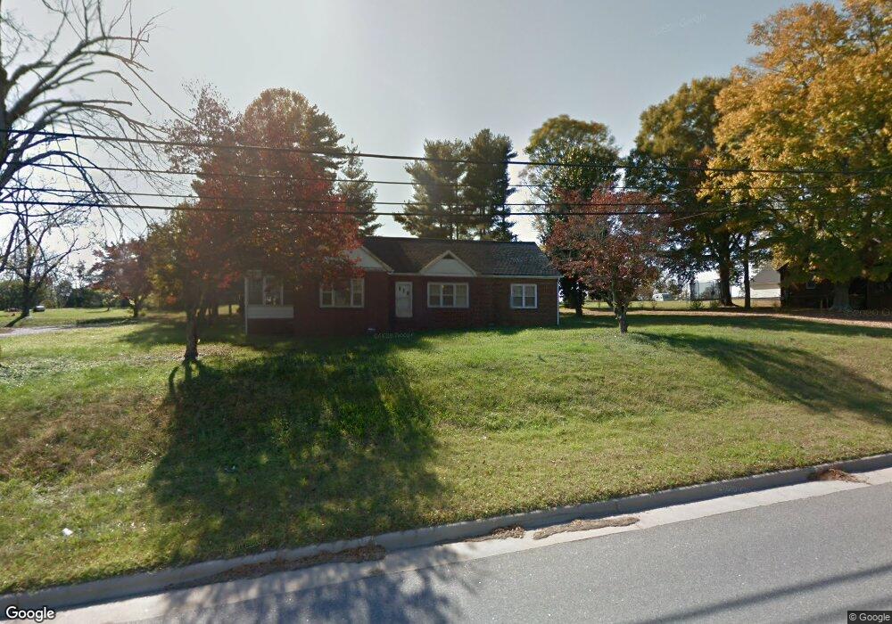
1827 S Nc 16 Hwy Newton, NC 28658
Estimated Value: $271,000 - $366,000
3
Beds
2
Baths
2,414
Sq Ft
$134/Sq Ft
Est. Value
About This Home
This home is located at 1827 S Nc 16 Hwy, Newton, NC 28658 and is currently estimated at $323,485, approximately $134 per square foot. 1827 S Nc 16 Hwy is a home located in Catawba County with nearby schools including Balls Creek Elementary School, Bandys High School, and Mill Creek Middle School.
Ownership History
Date
Name
Owned For
Owner Type
Purchase Details
Closed on
Oct 3, 2011
Sold by
Yount Philip C and Yount Sara H
Bought by
Willis Donald A and Willis Regina P
Current Estimated Value
Home Financials for this Owner
Home Financials are based on the most recent Mortgage that was taken out on this home.
Original Mortgage
$135,000
Outstanding Balance
$12,873
Interest Rate
4.24%
Mortgage Type
Seller Take Back
Estimated Equity
$310,612
Purchase Details
Closed on
Oct 13, 2006
Sold by
Willis Regina P and Clarke Regina
Bought by
Willis Donald and Willis Regina P
Home Financials for this Owner
Home Financials are based on the most recent Mortgage that was taken out on this home.
Original Mortgage
$118,000
Interest Rate
6.45%
Mortgage Type
Purchase Money Mortgage
Purchase Details
Closed on
May 14, 2003
Bought by
Massey Elizabeth Dellinger
Purchase Details
Closed on
Dec 10, 1999
Purchase Details
Closed on
Dec 1, 1998
Create a Home Valuation Report for This Property
The Home Valuation Report is an in-depth analysis detailing your home's value as well as a comparison with similar homes in the area
Home Values in the Area
Average Home Value in this Area
Purchase History
| Date | Buyer | Sale Price | Title Company |
|---|---|---|---|
| Willis Donald A | $140,000 | Chicago Title Insurance Co | |
| Willis Donald | -- | None Available | |
| Massey Elizabeth Dellinger | $99,000 | -- | |
| -- | $88,000 | -- | |
| -- | $88,000 | -- |
Source: Public Records
Mortgage History
| Date | Status | Borrower | Loan Amount |
|---|---|---|---|
| Open | Willis Donald A | $135,000 | |
| Previous Owner | Willis Donald | $118,000 |
Source: Public Records
Tax History Compared to Growth
Tax History
| Year | Tax Paid | Tax Assessment Tax Assessment Total Assessment is a certain percentage of the fair market value that is determined by local assessors to be the total taxable value of land and additions on the property. | Land | Improvement |
|---|---|---|---|---|
| 2025 | $1,389 | $278,100 | $15,900 | $262,200 |
| 2024 | $1,389 | $278,100 | $15,900 | $262,200 |
| 2023 | $1,389 | $278,100 | $15,900 | $262,200 |
| 2022 | $1,154 | $159,200 | $15,900 | $143,300 |
| 2021 | $1,122 | $159,200 | $15,900 | $143,300 |
| 2020 | $1,122 | $159,200 | $15,900 | $143,300 |
| 2019 | $1,106 | $159,200 | $0 | $0 |
| 2018 | $882 | $126,900 | $16,000 | $110,900 |
| 2017 | $844 | $0 | $0 | $0 |
| 2016 | $844 | $0 | $0 | $0 |
| 2015 | $888 | $126,880 | $16,000 | $110,880 |
| 2014 | $888 | $148,000 | $15,400 | $132,600 |
Source: Public Records
Map
Nearby Homes
- 1895 Sandy Cir
- 1585 Nathanial St
- 1502 Mulberry Ridge Dr Unit 1
- 1492 Mulberry Ridge Dr
- 2320 Claremont Rd
- 7.03 acres 5 W Hwy 10 Hwy
- 624 Overlook Dr
- 1478 Cannan Mountain Dr
- 1433 Wildflower St
- 1490 Edisons Bright Way
- 1429 Wildflower St
- 2094 Sunflower Cir
- 2111 Sunflower Cir
- 2100 Sunflower Cir
- 2117 Sunflower Cir
- 2125 Sunflower Cir
- 2106 Sunflower Cir
- 2112 Sunflower Cir
- 2131 E Nc 10 Hwy
- 2130 Sunflower Cir
- 1817 S Nc 16 Hwy
- 1837 S Nc 16 Hwy
- 1809 S Nc 16 Hwy
- 1842 S Nc 16 Hwy
- 1816 S Nc 16 Hwy
- 1851 S Nc 16 Hwy
- 1799 S Nc 16 Hwy
- 1852 S Nc 16 Hwy
- 1816 Hwy 16 S
- 1793 S Nc 16 Hwy
- 1861 S Nc 16 Hwy
- 1785 S Nc 16 Hwy
- 1781 N Carolina Highway 16
- 1475 Harris Ave
- 1469 Harris Ave
- 1483 Harris Ave
- 1459 Harris Ave
- 1493 Harris Ave
- 1878 S Nc 16 Hwy
- 1501 Harris Ave