Estimated Value: $473,479 - $562,000
4
Beds
4
Baths
2,818
Sq Ft
$186/Sq Ft
Est. Value
About This Home
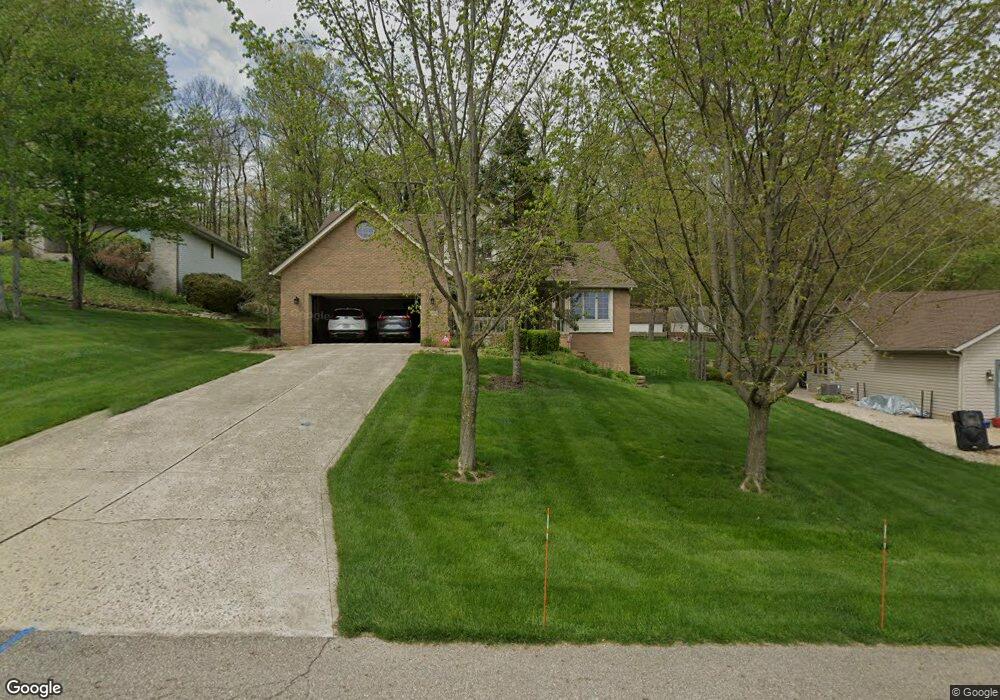
This home is located at 1828 Cumberland Crest, Heath, OH 43056 and is currently estimated at $525,120, approximately $186 per square foot. 1828 Cumberland Crest is a home located in Licking County with nearby schools including Garfield Elementary School, Stevenson Elementary School, and Heath Middle School.
Ownership History
Date
Name
Owned For
Owner Type
Purchase Details
Closed on
Oct 13, 2011
Sold by
Lee Roy S and Otts Patricia D
Bought by
Harvey Michael J and Harvey Janis M
Current Estimated Value
Home Financials for this Owner
Home Financials are based on the most recent Mortgage that was taken out on this home.
Original Mortgage
$144,900
Outstanding Balance
$99,398
Interest Rate
4.22%
Mortgage Type
New Conventional
Estimated Equity
$425,722
Purchase Details
Closed on
Jun 2, 2008
Sold by
Foltz Arthur W and Foltz Barbara J
Bought by
Lee Roy S and Lee Patricia D
Home Financials for this Owner
Home Financials are based on the most recent Mortgage that was taken out on this home.
Original Mortgage
$205,500
Interest Rate
6.01%
Mortgage Type
VA
Purchase Details
Closed on
Feb 6, 2001
Sold by
Blue Robert M
Bought by
Foltz Arthur W and Foltz Barbara J
Home Financials for this Owner
Home Financials are based on the most recent Mortgage that was taken out on this home.
Original Mortgage
$172,000
Interest Rate
7.22%
Mortgage Type
New Conventional
Create a Home Valuation Report for This Property
The Home Valuation Report is an in-depth analysis detailing your home's value as well as a comparison with similar homes in the area
Home Values in the Area
Average Home Value in this Area
Purchase History
| Date | Buyer | Sale Price | Title Company |
|---|---|---|---|
| Harvey Michael J | $219,500 | Attorney | |
| Lee Roy S | $227,000 | First Ameri | |
| Foltz Arthur W | $227,000 | -- |
Source: Public Records
Mortgage History
| Date | Status | Borrower | Loan Amount |
|---|---|---|---|
| Open | Harvey Michael J | $144,900 | |
| Closed | Lee Roy S | $205,500 | |
| Previous Owner | Foltz Arthur W | $172,000 |
Source: Public Records
Tax History Compared to Growth
Tax History
| Year | Tax Paid | Tax Assessment Tax Assessment Total Assessment is a certain percentage of the fair market value that is determined by local assessors to be the total taxable value of land and additions on the property. | Land | Improvement |
|---|---|---|---|---|
| 2024 | $5,477 | $137,140 | $18,030 | $119,110 |
| 2023 | $6,091 | $137,140 | $18,030 | $119,110 |
| 2022 | $4,983 | $100,770 | $19,180 | $81,590 |
| 2021 | $5,084 | $100,770 | $19,180 | $81,590 |
| 2020 | $5,117 | $100,770 | $19,180 | $81,590 |
| 2019 | $4,603 | $93,030 | $15,330 | $77,700 |
| 2018 | $4,652 | $0 | $0 | $0 |
| 2017 | $4,166 | $0 | $0 | $0 |
| 2016 | $3,621 | $0 | $0 | $0 |
| 2015 | $3,682 | $0 | $0 | $0 |
| 2014 | $5,882 | $0 | $0 | $0 |
| 2013 | $3,395 | $0 | $0 | $0 |
Source: Public Records
Map
Nearby Homes
- 0 Cumberland Crest
- 1782 Cumberland Crest
- 606 Kimberly Ct
- 1933 Blue Jay Rd
- 793 Francis Dr
- Yosemite Plan at Heron Manor - Maple Street Collection
- Cumberland Plan at Heron Manor - Maple Street Collection
- Wesley Plan at Linnview Crossing - Maple Street Collection
- Breckenridge Plan at Heron Manor - Maple Street Collection
- Yosemite Plan at Linnview Crossing - Maple Street Collection
- DaVinci Plan at Heron Manor - Maple Street Collection
- Fairfax Plan at Linnview Crossing - Maple Street Collection
- Greenbriar Plan at Linnview Crossing - Maple Street Collection
- Jensen Plan at Linnview Crossing - Maple Street Collection
- Jensen Plan at Heron Manor - Maple Street Collection
- Cumberland Plan at Linnview Crossing - Maple Street Collection
- Wesley Plan at Heron Manor - Maple Street Collection
- Preston Plan at Heron Manor - Maple Street Collection
- Denali Plan at Linnview Crossing - Maple Street Collection
- Fairfax Plan at Heron Manor - Maple Street Collection
- 1816 Cumberland Crest
- 1840 Cumberland Crest
- 1804 Cumberland Crest
- 1852 Cumberland Crest
- 1829 Cumberland Crest
- 1781 Cumberland Crest
- 1805 Cumberland Crest
- 8780 Cumberland Crest
- 598 Alpine Cir
- 628 Alpine Cir
- 1817 Cumberland Crest
- 0 Alpine Cir Unit 2622168
- 0 Alpine Cir Unit 2515015
- 573 Alpine Cir
- 573 Alpine Cir Unit L-573
- 0 Alpine Cir Unit L-574 2229470
- 0 Alpine Cir Unit 573
- 1790 Cumberland Crest
- 636 Alpine Cir
- 1838 Willow Ridge Dr