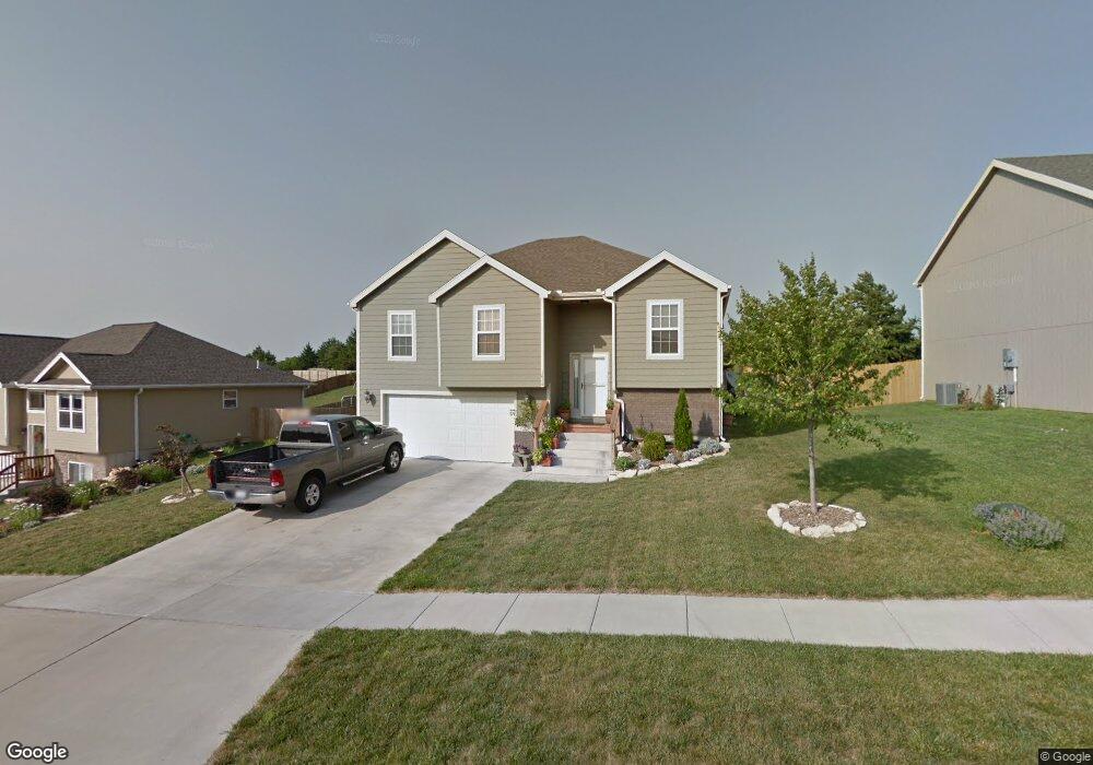
1828 Katie Rose Trail Junction City, KS 66441
Estimated Value: $278,000 - $291,000
3
Beds
2
Baths
1,366
Sq Ft
$208/Sq Ft
Est. Value
About This Home
This home is located at 1828 Katie Rose Trail, Junction City, KS 66441 and is currently estimated at $283,679, approximately $207 per square foot. 1828 Katie Rose Trail is a home located in Geary County with nearby schools including Eisenhower Elementary School, Junction City Middle School, and Junction City Senior High School.
Ownership History
Date
Name
Owned For
Owner Type
Purchase Details
Closed on
Aug 27, 2008
Sold by
Stephen Ayres Llc
Bought by
Harvey Gregory A and Harvey Diane L
Current Estimated Value
Home Financials for this Owner
Home Financials are based on the most recent Mortgage that was taken out on this home.
Original Mortgage
$148,393
Outstanding Balance
$98,796
Interest Rate
6.54%
Mortgage Type
VA
Estimated Equity
$184,883
Create a Home Valuation Report for This Property
The Home Valuation Report is an in-depth analysis detailing your home's value as well as a comparison with similar homes in the area
Home Values in the Area
Average Home Value in this Area
Purchase History
| Date | Buyer | Sale Price | Title Company |
|---|---|---|---|
| Harvey Gregory A | -- | Heartland Title Services Inc |
Source: Public Records
Mortgage History
| Date | Status | Borrower | Loan Amount |
|---|---|---|---|
| Open | Harvey Gregory A | $148,393 |
Source: Public Records
Tax History Compared to Growth
Tax History
| Year | Tax Paid | Tax Assessment Tax Assessment Total Assessment is a certain percentage of the fair market value that is determined by local assessors to be the total taxable value of land and additions on the property. | Land | Improvement |
|---|---|---|---|---|
| 2025 | $3,898 | $29,200 | $3,426 | $25,774 |
| 2024 | $5,314 | $26,519 | $3,192 | $23,327 |
| 2023 | $5,401 | $25,499 | $3,081 | $22,418 |
| 2022 | $0 | $23,610 | $2,846 | $20,764 |
| 2021 | $0 | $21,271 | $2,705 | $18,566 |
| 2020 | $4,892 | $20,082 | $2,650 | $17,432 |
| 2019 | $4,952 | $20,420 | $2,234 | $18,186 |
| 2018 | $4,977 | $20,665 | $2,234 | $18,431 |
| 2017 | $4,945 | $20,286 | $2,627 | $17,659 |
| 2016 | $4,978 | $20,286 | $1,222 | $19,064 |
| 2015 | $4,737 | $19,607 | $1,083 | $18,524 |
| 2014 | $4,590 | $19,504 | $1,654 | $17,850 |
Source: Public Records
Map
Nearby Homes
- 1834 Katie Rose Trail
- 1840 Katie Rose Trail
- 2007 Quail Run
- 1703 Lydia Ln
- 2137 Killdeer Ct
- 2328 Osprey Ct
- 2117 Thompson Dr
- 2326 Osprey Ct
- 2218 Cinder Ct
- 2332 Buckshot Dr
- 0000 Rucker Rd
- 1504 Thompson Dr
- 2434 Jaeger Dr
- 1129 W 20th Cir
- 0000 Us Highway 77
- 2431 Harrier Dr
- 2433 Harrier Dr
- 1743 Sutter Woods Rd
- 2514 Oriole Ln
- 2529 Wren Ln
- 1822 Katie Rose Trail
- 1818 Katie Rose Trail
- 2508 Deer Trail
- 1829 Katie Rose Trail
- 1902 Katie Rose Trail
- 2502 Deer Trail
- 1833 Katie Rose Trail
- 2514 Deer Trail
- 1823 Katie Rose Trail
- 1839 Katie Rose Trail
- 2440 Deer Trail
- 1817 Katie Rose Trail
- 1901 Katie Rose Trail
- 1806 Katie Rose Trail
- 2520 Deer Trail
- 1905 Katie Rose Trail
- 2420 Deer Trail
- 1811 Katie Rose Trail
- 1805 Katie Rose Trail
- 2526 Deer Trail