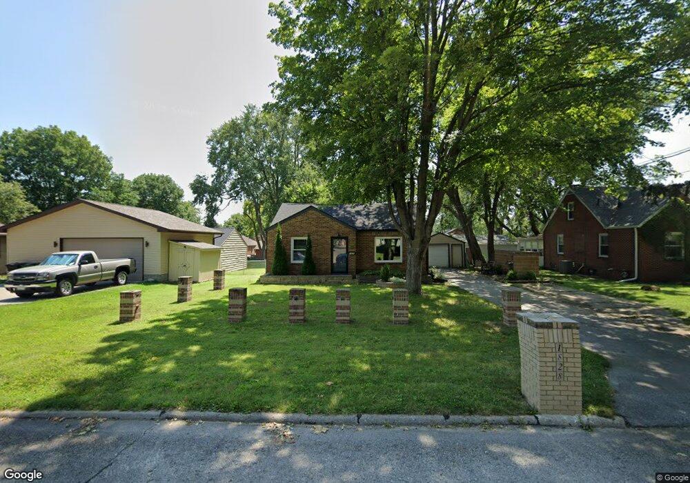
1828 Locust St West Des Moines, IA 50265
Estimated Value: $226,187 - $255,000
2
Beds
2
Baths
809
Sq Ft
$300/Sq Ft
Est. Value
About This Home
This home is located at 1828 Locust St, West Des Moines, IA 50265 and is currently estimated at $242,547, approximately $299 per square foot. 1828 Locust St is a home located in Polk County with nearby schools including Hillside Elementary School, Stilwell Junior High School, and Valley Southwoods Freshman High School.
Ownership History
Date
Name
Owned For
Owner Type
Purchase Details
Closed on
Aug 19, 2016
Sold by
Martens Gary A and Martens Marlene
Bought by
Levine Ryan
Current Estimated Value
Purchase Details
Closed on
Jan 22, 2001
Sold by
Martens Joseph E
Bought by
Martens Gary A
Home Financials for this Owner
Home Financials are based on the most recent Mortgage that was taken out on this home.
Original Mortgage
$43,000
Interest Rate
6.72%
Purchase Details
Closed on
Sep 11, 1997
Sold by
Lind Mary Ellen
Bought by
Martens Joseph E
Home Financials for this Owner
Home Financials are based on the most recent Mortgage that was taken out on this home.
Original Mortgage
$64,000
Interest Rate
7.44%
Create a Home Valuation Report for This Property
The Home Valuation Report is an in-depth analysis detailing your home's value as well as a comparison with similar homes in the area
Home Values in the Area
Average Home Value in this Area
Purchase History
| Date | Buyer | Sale Price | Title Company |
|---|---|---|---|
| Levine Ryan | $132,000 | None Available | |
| Martens Gary A | $74,500 | -- | |
| Martens Joseph E | $79,500 | -- |
Source: Public Records
Mortgage History
| Date | Status | Borrower | Loan Amount |
|---|---|---|---|
| Previous Owner | Martens Gary A | $43,000 | |
| Previous Owner | Martens Joseph E | $64,000 |
Source: Public Records
Tax History Compared to Growth
Tax History
| Year | Tax Paid | Tax Assessment Tax Assessment Total Assessment is a certain percentage of the fair market value that is determined by local assessors to be the total taxable value of land and additions on the property. | Land | Improvement |
|---|---|---|---|---|
| 2025 | $2,984 | $208,900 | $65,000 | $143,900 |
| 2024 | $2,984 | $188,300 | $57,900 | $130,400 |
| 2023 | $3,054 | $188,300 | $57,900 | $130,400 |
| 2022 | $3,018 | $158,200 | $50,200 | $108,000 |
| 2021 | $2,890 | $158,200 | $50,200 | $108,000 |
| 2020 | $2,846 | $144,100 | $45,600 | $98,500 |
| 2019 | $2,716 | $144,100 | $45,600 | $98,500 |
| 2018 | $2,722 | $132,600 | $41,200 | $91,400 |
| 2017 | $2,626 | $132,600 | $41,200 | $91,400 |
| 2016 | $2,568 | $124,200 | $38,100 | $86,100 |
| 2015 | $2,568 | $124,200 | $38,100 | $86,100 |
| 2014 | $2,438 | $120,200 | $36,200 | $84,000 |
Source: Public Records
Map
Nearby Homes
- 1829 Locust St
- 417 18th Place
- 1916 Locust St
- 1829 Pearl Dr
- 2009 Vine St
- 1809 Pearl Dr
- 2021 Elm Cir
- 2002 Maple Cir
- 2006 Maple Cir
- 720 19th St
- 725 20th St
- 1909 Prospect Ave
- 262 23rd St
- 248 Holiday Cir Unit 37
- 2300 Locust St
- 2100 Meadow Brook Dr Unit 103
- 212 25th St
- 536 14th St
- 2412 Fairlawn Dr
- 616 14th St