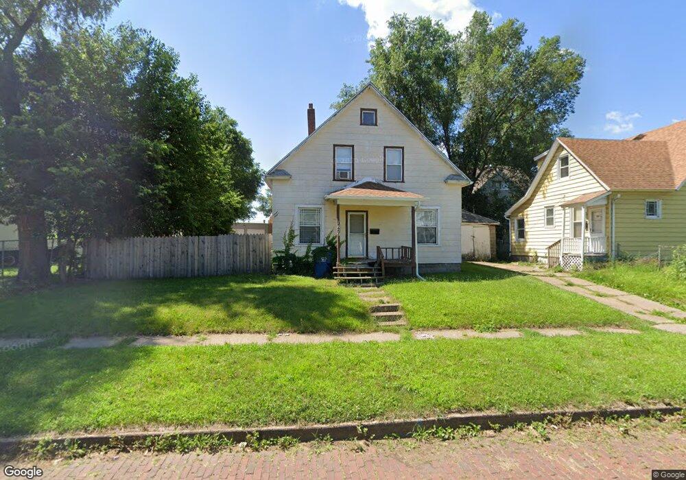
1829 Dixwell St Davenport, IA 52802
West End NeighborhoodEstimated Value: $85,856 - $103,000
2
Beds
1
Bath
1,299
Sq Ft
$70/Sq Ft
Est. Value
About This Home
This home is located at 1829 Dixwell St, Davenport, IA 52802 and is currently estimated at $91,464, approximately $70 per square foot. 1829 Dixwell St is a home located in Scott County with nearby schools including Walnut Hill Elementary School, South Christian Elementary School, and Caverna Middle School.
Ownership History
Date
Name
Owned For
Owner Type
Purchase Details
Closed on
Jul 2, 2020
Sold by
Studeny Bobbi L and White Bobbi L
Bought by
Miller Leslie and Miller Rebecca
Current Estimated Value
Purchase Details
Closed on
Dec 21, 2005
Sold by
Thomann Stephen H and Thomann Wendy K
Bought by
Studeny Edward A and White Bobbi L
Home Financials for this Owner
Home Financials are based on the most recent Mortgage that was taken out on this home.
Original Mortgage
$38,000
Interest Rate
8%
Mortgage Type
Seller Take Back
Create a Home Valuation Report for This Property
The Home Valuation Report is an in-depth analysis detailing your home's value as well as a comparison with similar homes in the area
Home Values in the Area
Average Home Value in this Area
Purchase History
| Date | Buyer | Sale Price | Title Company |
|---|---|---|---|
| Miller Leslie | $38,000 | None Available | |
| White Bobbie L | $45,000 | None Available | |
| Studeny Edward A | $45,000 | None Available |
Source: Public Records
Mortgage History
| Date | Status | Borrower | Loan Amount |
|---|---|---|---|
| Previous Owner | Studeny Edward A | $38,000 |
Source: Public Records
Tax History Compared to Growth
Tax History
| Year | Tax Paid | Tax Assessment Tax Assessment Total Assessment is a certain percentage of the fair market value that is determined by local assessors to be the total taxable value of land and additions on the property. | Land | Improvement |
|---|---|---|---|---|
| 2025 | $1,220 | $81,240 | $16,500 | $64,740 |
| 2024 | $1,192 | $68,290 | $16,500 | $51,790 |
| 2023 | $1,899 | $68,290 | $16,500 | $51,790 |
| 2022 | $1,932 | $59,080 | $16,500 | $42,580 |
| 2021 | $1,268 | $59,080 | $16,500 | $42,580 |
| 2020 | $932 | $55,030 | $16,500 | $38,530 |
| 2019 | $880 | $50,970 | $16,500 | $34,470 |
| 2018 | $810 | $50,970 | $16,500 | $34,470 |
| 2017 | $254 | $48,940 | $16,500 | $32,440 |
| 2016 | $924 | $48,940 | $0 | $0 |
| 2015 | $808 | $47,730 | $0 | $0 |
| 2014 | $792 | $47,730 | $0 | $0 |
| 2013 | $772 | $0 | $0 | $0 |
| 2012 | -- | $49,320 | $13,070 | $36,250 |
Source: Public Records
Map
Nearby Homes
- 2008 Dixwell St
- 2006 Claussen St
- 1815 W 3rd St
- 2014 Claussen St
- 2010 W 1st St
- 2011 W 2nd St
- 211 Cedar St
- 117 S Pine St
- 1636 W 3rd St
- 321 Cedar St
- 1614 W 3rd St
- 120 N Pine St
- 1538 W 3rd St
- 2101 W 5th St
- 131 S Lincoln Ave
- 223 S Lincoln Ave
- 2312 W 1st St
- 2312 1/2 W 1st St
- 2024 W 6th St
- 1120 & 1124 W 3rd St
- 205 S Howell St
- 201 S Howell St Unit 201 Half
- 201 S Howell St Unit 1/2
- 207 S Howell St
- 1826 Rockingham Rd
- 1828 Rockingham Rd
- 1836 Rockingham Rd
- 1828 Dixwell St
- 1826 Dixwell St
- 1842 Rockingham Rd
- 210 S Howell St
- 1830 Dixwell St
- 1834 Dixwell St
- 206 S Howell St
- 1838 Dixwell St
- 1842 Dixwell St
- 220 S Howell St
- 130 S Howell St
- 1822 Dixwell St
- 1816 Dixwell St