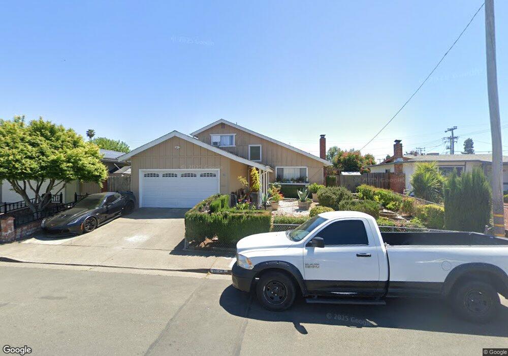
1829 Severus Dr Vallejo, CA 94589
North Vallejo NeighborhoodEstimated Value: $434,000 - $492,015
4
Beds
2
Baths
1,536
Sq Ft
$304/Sq Ft
Est. Value
About This Home
This home is located at 1829 Severus Dr, Vallejo, CA 94589 and is currently estimated at $466,504, approximately $303 per square foot. 1829 Severus Dr is a home located in Solano County with nearby schools including Dan Mini Elementary School, Solano Middle School, and Vallejo High School.
Ownership History
Date
Name
Owned For
Owner Type
Purchase Details
Closed on
Aug 27, 2010
Sold by
Deutsche Bank National Trust Company
Bought by
Rodas Ofelia Tomasa
Current Estimated Value
Purchase Details
Closed on
Feb 1, 2010
Sold by
Cobar Juanita E
Bought by
Deutsche Bank National Trust Company
Purchase Details
Closed on
Jul 17, 2002
Sold by
Cobar Juanita E and Magalong Juvymeryl C
Bought by
Cobar Juanita E
Home Financials for this Owner
Home Financials are based on the most recent Mortgage that was taken out on this home.
Original Mortgage
$187,125
Interest Rate
6.6%
Mortgage Type
Stand Alone First
Create a Home Valuation Report for This Property
The Home Valuation Report is an in-depth analysis detailing your home's value as well as a comparison with similar homes in the area
Home Values in the Area
Average Home Value in this Area
Purchase History
| Date | Buyer | Sale Price | Title Company |
|---|---|---|---|
| Rodas Ofelia Tomasa | $115,000 | Lsi Title Company | |
| Deutsche Bank National Trust Company | $138,447 | Accommodation | |
| Cobar Juanita E | $68,500 | Fidelity National Title | |
| Magalong Juvymeryl C | -- | Fidelity National Title |
Source: Public Records
Mortgage History
| Date | Status | Borrower | Loan Amount |
|---|---|---|---|
| Previous Owner | Cobar Juanita E | $187,125 |
Source: Public Records
Tax History
| Year | Tax Paid | Tax Assessment Tax Assessment Total Assessment is a certain percentage of the fair market value that is determined by local assessors to be the total taxable value of land and additions on the property. | Land | Improvement |
|---|---|---|---|---|
| 2025 | $3,273 | $147,321 | $44,833 | $102,488 |
| 2024 | $3,273 | $144,433 | $43,954 | $100,479 |
| 2023 | $2,841 | $141,602 | $43,093 | $98,509 |
| 2022 | $2,883 | $138,827 | $42,249 | $96,578 |
| 2021 | $2,323 | $136,106 | $41,421 | $94,685 |
| 2020 | $2,314 | $134,712 | $40,997 | $93,715 |
| 2019 | $2,223 | $132,072 | $40,194 | $91,878 |
| 2018 | $2,332 | $129,483 | $39,406 | $90,077 |
| 2017 | $2,054 | $126,945 | $38,634 | $88,311 |
| 2016 | $1,384 | $124,457 | $37,877 | $86,580 |
| 2015 | $1,635 | $122,589 | $37,309 | $85,280 |
| 2014 | $1,724 | $120,189 | $36,579 | $83,610 |
Source: Public Records
Map
Nearby Homes
- 130 Kennison Ct
- 240 Rinaldo Dr
- 1537 Mini Dr
- 35 Marla Dr
- 1355 Jack London Dr
- 1335 Jack London Dr
- 552 Cattail Ct
- 568 Cattail Ct
- 601 Danrose Dr
- 148 Obrien Cir
- 705 Danrose Dr
- 316 Meadows Dr
- 1001 Jack London Dr
- 121 Forsythia Ct
- 141 Dartmouth Ave
- 203 Baylor Dr Unit 11
- 446 Kensington Way
- 151 Marquette Ave
- 570 Newport Way
- 444 Corcoran Ave Unit 4
- 1833 Severus Dr
- 1823 Severus Dr
- 1900 Alice Dr
- 1839 Severus Dr
- 1817 Severus Dr
- 1906 Alice Dr
- 1824 Alice Dr
- 1830 Severus Dr
- 1912 Alice Dr
- 1818 Alice Dr
- 1824 Severus Dr
- 1836 Severus Dr
- 1845 Severus Dr
- 1818 Severus Dr
- 1805 Severus Dr
- 1842 Severus Dr
- 710 Echo Summit Rd
- 1918 Alice Dr
- 1810 Alice Dr
- 1851 Severus Dr
Your Personal Tour Guide
Ask me questions while you tour the home.