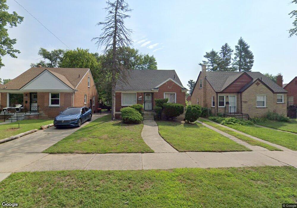
18290 Shaftsbury Ave Detroit, MI 48219
Evergreen-Outer Drive NeighborhoodEstimated Value: $97,000 - $117,000
--
Bed
1
Bath
1,036
Sq Ft
$101/Sq Ft
Est. Value
About This Home
This home is located at 18290 Shaftsbury Ave, Detroit, MI 48219 and is currently estimated at $105,014, approximately $101 per square foot. 18290 Shaftsbury Ave is a home located in Wayne County with nearby schools including Ralph W. Emerson Elementary-Middle School, Charles L. Spain Elementary-Middle School, and Edward 'Duke' Ellington Conservatory of Music and Art.
Ownership History
Date
Name
Owned For
Owner Type
Purchase Details
Closed on
May 27, 2004
Sold by
Hudgins Ruby
Bought by
Hudgins Bobby
Current Estimated Value
Home Financials for this Owner
Home Financials are based on the most recent Mortgage that was taken out on this home.
Original Mortgage
$33,600
Interest Rate
5.95%
Mortgage Type
Purchase Money Mortgage
Purchase Details
Closed on
Aug 17, 1994
Sold by
Shrf Donald Ellis Pr
Bought by
Secretary Of Housing & Urban Dev
Create a Home Valuation Report for This Property
The Home Valuation Report is an in-depth analysis detailing your home's value as well as a comparison with similar homes in the area
Home Values in the Area
Average Home Value in this Area
Purchase History
| Date | Buyer | Sale Price | Title Company |
|---|---|---|---|
| Hudgins Bobby | $42,500 | Title Source Inc | |
| Secretary Of Housing & Urban Dev | $40,532 | -- |
Source: Public Records
Mortgage History
| Date | Status | Borrower | Loan Amount |
|---|---|---|---|
| Closed | Hudgins Bobby | $33,600 |
Source: Public Records
Tax History Compared to Growth
Tax History
| Year | Tax Paid | Tax Assessment Tax Assessment Total Assessment is a certain percentage of the fair market value that is determined by local assessors to be the total taxable value of land and additions on the property. | Land | Improvement |
|---|---|---|---|---|
| 2025 | $1,475 | $48,200 | $0 | $0 |
| 2024 | $1,475 | $40,900 | $0 | $0 |
| 2023 | $1,433 | $32,200 | $0 | $0 |
| 2022 | $1,530 | $26,300 | $0 | $0 |
| 2021 | $1,487 | $20,900 | $0 | $0 |
| 2020 | $1,486 | $19,200 | $0 | $0 |
| 2019 | $1,463 | $15,400 | $0 | $0 |
| 2018 | $1,279 | $13,500 | $0 | $0 |
| 2017 | $260 | $13,800 | $0 | $0 |
| 2016 | $1,450 | $16,000 | $0 | $0 |
| 2015 | $1,600 | $16,000 | $0 | $0 |
| 2013 | $2,242 | $22,417 | $0 | $0 |
| 2010 | -- | $32,119 | $1,052 | $31,067 |
Source: Public Records
Map
Nearby Homes
- 19026 Curtis St
- 19121 Curtis St
- 19105 Curtis St
- 19178 Sunderland Rd
- 19003 Curtis St
- 17694 Shaftsbury Ave
- 18452 Shaftsbury Ave
- 18462 Grandville Ave
- 18500 Warwick St
- 19123 Margareta St
- 17706 Stahelin Ave
- 18635 Curtis St
- 18415 Edinborough Rd
- 18431 Edinborough Rd
- 18460 Avon Ave
- 18821 Margareta St
- 17690 Annchester Rd
- 18651 Warwick St
- 18631 Margareta St
- 18668 Warwick St
- 18298 Shaftsbury Ave
- 18282 Shaftsbury Ave
- 18299 Warwick St
- 18281 Warwick St
- 18306 Shaftsbury Ave
- 18274 Shaftsbury Ave
- 18273 Warwick St
- 18314 Shaftsbury Ave
- 18264 Shaftsbury Ave
- 18265 Warwick St
- 18307 Warwick St
- 18320 Shaftsbury Ave
- 18258 Shaftsbury Ave
- 18323 Warwick St
- 18315 Warwick St
- 18291 Shaftsbury Ave
- 18330 Shaftsbury Ave
- 18250 Shaftsbury Ave
- 18275 Shaftsbury Ave
- 18307 Shaftsbury Ave