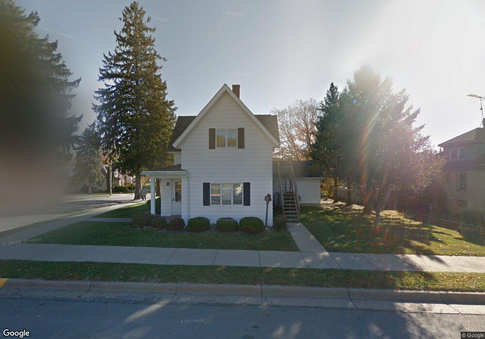
183 1st St SW Spring Grove, MN 55974
Estimated Value: $156,000 - $240,000
4
Beds
2
Baths
1,669
Sq Ft
$120/Sq Ft
Est. Value
About This Home
This home is located at 183 1st St SW, Spring Grove, MN 55974 and is currently estimated at $200,040, approximately $119 per square foot. 183 1st St SW is a home located in Houston County with nearby schools including Spring Grove Elementary School and Spring Grove Secondary School.
Ownership History
Date
Name
Owned For
Owner Type
Purchase Details
Closed on
Jul 13, 2023
Sold by
Onstad Delores A and Onstad Keith
Bought by
Lewis Ross W and Lewis Annette Rae
Current Estimated Value
Home Financials for this Owner
Home Financials are based on the most recent Mortgage that was taken out on this home.
Original Mortgage
$120,000
Outstanding Balance
$117,137
Interest Rate
6.79%
Mortgage Type
New Conventional
Estimated Equity
$82,903
Purchase Details
Closed on
Sep 10, 2007
Sold by
Wells Fargo Bank Na
Bought by
Miles James E and Ramsey Claudia C
Create a Home Valuation Report for This Property
The Home Valuation Report is an in-depth analysis detailing your home's value as well as a comparison with similar homes in the area
Home Values in the Area
Average Home Value in this Area
Purchase History
| Date | Buyer | Sale Price | Title Company |
|---|---|---|---|
| Lewis Ross W | $170,000 | None Listed On Document | |
| Miles James E | $35,000 | None Available |
Source: Public Records
Mortgage History
| Date | Status | Borrower | Loan Amount |
|---|---|---|---|
| Open | Lewis Ross W | $120,000 |
Source: Public Records
Tax History Compared to Growth
Tax History
| Year | Tax Paid | Tax Assessment Tax Assessment Total Assessment is a certain percentage of the fair market value that is determined by local assessors to be the total taxable value of land and additions on the property. | Land | Improvement |
|---|---|---|---|---|
| 2025 | $2,214 | $165,600 | $34,900 | $130,700 |
| 2024 | $2,096 | $163,200 | $34,900 | $128,300 |
| 2023 | $1,538 | $139,800 | $11,300 | $128,500 |
| 2022 | $1,386 | $111,100 | $8,900 | $102,200 |
| 2021 | $1,206 | $98,600 | $8,900 | $89,700 |
| 2020 | $1,228 | $86,500 | $8,900 | $77,600 |
| 2019 | $1,122 | $86,500 | $8,900 | $77,600 |
| 2018 | $1,160 | $77,100 | $8,900 | $68,200 |
| 2017 | $1,160 | $48,100 | $5,959 | $42,141 |
| 2016 | $1,280 | $78,300 | $9,700 | $68,600 |
| 2015 | $1,094 | $83,000 | $10,300 | $72,700 |
| 2014 | $1,094 | $45,200 | $5,515 | $39,685 |
Source: Public Records
Map
Nearby Homes
- 170 1st St SW
- 310 Maple Dr
- 147 4th Ave SE
- Rooster Valley Rd
- 110 Lyndale St S
- 237 S Robert St
- 241 S Robert St
- 44331 State Hwy 44
- 409 Maple St N
- 405 Maple St N
- 105 Oak St N
- 315 Newburg Ave W
- TBD Prairie Ridge Rd
- 118 Quandahl Rd
- 14327 County 1
- 11984 S Prairie Dr
- 19708 Camp Winnebago Rd
- 126 Bissen St
- 12384 Green Acres Dr
- 107 E Sunnyside Dr
- 129 1st Ave SW
- 135 1st Ave SW
- 135 1st Ave SW
- 115 1st Ave SW
- 135 1st Ave SW
- 112 1st Ave SW
- TBD 1st Ave SW
- 120 1st Ave SW
- 126 1st Ave SW
- 111 1st Ave SW
- 116 1st Ave SW
- 134 1st Ave SW
- 110 110 1st Ave--Sw
- 165 1st St SW
- 145 1st Ave SW
- 110 1st Ave SW
- 140 1st Ave SW
- 166 1st St SW
- 161 1st St SW
- 197 W Main St