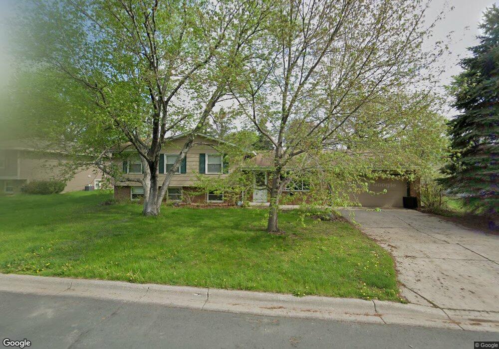
183 Muriel Blvd West St. Paul, MN 55118
Estimated Value: $351,000 - $359,000
4
Beds
2
Baths
1,232
Sq Ft
$288/Sq Ft
Est. Value
About This Home
This home is located at 183 Muriel Blvd, West St. Paul, MN 55118 and is currently estimated at $354,904, approximately $288 per square foot. 183 Muriel Blvd is a home located in Dakota County with nearby schools including Garlough Environmental Magnet, Friendly Hills Middle School, and Two Rivers High School.
Ownership History
Date
Name
Owned For
Owner Type
Purchase Details
Closed on
Sep 27, 2024
Sold by
Critchley Dale and Critchley Teresa
Bought by
Paw Stee and Muie Are
Current Estimated Value
Home Financials for this Owner
Home Financials are based on the most recent Mortgage that was taken out on this home.
Original Mortgage
$272,000
Outstanding Balance
$269,215
Interest Rate
6.49%
Mortgage Type
New Conventional
Estimated Equity
$85,689
Purchase Details
Closed on
Jan 8, 2015
Sold by
Messicci Alex J and Messicci Karen
Bought by
Critchley Dale and Critchley Teresa
Home Financials for this Owner
Home Financials are based on the most recent Mortgage that was taken out on this home.
Original Mortgage
$179,910
Interest Rate
3.5%
Mortgage Type
Adjustable Rate Mortgage/ARM
Purchase Details
Closed on
Jul 28, 2000
Sold by
Sharer Michael P and Sharer Julie A
Bought by
Messicci Alex J and Messicci Karen C
Create a Home Valuation Report for This Property
The Home Valuation Report is an in-depth analysis detailing your home's value as well as a comparison with similar homes in the area
Home Values in the Area
Average Home Value in this Area
Purchase History
| Date | Buyer | Sale Price | Title Company |
|---|---|---|---|
| Paw Stee | $340,000 | -- | |
| Critchley Dale | $199,900 | Partners Title | |
| Messicci Alex J | $164,900 | -- |
Source: Public Records
Mortgage History
| Date | Status | Borrower | Loan Amount |
|---|---|---|---|
| Open | Paw Stee | $272,000 | |
| Previous Owner | Critchley Dale | $179,910 |
Source: Public Records
Tax History
| Year | Tax Paid | Tax Assessment Tax Assessment Total Assessment is a certain percentage of the fair market value that is determined by local assessors to be the total taxable value of land and additions on the property. | Land | Improvement |
|---|---|---|---|---|
| 2024 | $3,822 | $305,600 | $77,300 | $228,300 |
| 2023 | $3,822 | $316,000 | $81,800 | $234,200 |
| 2022 | $3,512 | $309,300 | $81,500 | $227,800 |
| 2021 | $3,338 | $277,100 | $70,900 | $206,200 |
| 2020 | $3,112 | $263,000 | $67,500 | $195,500 |
| 2019 | $2,918 | $240,700 | $64,300 | $176,400 |
| 2018 | $2,699 | $217,800 | $60,100 | $157,700 |
| 2017 | $2,501 | $211,100 | $55,000 | $156,100 |
| 2016 | $2,349 | $190,600 | $50,000 | $140,600 |
| 2015 | $2,353 | $159,941 | $43,411 | $116,530 |
| 2014 | -- | $155,145 | $39,995 | $115,150 |
| 2013 | -- | $141,411 | $36,237 | $105,174 |
Source: Public Records
Map
Nearby Homes
- 191 Muriel Blvd
- 260 Westview Dr Unit 105
- 1923 Fox Ridge Dr Unit B
- 8XX Humboldt Ave
- 1560 Oakdale Ave
- 360 Trenton Ln
- 1540 Trellis Ln
- 2012 Pine Ridge Dr
- 1538 Trellis Ln
- 1536 Trellis Ln
- Bayfield Plan at Thompson Square East
- Capri Plan at Thompson Square East
- 1531 Traverse Ln
- Hayward Plan at Thompson Square East
- Barcelona Plan at Thompson Square East
- Athens II Plan at Thompson Square East
- Athens Plan at Thompson Square East
- 1526 Traverse Ln
- 1534 Trellis Ln
- 1532 Trellis Ln
- 183 Muriel Blvd
- 182 182 Muriel-Boulevard-
- 175 Muriel Blvd
- 191 Muriel Blvd
- 191 Muriel Blvd
- 186 Kathleen Dr
- 178 Kathleen Dr
- 182 Muriel Blvd
- 168 168 Muriel-Boulevard-
- 174 Muriel Blvd
- 167 Muriel Blvd
- 188 Muriel Blvd
- 199 Muriel Blvd
- 194 Kathleen Dr
- 170 Kathleen Dr
- 194 Muriel Blvd
- 168 Muriel Blvd
- 194 Muriel Blvd
- 178 178 Kathleen Dr
- 159 Muriel Blvd