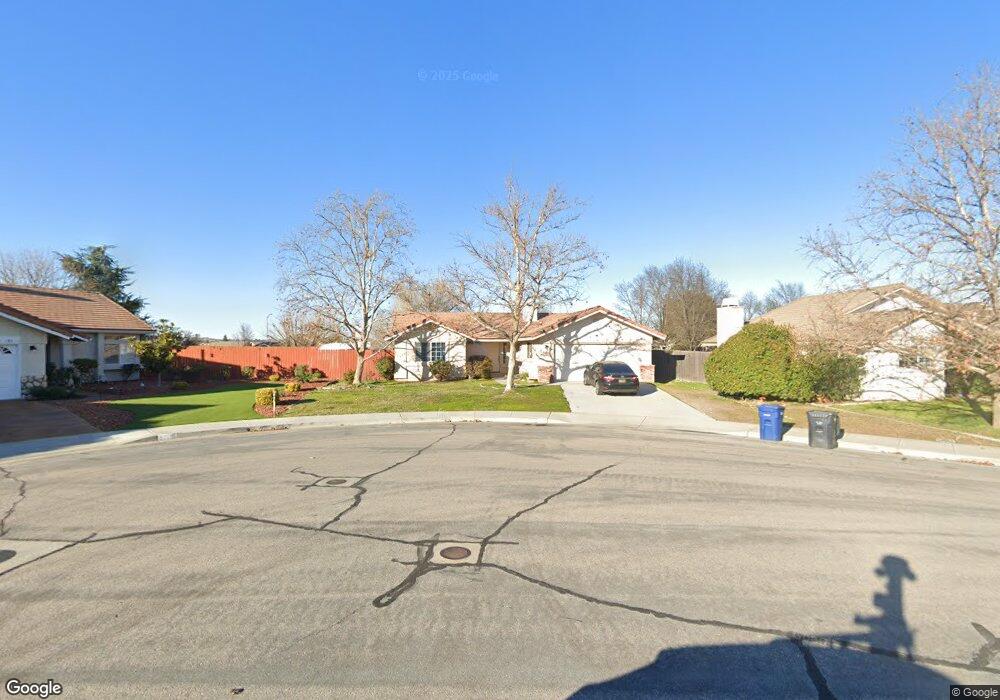
183 Stonebridge Ln Paso Robles, CA 93446
Estimated Value: $615,713 - $732,000
3
Beds
2
Baths
1,281
Sq Ft
$525/Sq Ft
Est. Value
About This Home
This home is located at 183 Stonebridge Ln, Paso Robles, CA 93446 and is currently estimated at $672,678, approximately $525 per square foot. 183 Stonebridge Ln is a home located in San Luis Obispo County with nearby schools including Pat Butler Elementary School, George H. Flamson Middle School, and Paso Robles High School.
Ownership History
Date
Name
Owned For
Owner Type
Purchase Details
Closed on
Dec 12, 2018
Sold by
Bruce Stacy Lynn
Bought by
Kardel Hans M and Kardel Bruce Stacy
Current Estimated Value
Purchase Details
Closed on
Nov 2, 1995
Sold by
Bonita Land Company
Bought by
Bruce Stacy Lynn
Home Financials for this Owner
Home Financials are based on the most recent Mortgage that was taken out on this home.
Original Mortgage
$116,900
Outstanding Balance
$1,616
Interest Rate
7.48%
Estimated Equity
$671,062
Create a Home Valuation Report for This Property
The Home Valuation Report is an in-depth analysis detailing your home's value as well as a comparison with similar homes in the area
Purchase History
| Date | Buyer | Sale Price | Title Company |
|---|---|---|---|
| Kardel Hans M | -- | None Available | |
| Bruce Stacy Lynn | $130,000 | Cuesta Title |
Source: Public Records
Mortgage History
| Date | Status | Borrower | Loan Amount |
|---|---|---|---|
| Open | Bruce Stacy Lynn | $116,900 |
Source: Public Records
Tax History
| Year | Tax Paid | Tax Assessment Tax Assessment Total Assessment is a certain percentage of the fair market value that is determined by local assessors to be the total taxable value of land and additions on the property. | Land | Improvement |
|---|---|---|---|---|
| 2025 | $2,484 | $215,763 | $89,691 | $126,072 |
| 2024 | $2,442 | $211,533 | $87,933 | $123,600 |
| 2023 | $2,442 | $207,386 | $86,209 | $121,177 |
| 2022 | $2,397 | $203,320 | $84,519 | $118,801 |
| 2021 | $2,358 | $199,334 | $82,862 | $116,472 |
| 2020 | $2,326 | $197,291 | $82,013 | $115,278 |
| 2019 | $2,291 | $193,423 | $80,405 | $113,018 |
| 2018 | $2,262 | $189,631 | $78,829 | $110,802 |
| 2017 | $2,129 | $185,914 | $77,284 | $108,630 |
| 2016 | $2,086 | $182,269 | $75,769 | $106,500 |
| 2015 | $2,078 | $179,532 | $74,631 | $104,901 |
| 2014 | $2,010 | $176,017 | $73,170 | $102,847 |
Source: Public Records
Map
Nearby Homes
- 192 Sandbar Ct
- 1720 Willowbank Ln
- 470 Kenton Ct
- 350 Robles Rd
- 795 Angus St
- 1736 Wade Dr
- 1635 Wade Dr
- 834 Nicklaus St
- 143 Vine St
- 1410 Fire Rock Loop
- 448 Morgan Ln
- 1320 Fire Rock Loop
- 912 Wade Dr
- 829 Saint Andrews Cir
- 427 Olive St
- 419 Cherokee Ct
- 1006 Eagle Ct
- 907 Saint Ann Dr
- 940 Austin Ct
- 911 Saint Ann Dr
- 185 Stonebridge Ln
- 181 Stonebridge Ln
- 186 Bridgegate Ln
- 182 Bridgegate Ln
- 187 Stonebridge Ln
- 188 Bridgegate Ln
- 180 Bridgegate Ln
- 180 Stonebridge Ln
- 184 Stonebridge Ln
- 186 Stonebridge Ln
- 182 Stonebridge Ln
- 178 Bridgegate Ln
- 177 Sandcove Ln
- 188 Stonebridge Ln
- 179 Sandcove Ln
- 1726 Stillwater Ct
- 1725 Creeksand Ln
- 193 Stonebridge Ln
- 190 Stonebridge Ln
- 192 Bridgegate Ln
Your Personal Tour Guide
Ask me questions while you tour the home.