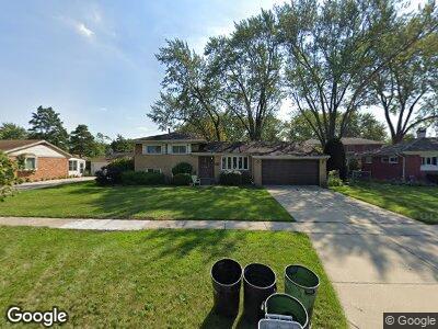
183 W Walnut Ave Des Plaines, IL 60016
Estimated Value: $404,000 - $468,000
3
Beds
2
Baths
1,306
Sq Ft
$328/Sq Ft
Est. Value
About This Home
This home is located at 183 W Walnut Ave, Des Plaines, IL 60016 and is currently estimated at $427,895, approximately $327 per square foot. 183 W Walnut Ave is a home located in Cook County with nearby schools including Devonshire Elementary School, Friendship Jr High School, and Elk Grove High School.
Ownership History
Date
Name
Owned For
Owner Type
Purchase Details
Closed on
Sep 3, 2009
Sold by
Kronforst Cathy M
Bought by
Pitzaferro Catherine M
Current Estimated Value
Home Financials for this Owner
Home Financials are based on the most recent Mortgage that was taken out on this home.
Original Mortgage
$150,000
Interest Rate
5.19%
Mortgage Type
New Conventional
Purchase Details
Closed on
Jan 8, 2001
Sold by
Nolan Daniel and Nolan Lynn M
Bought by
Kronforst Cathy M
Home Financials for this Owner
Home Financials are based on the most recent Mortgage that was taken out on this home.
Original Mortgage
$158,000
Interest Rate
7.69%
Purchase Details
Closed on
Jan 31, 1994
Sold by
Lou Paul Fred S and Lou Paul Mary
Bought by
Nolan Daniel and Nolan Lynn M
Home Financials for this Owner
Home Financials are based on the most recent Mortgage that was taken out on this home.
Original Mortgage
$168,000
Interest Rate
7.31%
Create a Home Valuation Report for This Property
The Home Valuation Report is an in-depth analysis detailing your home's value as well as a comparison with similar homes in the area
Home Values in the Area
Average Home Value in this Area
Purchase History
| Date | Buyer | Sale Price | Title Company |
|---|---|---|---|
| Pitzaferro Catherine M | -- | Law Title Insurance | |
| Kronforst Cathy M | $218,000 | Chicago Title Insurance Co | |
| Nolan Daniel | $118,000 | -- |
Source: Public Records
Mortgage History
| Date | Status | Borrower | Loan Amount |
|---|---|---|---|
| Previous Owner | Pitzaferro Catherine M | $150,000 | |
| Previous Owner | Kronforst Cathy M | $158,000 | |
| Previous Owner | Kronforst Cathy M | $158,000 | |
| Previous Owner | Kronforst Cathy M | $158,000 | |
| Previous Owner | Nolan Daniel | $24,000 | |
| Previous Owner | Nolan Daniel | $168,000 |
Source: Public Records
Tax History Compared to Growth
Tax History
| Year | Tax Paid | Tax Assessment Tax Assessment Total Assessment is a certain percentage of the fair market value that is determined by local assessors to be the total taxable value of land and additions on the property. | Land | Improvement |
|---|---|---|---|---|
| 2024 | $6,904 | $31,920 | $7,929 | $23,991 |
| 2023 | $6,904 | $31,920 | $7,929 | $23,991 |
| 2022 | $6,904 | $31,920 | $7,929 | $23,991 |
| 2021 | $5,328 | $22,506 | $5,286 | $17,220 |
| 2020 | $5,273 | $22,506 | $5,286 | $17,220 |
| 2019 | $5,334 | $25,007 | $5,286 | $19,721 |
| 2018 | $5,341 | $22,546 | $4,405 | $18,141 |
| 2017 | $5,521 | $23,499 | $4,405 | $19,094 |
| 2016 | $5,684 | $24,517 | $4,405 | $20,112 |
| 2015 | $4,817 | $20,106 | $3,964 | $16,142 |
| 2014 | $5,725 | $23,580 | $3,964 | $19,616 |
| 2013 | $5,587 | $23,580 | $3,964 | $19,616 |
Source: Public Records
Map
Nearby Homes
- 229 Leahy Cir S
- 1048 Marshall Dr
- 901 S Westgate Rd
- 240 Springfield Terrace
- 410 Dorothy Dr
- 1224 S Mount Prospect Rd
- 161 E Thacker St
- 567 W Dempster St
- 884 Arnold Ct
- 857 Beau Dr Unit 9
- 940 Beau Dr Unit 111
- 920 Beau Dr Unit 108
- 1272 Andrea Ln
- 255 Dover Dr
- 1520 Pennsylvania Ave
- 165 Dover Dr Unit 3
- 220 E Washington St
- 971 S Wolf Rd
- 1470 Oxford Rd
- 813 S Wolf Rd
- 183 W Walnut Ave
- 171 W Walnut Ave
- 195 W Walnut Ave
- 186 Kinkaid Ct
- 172 Kinkaid Ct
- 200 Kinkaid Ct
- 159 W Walnut Ave
- 207 W Walnut Ave
- 198 W Walnut Ave
- 158 Kinkaid Ct
- 961 Anderson Terrace
- 214 Kinkaid Ct
- 998 Leahy Cir E
- 219 W Walnut Ave
- 210 W Walnut Ave
- 154 W Walnut Ave
- 1012 Leahy Cir E
- 942 Anderson Terrace
- 193 Kinkaid Ct