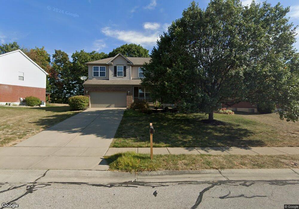
1830 Freedom Trail Independence, KY 41051
Estimated Value: $406,000 - $441,000
4
Beds
3
Baths
3,060
Sq Ft
$139/Sq Ft
Est. Value
About This Home
This home is located at 1830 Freedom Trail, Independence, KY 41051 and is currently estimated at $425,868, approximately $139 per square foot. 1830 Freedom Trail is a home located in Kenton County with nearby schools including Kenton Elementary School, Twenhofel Middle School, and Simon Kenton High School.
Ownership History
Date
Name
Owned For
Owner Type
Purchase Details
Closed on
Jun 24, 2008
Sold by
The Ryland Group Inc
Bought by
Roberts Troy and Roberts Jennifer
Current Estimated Value
Home Financials for this Owner
Home Financials are based on the most recent Mortgage that was taken out on this home.
Original Mortgage
$195,150
Outstanding Balance
$124,650
Interest Rate
5.96%
Mortgage Type
Purchase Money Mortgage
Estimated Equity
$301,218
Purchase Details
Closed on
Jun 13, 2007
Sold by
Freedom Park Llc
Bought by
The Ryland Group Inc
Create a Home Valuation Report for This Property
The Home Valuation Report is an in-depth analysis detailing your home's value as well as a comparison with similar homes in the area
Home Values in the Area
Average Home Value in this Area
Purchase History
| Date | Buyer | Sale Price | Title Company |
|---|---|---|---|
| Roberts Troy | $216,843 | Imperial Title Services Llc | |
| The Ryland Group Inc | $86,100 | Imperial Title Services Llc |
Source: Public Records
Mortgage History
| Date | Status | Borrower | Loan Amount |
|---|---|---|---|
| Open | Roberts Troy | $195,150 |
Source: Public Records
Tax History Compared to Growth
Tax History
| Year | Tax Paid | Tax Assessment Tax Assessment Total Assessment is a certain percentage of the fair market value that is determined by local assessors to be the total taxable value of land and additions on the property. | Land | Improvement |
|---|---|---|---|---|
| 2024 | $3,455 | $282,000 | $40,000 | $242,000 |
| 2023 | $3,559 | $282,000 | $40,000 | $242,000 |
| 2022 | $3,612 | $282,000 | $40,000 | $242,000 |
| 2021 | $3,666 | $282,000 | $40,000 | $242,000 |
| 2020 | $3,197 | $240,000 | $40,000 | $200,000 |
| 2019 | $3,206 | $240,000 | $40,000 | $200,000 |
| 2018 | $3,223 | $240,000 | $40,000 | $200,000 |
| 2017 | $3,135 | $240,000 | $40,000 | $200,000 |
| 2015 | $3,049 | $240,000 | $42,000 | $198,000 |
| 2014 | $3,006 | $240,000 | $42,000 | $198,000 |
Source: Public Records
Map
Nearby Homes
- 1818 Freedom Trail
- 60 Oby Dr
- 56 Apple Dr
- 10741 Lakefront Cir
- 11553 Allaire Ct
- 11556 Allaire Ct
- 1427 Rosewynne Way
- 1436 Rosewynne Way
- 1455 Thornberry Ct
- 1447 Thornberry Ct
- WEMBLEY Plan at Stonewater
- SARASOTA Plan at Stonewater
- ASHTON Plan at Stonewater
- SAXON Plan at Stonewater
- ALEXANDER Plan at Stonewater
- PARKETTE Plan at Stonewater - Stonewater Reserve
- ATWELL Plan at Stonewater - Stonewater Reserve
- HORIZON Plan at Stonewater - Stonewater Reserve
- BUCHANAN Plan at Stonewater - Stonewater Reserve
- ALDEN Plan at Stonewater - Stonewater Reserve
- 1834 Freedom Trail
- 1826 Freedom Trail
- 1838 Freedom Trail
- 1822 Freedom Trail
- 1831 Freedom Trail
- 1837 Freedom Trail
- 1842 Freedom Trail
- 1819 Freedom Trail
- 1841 Freedom Trail
- 1846 Freedom Trail
- 1814 Freedom Trail
- 1845 Freedom Trail
- 11575 Bunker Hill Ct
- 11574 Bunker Hill Ct
- 1811 Freedom Trail
- 1850 Freedom Trail
- 11574 Saratoga Ct
- 1810 Freedom Trail Unit 4
- 1810 Freedom Trail
- 11571 Bunker Hill Ct