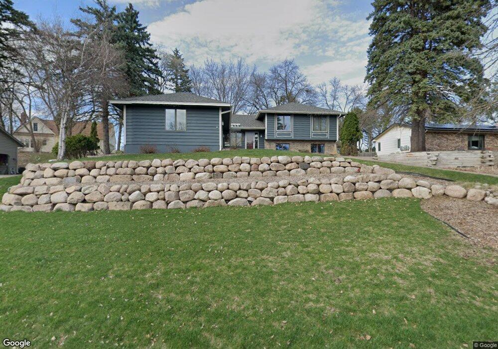
1830 Pheasant Dr Excelsior, MN 55331
Estimated Value: $553,171 - $624,000
4
Beds
3
Baths
1,392
Sq Ft
$418/Sq Ft
Est. Value
About This Home
This home is located at 1830 Pheasant Dr, Excelsior, MN 55331 and is currently estimated at $581,293, approximately $417 per square foot. 1830 Pheasant Dr is a home located in Carver County with nearby schools including Excelsior Elementary School, Minnetonka West Middle School, and Minnetonka Senior High School.
Ownership History
Date
Name
Owned For
Owner Type
Purchase Details
Closed on
May 10, 2021
Sold by
Bonahoom Peter and Bonahoom Lisa
Bought by
Bonahoom Peter and Bonahoom Lisa
Current Estimated Value
Purchase Details
Closed on
Jul 31, 2018
Sold by
Hilgers Kevin G and Hilgers Ann E
Bought by
Bonahoom Peter and Bonahoom Lisa
Home Financials for this Owner
Home Financials are based on the most recent Mortgage that was taken out on this home.
Original Mortgage
$239,900
Interest Rate
4.5%
Mortgage Type
New Conventional
Purchase Details
Closed on
Apr 9, 2014
Sold by
Lubbers Duane A and Lubbers Lois I
Bought by
Hilgers Kevin G and Hilgers Ann E
Home Financials for this Owner
Home Financials are based on the most recent Mortgage that was taken out on this home.
Original Mortgage
$175,000
Interest Rate
4.41%
Mortgage Type
New Conventional
Create a Home Valuation Report for This Property
The Home Valuation Report is an in-depth analysis detailing your home's value as well as a comparison with similar homes in the area
Home Values in the Area
Average Home Value in this Area
Purchase History
| Date | Buyer | Sale Price | Title Company |
|---|---|---|---|
| Bonahoom Peter | -- | None Listed On Document | |
| Bonahoom Peter | $389,900 | Burnet Title | |
| Hilgers Kevin G | $320,000 | Burnet Title |
Source: Public Records
Mortgage History
| Date | Status | Borrower | Loan Amount |
|---|---|---|---|
| Previous Owner | Bonahoom Peter | $239,900 | |
| Previous Owner | Hilgers Kevin G | $175,000 |
Source: Public Records
Tax History Compared to Growth
Tax History
| Year | Tax Paid | Tax Assessment Tax Assessment Total Assessment is a certain percentage of the fair market value that is determined by local assessors to be the total taxable value of land and additions on the property. | Land | Improvement |
|---|---|---|---|---|
| 2025 | $5,062 | $490,200 | $175,800 | $314,400 |
| 2024 | $4,954 | $475,900 | $161,500 | $314,400 |
| 2023 | $4,932 | $475,900 | $161,500 | $314,400 |
| 2022 | $4,616 | $475,800 | $156,000 | $319,800 |
| 2021 | $4,420 | $381,400 | $123,400 | $258,000 |
| 2020 | $4,456 | $377,400 | $123,400 | $254,000 |
| 2019 | $4,280 | $358,200 | $117,500 | $240,700 |
| 2018 | $3,850 | $358,200 | $117,500 | $240,700 |
| 2017 | $3,792 | $322,500 | $106,800 | $215,700 |
| 2016 | $3,914 | $312,200 | $0 | $0 |
| 2015 | $3,648 | $311,700 | $0 | $0 |
| 2014 | $3,648 | $271,600 | $0 | $0 |
Source: Public Records
Map
Nearby Homes
- 1770 Pheasant Cir
- 6456 Yosemite Ln
- 6480 Yosemite
- 2150 Crestview Dr
- 6040 Oakview Ct
- 6140 Chaska Rd
- 6591 Galpin Blvd
- 6430 Bretton Way
- 351 Morse Ave
- 5910 Minnetonka Dr
- 6491 Bretton Way
- 1350 Heather Ct
- 6687 Mulberry Cir E
- 205 Mill St Unit S205
- 7053 Pearl Dr
- 2125 Longacres Dr
- 151 Bell St
- 5800 Echo Rd
- 7266 Fawn Hill Rd
- 126 Courtland St
- 1830 1830 Pheasant Dr
- 1820 Pheasant Dr
- 1840 Pheasant Dr
- 6311 Steller Cir
- 6321 Steller Cir
- 1841 Pheasant Dr
- 1810 Pheasant Dr
- 1820 1820 Ringneck-Drive-
- 1851 Pheasant Dr
- 1851 1851 Pheasant-Drive-
- 1851 1851 Pheasant Dr
- 6301 Steller Cir
- 1820 Ringneck Dr
- 1821 Pheasant Dr
- 1810 Ringneck Dr
- 1800 Pheasant Dr
- 6411 White Dove Dr
- 6330 Steller Cir
- 1901 Moline Cir
- 6310 Steller Cir