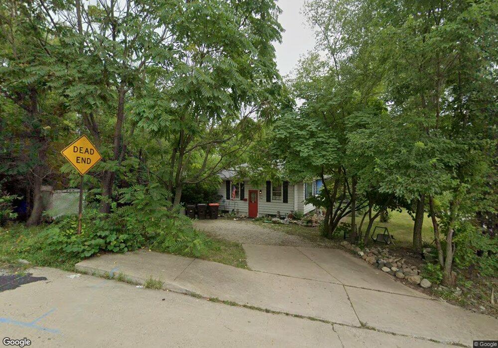
1830 W High St Peoria, IL 61606
West Bluff NeighborhoodEstimated Value: $55,776 - $103,000
4
Beds
1
Bath
790
Sq Ft
$89/Sq Ft
Est. Value
About This Home
This home is located at 1830 W High St, Peoria, IL 61606 and is currently estimated at $70,194, approximately $88 per square foot. 1830 W High St is a home with nearby schools including Whittier Primary School, Harold B. Dawson Jr. Middle School, and Manual High School.
Ownership History
Date
Name
Owned For
Owner Type
Purchase Details
Closed on
Sep 27, 2024
Sold by
Mitchell Jesse S and Armich Daniel M
Bought by
Whiskey City Llc and Whiskey City Rentals Llc
Current Estimated Value
Home Financials for this Owner
Home Financials are based on the most recent Mortgage that was taken out on this home.
Original Mortgage
$1,159,481
Outstanding Balance
$973,886
Interest Rate
6.46%
Mortgage Type
New Conventional
Estimated Equity
-$903,692
Purchase Details
Closed on
Jun 8, 2021
Sold by
Amato Dintini Famiglia Trust
Bought by
Armich Daniel and Mitchell Jesse
Home Financials for this Owner
Home Financials are based on the most recent Mortgage that was taken out on this home.
Original Mortgage
$90,400
Interest Rate
2.9%
Mortgage Type
New Conventional
Create a Home Valuation Report for This Property
The Home Valuation Report is an in-depth analysis detailing your home's value as well as a comparison with similar homes in the area
Home Values in the Area
Average Home Value in this Area
Purchase History
| Date | Buyer | Sale Price | Title Company |
|---|---|---|---|
| Whiskey City Llc | -- | None Listed On Document | |
| Armich Daniel | $113,000 | None Listed On Document |
Source: Public Records
Mortgage History
| Date | Status | Borrower | Loan Amount |
|---|---|---|---|
| Open | Whiskey City Llc | $1,159,481 | |
| Previous Owner | Armich Daniel | $90,400 |
Source: Public Records
Tax History Compared to Growth
Tax History
| Year | Tax Paid | Tax Assessment Tax Assessment Total Assessment is a certain percentage of the fair market value that is determined by local assessors to be the total taxable value of land and additions on the property. | Land | Improvement |
|---|---|---|---|---|
| 2024 | $1,021 | $11,290 | $1,130 | $10,160 |
| 2023 | $876 | $9,310 | $1,020 | $8,290 |
| 2022 | $708 | $7,340 | $850 | $6,490 |
| 2021 | $695 | $6,990 | $810 | $6,180 |
| 2020 | $693 | $6,920 | $800 | $6,120 |
| 2019 | $703 | $7,060 | $820 | $6,240 |
| 2018 | $698 | $7,170 | $870 | $6,300 |
| 2017 | $698 | $7,240 | $880 | $6,360 |
| 2016 | $679 | $7,240 | $880 | $6,360 |
| 2015 | $768 | $7,100 | $860 | $6,240 |
| 2014 | $768 | $8,340 | $880 | $7,460 |
| 2013 | -- | $8,440 | $890 | $7,550 |
Source: Public Records
Map
Nearby Homes
- 120 S Cedar Ave
- 1637 W Moss Ave
- 1605 W Martin St
- 2027 W Sherman Ave
- 1801 W Ayres Ave
- 1622 W Callender Ave
- 2321 W Manor Pkwy
- 2115 W Kellogg Ave
- 1808 W Fredonia Ave
- 2316 W Ayres Ave
- 2011 W Barker Ave
- 1503 W Callender Ave
- 1412 W Butler St
- 1512 W Millman St
- 125 S Steubenville St
- 1300 W Martin St
- 2309 W Kellogg Ave
- 1302 W Butler St
- 1203 W Butler St
- 801 S Warren St
- 106 N Western Ave
- 1827 Martin Luther King jr Dr
- 1820 W High St
- 1825 Martin Luther King jr Dr
- 108 N Western Ave
- 1819 W High St
- 1816 W High St
- 1819 Martin Luther King jr Dr
- 1815 Martin Luther King jr Dr
- 1815 W High St
- 1815 W Martin Luther King Junior Dr
- 117 N Western Ave
- 120 N Western Ave
- 1811 W High St
- 106 S Arthur Ave
- 1916 W Manor Pkwy
- 1811 Martin Luther King jr Dr
- 110 S Arthur Ave
- 1836 W Moss Ave
- 1812 Martin Luther King jr Dr