Estimated Value: $328,784 - $374,000
3
Beds
2
Baths
3,350
Sq Ft
$104/Sq Ft
Est. Value
About This Home
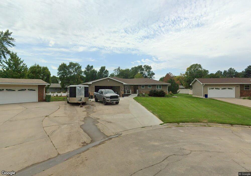
This home is located at 1831 Dexter Ct, Huron, SD 57350 and is currently estimated at $349,946, approximately $104 per square foot. 1831 Dexter Ct is a home located in Beadle County with nearby schools including Huron High School, Holy Trinity Catholic Elementary School, and James Valley Christian School.
Ownership History
Date
Name
Owned For
Owner Type
Purchase Details
Closed on
May 2, 2009
Sold by
Kluth David W and Kluth Rose A
Bought by
Nelson Hartman Megan B and Hartman Shane M
Current Estimated Value
Home Financials for this Owner
Home Financials are based on the most recent Mortgage that was taken out on this home.
Original Mortgage
$18,900
Outstanding Balance
$11,877
Interest Rate
4.83%
Mortgage Type
Future Advance Clause Open End Mortgage
Estimated Equity
$338,069
Create a Home Valuation Report for This Property
The Home Valuation Report is an in-depth analysis detailing your home's value as well as a comparison with similar homes in the area
Home Values in the Area
Average Home Value in this Area
Purchase History
| Date | Buyer | Sale Price | Title Company |
|---|---|---|---|
| Nelson Hartman Megan B | -- | Huron Title | |
| Nelson Hartman Megan B | -- | Huron Title |
Source: Public Records
Mortgage History
| Date | Status | Borrower | Loan Amount |
|---|---|---|---|
| Open | Nelson Hartman Megan B | $18,900 | |
| Closed | Nelson Hartman Megan B | $18,900 | |
| Open | Nelson Hartman Megan B | $151,200 | |
| Closed | Nelson Hartman Megan B | $151,200 |
Source: Public Records
Tax History
| Year | Tax Paid | Tax Assessment Tax Assessment Total Assessment is a certain percentage of the fair market value that is determined by local assessors to be the total taxable value of land and additions on the property. | Land | Improvement |
|---|---|---|---|---|
| 2025 | $5,180 | $329,902 | $19,790 | $310,112 |
| 2024 | $5,327 | $315,135 | $19,790 | $295,345 |
| 2023 | $4,341 | $301,071 | $19,790 | $281,281 |
| 2022 | $4,341 | $233,408 | $19,790 | $213,618 |
| 2021 | $4,303 | $233,408 | $19,790 | $213,618 |
| 2020 | $4,174 | $233,408 | $19,790 | $213,618 |
| 2019 | $4,230 | $223,394 | $19,790 | $203,604 |
| 2018 | -- | $223,394 | $19,790 | $203,604 |
| 2017 | -- | $223,394 | $19,790 | $203,604 |
| 2016 | -- | $213,699 | $19,790 | $193,909 |
| 2015 | -- | $216,478 | $19,790 | $196,688 |
| 2014 | -- | $216,478 | $19,790 | $196,688 |
| 2013 | -- | $203,611 | $19,790 | $183,821 |
Source: Public Records
Map
Nearby Homes
- 540 18th St SW
- 1980 Meadowlark Ln Unit 302
- 0 Lot 7 Blk 1 McDonald Dr
- 0 Lot 6 Blk 1 McDonald Dr
- 0 Lot 10 Blk 1 McDonald Dr
- 1980 Illinois Ave SW
- 0 Lot 6 Blk 2 McDonald Dr
- 0 Lot 7 Blk 2 McDonald Dr
- 2405 Prairie Eagle Cir
- 0 S Dakota 37
- 0 Prairie Eagle Cir Unit 25-2
- 1810 Kansas Ave
- 69 21st St SE
- 1949 Lampert Dr
- 280 20th St
- 1776 Idaho Ave SE
- 679 10th St SW
- 0 24th St St
- 1865 Utah Ave SE
- 0 21st St Unit 25-140
- 1836 Dexter Ct
- 1919 McDonald Dr
- 1877 McDonald Dr
- 1876 Dexter Ct
- 1925 McDonald Dr
- 1825 Dexter Ct
- 1860 Robin Ct
- 1850 Robin Ct
- 612 18th St SW
- 620 18th St SW
- 1805 Dexter Ct
- 1849 McDonald Dr
- 1939 McDonald Dr
- 626 18th St SW
- 1906 Cardinal Ln
- 1835 McDonald Dr
- 1914 McDonald Dr
- 1920 McDonald Dr
- 1920 Cardinal Ln
- 1880 Cardinal Ln
Your Personal Tour Guide
Ask me questions while you tour the home.