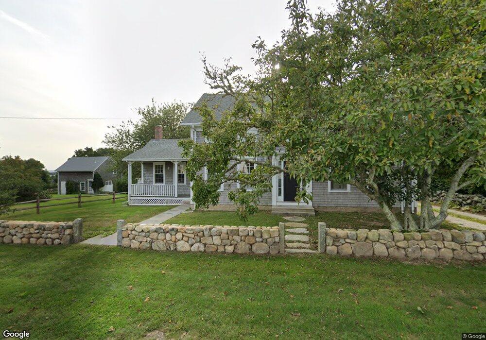
1831 Main Rd Westport Point, MA 02791
Westport Point NeighborhoodEstimated Value: $1,009,000 - $1,452,000
3
Beds
--
Bath
1,836
Sq Ft
$662/Sq Ft
Est. Value
About This Home
This home is located at 1831 Main Rd, Westport Point, MA 02791 and is currently estimated at $1,215,457, approximately $662 per square foot. 1831 Main Rd is a home with nearby schools including Alice A. Macomber Primary School, Westport Elementary School, and Westport Middle-High School.
Ownership History
Date
Name
Owned For
Owner Type
Purchase Details
Closed on
Jul 8, 2016
Sold by
Kennedy Mary E
Bought by
Mary Ellen Kennedy T
Current Estimated Value
Purchase Details
Closed on
Jun 28, 2006
Sold by
Sears Carolyn E and Swanzey Gregg H
Bought by
Kennedy Mary E and Sears Carolyn E
Purchase Details
Closed on
Jun 10, 1996
Sold by
Errington Joseph and Errington Frances C
Bought by
Swanzey Gregg H and Sears Carolyn E
Home Financials for this Owner
Home Financials are based on the most recent Mortgage that was taken out on this home.
Original Mortgage
$201,000
Interest Rate
7.89%
Mortgage Type
Purchase Money Mortgage
Create a Home Valuation Report for This Property
The Home Valuation Report is an in-depth analysis detailing your home's value as well as a comparison with similar homes in the area
Home Values in the Area
Average Home Value in this Area
Purchase History
| Date | Buyer | Sale Price | Title Company |
|---|---|---|---|
| Mary Ellen Kennedy T | -- | -- | |
| Mary Ellen Kennedy T | -- | -- | |
| Kennedy Mary E | $679,000 | -- | |
| Kennedy Mary E | $679,000 | -- | |
| Swanzey Gregg H | $225,000 | -- | |
| Swanzey Gregg H | $225,000 | -- |
Source: Public Records
Mortgage History
| Date | Status | Borrower | Loan Amount |
|---|---|---|---|
| Previous Owner | Swanzey Gregg H | $210,500 | |
| Previous Owner | Swanzey Gregg H | $210,000 | |
| Previous Owner | Swanzey Gregg H | $201,000 |
Source: Public Records
Tax History Compared to Growth
Tax History
| Year | Tax Paid | Tax Assessment Tax Assessment Total Assessment is a certain percentage of the fair market value that is determined by local assessors to be the total taxable value of land and additions on the property. | Land | Improvement |
|---|---|---|---|---|
| 2025 | $6,705 | $900,000 | $610,400 | $289,600 |
| 2024 | $6,325 | $818,200 | $532,600 | $285,600 |
| 2023 | $6,055 | $742,000 | $476,000 | $266,000 |
| 2022 | $5,386 | $635,200 | $425,900 | $209,300 |
| 2021 | $4,977 | $577,400 | $370,100 | $207,300 |
| 2020 | $4,743 | $562,600 | $355,300 | $207,300 |
| 2019 | $4,465 | $539,900 | $338,900 | $201,000 |
| 2018 | $5,077 | $621,400 | $364,200 | $257,200 |
| 2017 | $4,901 | $614,900 | $364,200 | $250,700 |
| 2016 | $4,816 | $608,800 | $364,200 | $244,600 |
| 2015 | $4,575 | $576,900 | $375,900 | $201,000 |
Source: Public Records
Map
Nearby Homes
- 1881 Main Rd
- 1749 Main Rd
- 1702J Drift Rd
- 1702 Drift Rd
- 1580 Main Rd
- 0 Reed Rd (Ss)
- 1346 Main Rd Unit B
- 99 Sylvia Ln
- 19 Seabury Ln
- 189 Brayton Point Rd
- 255 John Dyer Rd
- 304 Brayton Point Rd
- 225 Hixbridge Rd
- 238-242 E Beach Rd
- 920 Drift Rd
- 245 John Dyer Rd
- 17 Quail Trail
- Lot 2 Horseneck Rd
- 101 Adamsville Rd
- 837 Main Rd
- 1847 Main Rd
- 1847 Main Rd Unit VAC RENTAL
- 1847 Main Rd Unit WINTER RENT
- 1835 Main Rd
- 1835 Main Rd
- 1835 Main Road U: Summer Rental
- 1834 Main Rd
- 1823 Main Rd
- 1824 Main Rd
- 1819 Main Rd
- 1838 Main Rd
- 1818 Main Rd
- 1847 Main Rd
- 2 Fairview Ave
- 1846 Main Rd
- 1815 Main Rd
- 1814 Main Rd
- 1800 Main Rd
- 21 Cape Bial Ln
- 1853 Main Rd