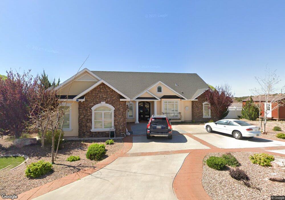
1831 Prairie Rd Snowflake, AZ 85937
Estimated Value: $576,000 - $718,000
4
Beds
4
Baths
3,381
Sq Ft
$190/Sq Ft
Est. Value
About This Home
This home is located at 1831 Prairie Rd, Snowflake, AZ 85937 and is currently estimated at $643,683, approximately $190 per square foot. 1831 Prairie Rd is a home located in Navajo County with nearby schools including Highland Primary School, Snowflake Intermediate School, and Snowflake Junior High School.
Ownership History
Date
Name
Owned For
Owner Type
Purchase Details
Closed on
Nov 22, 2005
Sold by
Armel Land Investors Llc
Bought by
Smith Roger G and Smith Sharleen
Current Estimated Value
Home Financials for this Owner
Home Financials are based on the most recent Mortgage that was taken out on this home.
Original Mortgage
$46,260
Outstanding Balance
$25,393
Interest Rate
6.07%
Mortgage Type
Seller Take Back
Estimated Equity
$618,290
Create a Home Valuation Report for This Property
The Home Valuation Report is an in-depth analysis detailing your home's value as well as a comparison with similar homes in the area
Home Values in the Area
Average Home Value in this Area
Purchase History
| Date | Buyer | Sale Price | Title Company |
|---|---|---|---|
| Smith Roger G | $51,400 | Transnation Title |
Source: Public Records
Mortgage History
| Date | Status | Borrower | Loan Amount |
|---|---|---|---|
| Open | Smith Roger G | $46,260 |
Source: Public Records
Tax History Compared to Growth
Tax History
| Year | Tax Paid | Tax Assessment Tax Assessment Total Assessment is a certain percentage of the fair market value that is determined by local assessors to be the total taxable value of land and additions on the property. | Land | Improvement |
|---|---|---|---|---|
| 2026 | $1,717 | -- | -- | -- |
| 2025 | $1,669 | $52,793 | $3,030 | $49,763 |
| 2024 | $1,781 | $52,752 | $2,978 | $49,774 |
| 2023 | $1,669 | $43,678 | $2,739 | $40,939 |
| 2022 | $1,781 | $0 | $0 | $0 |
| 2021 | $1,932 | $0 | $0 | $0 |
| 2020 | $1,943 | $0 | $0 | $0 |
| 2019 | $1,905 | $0 | $0 | $0 |
| 2018 | $1,846 | $0 | $0 | $0 |
| 2017 | $1,803 | $0 | $0 | $0 |
| 2016 | $1,847 | $0 | $0 | $0 |
| 2015 | $1,621 | $19,942 | $2,300 | $17,642 |
Source: Public Records
Map
Nearby Homes
- 1705 W Western Dove Dr
- 1738 W 7th St S
- 1788 W Stagecoach Ln
- 1778 W Stagecoach Ln
- 2174 W Antelope
- 362 S Pioneer Trail
- 1479 W Tumbleweed Trail
- Lot 27 S Temple Cir
- 411 Hillcrest Dr
- 2267 W Heritage Dr
- 1415 W Tumbleweed Trail
- 305 W Vista Dr
- 1403 Lobo Trail
- 1676 W Quarter Horse Dr
- 1717 Sand Trap Ln
- 1362 Lobo Trail
- 261 S Cedar Dr
- 2115 W Cedar Crest Dr
- 0 W Cedar Crest Dr
- 2642 W Foothill Cir Unit 13
- 1853 Prairie Rd Unit LOT 172, FRONTIER ES
- 1813 Prairie Rd
- 1836 W 7th St S
- Lot # 197 W 7th St S
- 1818 W 7th St S
- 1869 Prairie Rd
- 1868 W 7th St S
- 1787 Prairie Rd
- Lot 131 Prairie Rd
- 1887 Prairie Rd Unit 170
- Lot # 177 Prairie Rd
- Lot 181 Prairie Rd
- Lot 180 Prairie Rd
- Lot 182 Prairie Rd
- XXXX W Western Dove Dr Unit 116
- 1915 W Western Dove Dr
- 1784 W 7th St S Unit 194
- 1788 Prairie Rd
- 1957 W Western Dove Dr
- 1886 W 7th St S