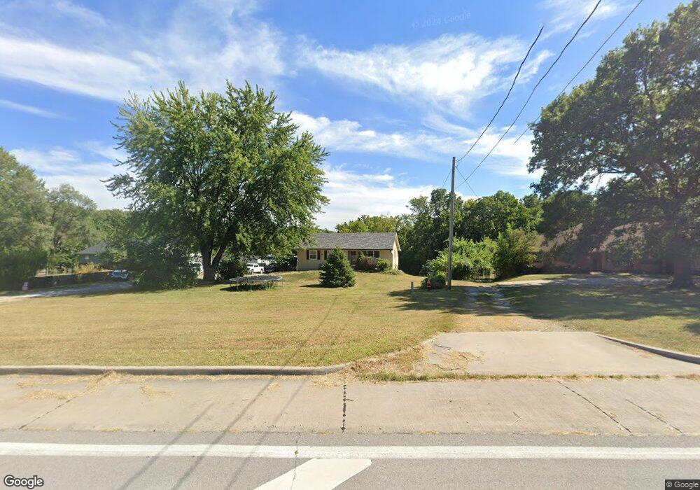
18317 E State Route 78 Independence, MO 64057
Blackburn NeighborhoodEstimated Value: $192,000 - $225,023
3
Beds
1
Bath
1,128
Sq Ft
$184/Sq Ft
Est. Value
About This Home
This home is located at 18317 E State Route 78, Independence, MO 64057 and is currently estimated at $207,506, approximately $183 per square foot. 18317 E State Route 78 is a home located in Jackson County with nearby schools including LITTLE BLUE ELEM., Bridger Middle School, and Pioneer Ridge Middle School.
Ownership History
Date
Name
Owned For
Owner Type
Purchase Details
Closed on
Dec 31, 2024
Sold by
Mclaughlin Elena R
Bought by
Mclaughlin Nicholas L
Current Estimated Value
Purchase Details
Closed on
Apr 14, 2014
Sold by
Miller Sandra L
Bought by
Mclaughlin Nicholas L
Home Financials for this Owner
Home Financials are based on the most recent Mortgage that was taken out on this home.
Original Mortgage
$81,987
Interest Rate
4.34%
Mortgage Type
FHA
Create a Home Valuation Report for This Property
The Home Valuation Report is an in-depth analysis detailing your home's value as well as a comparison with similar homes in the area
Home Values in the Area
Average Home Value in this Area
Purchase History
| Date | Buyer | Sale Price | Title Company |
|---|---|---|---|
| Mclaughlin Nicholas L | -- | None Listed On Document | |
| Mclaughlin Nicholas L | -- | First American Title |
Source: Public Records
Mortgage History
| Date | Status | Borrower | Loan Amount |
|---|---|---|---|
| Previous Owner | Mclaughlin Nicholas L | $81,987 |
Source: Public Records
Tax History Compared to Growth
Tax History
| Year | Tax Paid | Tax Assessment Tax Assessment Total Assessment is a certain percentage of the fair market value that is determined by local assessors to be the total taxable value of land and additions on the property. | Land | Improvement |
|---|---|---|---|---|
| 2025 | $1,601 | $26,572 | $6,924 | $19,648 |
| 2024 | $1,564 | $23,106 | $7,047 | $16,059 |
| 2023 | $1,564 | $23,106 | $1,294 | $21,812 |
| 2022 | $1,544 | $20,900 | $6,223 | $14,677 |
| 2021 | $1,543 | $20,900 | $6,223 | $14,677 |
| 2020 | $1,508 | $19,840 | $6,223 | $13,617 |
| 2019 | $1,484 | $19,840 | $6,223 | $13,617 |
| 2018 | $1,310 | $16,726 | $2,772 | $13,954 |
| 2017 | $1,290 | $16,726 | $2,772 | $13,954 |
| 2016 | $1,290 | $16,307 | $4,305 | $12,002 |
| 2014 | $1,225 | $15,832 | $4,180 | $11,652 |
Source: Public Records
Map
Nearby Homes
- 20100 Missouri 78
- 2316 S Ponca Ave
- 2423 S Ponca Ave
- 2431 S Ponca Ave
- 18205 E 24th Terrace S
- 18120 E 25th Terrace S
- 19105 E 19th Terrace Ct S
- 17904 E Whitney Rd S
- 18608 E 26th Terrace S
- 17824 Greentree Ave
- 1808 S Sioux Ct
- 2616 S Whitney Ave
- 18800 E 28th Terrace S
- 18701 E 28th Terrace S
- 18710 E Truman Rd
- 1910 S Jackson Dr
- 2100 James Downey Rd
- 2320 S Old Mill Ave
- 2901 Tepee Ave
- 2608 Baker Rd
- 18317 E M 78 Hwy
- 18305 Missouri 78
- 18305 E State Rt 78th
- 18405 E 78 Hwy
- 18405 E State Route 78
- 18303 E State Route 78
- 18305 E State Rt 78th N A
- 18409 E State Route 78
- 18409 E M 78 Hwy
- 18501 E State Route 78
- 18400 E State Route 78
- 18507 E State Route 78
- 18404 Holke Rd
- 18610 E State Route 78
- 18509 E 20 Ct
- 18513 E 20 Ct
- 18513 E 20th Street Ct
- 18505 E 20 Ct
- 2201 S Speck Rd
- 18517 E 20 Ct