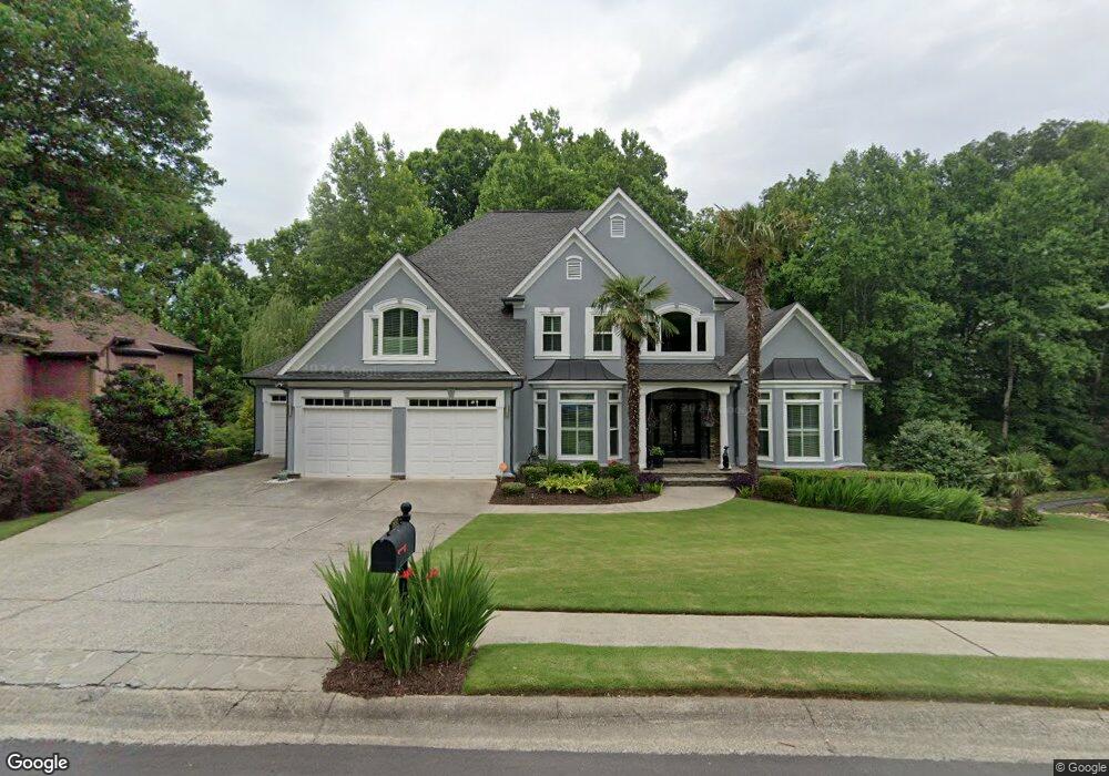
1832 Pemberton Place Unit 2 Marietta, GA 30062
East Cobb NeighborhoodEstimated Value: $1,108,000 - $1,307,000
4
Beds
5
Baths
4,103
Sq Ft
$294/Sq Ft
Est. Value
About This Home
This home is located at 1832 Pemberton Place Unit 2, Marietta, GA 30062 and is currently estimated at $1,207,106, approximately $294 per square foot. 1832 Pemberton Place Unit 2 is a home located in Cobb County with nearby schools including Mount Bethel Elementary School, Dodgen Middle School, and Walton High School.
Ownership History
Date
Name
Owned For
Owner Type
Purchase Details
Closed on
Nov 22, 1996
Sold by
John Wieland Homes Inc
Bought by
Thomas Sylvia L Lonnie M
Current Estimated Value
Purchase Details
Closed on
Aug 13, 1996
Sold by
Stigler John Jane
Bought by
John Wieland Homes Inc
Purchase Details
Closed on
Jun 30, 1995
Sold by
Wieland Homes
Bought by
Stigler John N Jane A
Create a Home Valuation Report for This Property
The Home Valuation Report is an in-depth analysis detailing your home's value as well as a comparison with similar homes in the area
Home Values in the Area
Average Home Value in this Area
Purchase History
| Date | Buyer | Sale Price | Title Company |
|---|---|---|---|
| Thomas Sylvia L Lonnie M | $408,700 | -- | |
| John Wieland Homes Inc | $414,100 | -- | |
| Stigler John N Jane A | $408,400 | -- |
Source: Public Records
Mortgage History
| Date | Status | Borrower | Loan Amount |
|---|---|---|---|
| Closed | Stigler John N Jane A | $0 |
Source: Public Records
Tax History Compared to Growth
Tax History
| Year | Tax Paid | Tax Assessment Tax Assessment Total Assessment is a certain percentage of the fair market value that is determined by local assessors to be the total taxable value of land and additions on the property. | Land | Improvement |
|---|---|---|---|---|
| 2025 | $2,596 | $382,704 | $90,000 | $292,704 |
| 2024 | $2,603 | $382,704 | $90,000 | $292,704 |
| 2023 | $2,397 | $382,704 | $90,000 | $292,704 |
| 2022 | $2,440 | $328,128 | $82,000 | $246,128 |
| 2021 | $2,435 | $326,380 | $84,000 | $242,380 |
| 2020 | $2,435 | $326,380 | $84,000 | $242,380 |
| 2019 | $2,435 | $326,380 | $84,000 | $242,380 |
| 2018 | $2,435 | $326,380 | $84,000 | $242,380 |
| 2017 | $2,052 | $286,936 | $72,000 | $214,936 |
| 2016 | $1,969 | $257,300 | $72,000 | $185,300 |
| 2015 | $2,100 | $257,300 | $72,000 | $185,300 |
| 2014 | $2,135 | $257,300 | $0 | $0 |
Source: Public Records
Map
Nearby Homes
- 4780 Waterhaven Bend
- 2082 Kinsmon Dr
- 4599 Lasalle Ct Unit 8A
- 4789 Waterhaven Bend
- 2100 Stone Hollow Ct
- 4804 Dalhousie Place NE
- 1961 Fields Pond Dr
- 4580 Roswell Rd
- 2281 Fox Hound Pkwy
- 4586 Hunting Hound Ln
- 4871 Karls Gate Dr
- 1804 Shelburne Ridge
- 1929 Fields Pond Glen
- 2269 Chimney Springs Dr
- 4255 Green Ridge Dr
- 2066 Old Forge Way
- 2212 Heritage Trace View
- 1836 Pemberton Place
- 1828 Pemberton Place
- 4657 Newell Dr
- 1825 Pemberton Place Unit 2
- 2028 Winsted Way
- 1840 Pemberton Place Unit 2
- 4655 Newell Dr
- 1824 Pemberton Place Unit II
- 4659 Newell Dr Unit 2
- 4789 Converse Ct
- 0 Converse Ct Unit 7499957
- 0 Converse Ct Unit 7484493
- 0 Converse Ct Unit 7418319
- 0 Converse Ct Unit 7288646
- 0 Converse Ct Unit 7088893
- 0 Converse Ct Unit 8348227
- 0 Converse Ct Unit 7365102
- 4790 Converse Ct
- 4790 Converse Ct Unit U1, 2, 2a
- 4665 Newell Dr