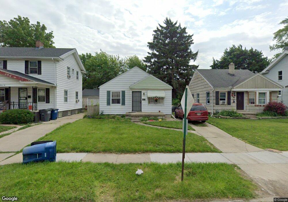
1832 Wyndhurst Rd Toledo, OH 43607
Ottawa NeighborhoodEstimated Value: $82,095 - $101,000
3
Beds
1
Bath
720
Sq Ft
$130/Sq Ft
Est. Value
About This Home
This home is located at 1832 Wyndhurst Rd, Toledo, OH 43607 and is currently estimated at $93,524, approximately $129 per square foot. 1832 Wyndhurst Rd is a home located in Lucas County with nearby schools including Old Orchard Elementary School, Start High School, and Explorers Academy.
Ownership History
Date
Name
Owned For
Owner Type
Purchase Details
Closed on
Apr 5, 2007
Sold by
Tes Rentals Llc
Bought by
Chapman & Eaton Properties Llc
Current Estimated Value
Home Financials for this Owner
Home Financials are based on the most recent Mortgage that was taken out on this home.
Original Mortgage
$106,296
Outstanding Balance
$64,411
Interest Rate
6.19%
Mortgage Type
Purchase Money Mortgage
Estimated Equity
$29,113
Purchase Details
Closed on
Apr 26, 2004
Sold by
Tanner N Daniel and Tanner Susan E
Bought by
Tes Rentals Llc
Purchase Details
Closed on
Aug 15, 2002
Sold by
Wood James A and Wood Elaine
Bought by
Tanner N Daniel and Tanner Susan E
Home Financials for this Owner
Home Financials are based on the most recent Mortgage that was taken out on this home.
Original Mortgage
$55,800
Interest Rate
6.64%
Purchase Details
Closed on
Dec 29, 1989
Sold by
Tillimon Duane J
Create a Home Valuation Report for This Property
The Home Valuation Report is an in-depth analysis detailing your home's value as well as a comparison with similar homes in the area
Home Values in the Area
Average Home Value in this Area
Purchase History
| Date | Buyer | Sale Price | Title Company |
|---|---|---|---|
| Chapman & Eaton Properties Llc | $66,500 | American Title | |
| Tes Rentals Llc | -- | -- | |
| Tanner N Daniel | $62,000 | Metropolitan Title Agency In | |
| -- | $31,900 | -- |
Source: Public Records
Mortgage History
| Date | Status | Borrower | Loan Amount |
|---|---|---|---|
| Open | Chapman & Eaton Properties Llc | $106,296 | |
| Previous Owner | Tanner N Daniel | $55,800 |
Source: Public Records
Tax History Compared to Growth
Tax History
| Year | Tax Paid | Tax Assessment Tax Assessment Total Assessment is a certain percentage of the fair market value that is determined by local assessors to be the total taxable value of land and additions on the property. | Land | Improvement |
|---|---|---|---|---|
| 2024 | $558 | $16,940 | $6,860 | $10,080 |
| 2023 | $927 | $13,195 | $4,970 | $8,225 |
| 2022 | $928 | $13,195 | $4,970 | $8,225 |
| 2021 | $945 | $13,195 | $4,970 | $8,225 |
| 2020 | $938 | $11,410 | $4,270 | $7,140 |
| 2019 | $909 | $11,410 | $4,270 | $7,140 |
| 2018 | $920 | $11,410 | $4,270 | $7,140 |
| 2017 | $930 | $11,130 | $4,165 | $6,965 |
| 2016 | $960 | $31,800 | $11,900 | $19,900 |
| 2015 | $929 | $31,800 | $11,900 | $19,900 |
| 2014 | $720 | $11,140 | $4,170 | $6,970 |
| 2013 | $720 | $11,140 | $4,170 | $6,970 |
Source: Public Records
Map
Nearby Homes
- 1911 Kensington Rd
- 1771 Kensington Rd
- 2019 Kensington Rd
- 1735 Perth St
- 2003 Farnham Rd
- 2127 Perth St
- 2547 Greenway St
- 1423 Roosevelt Ave
- 2041 Richmond Rd
- 1329 Parkside Blvd
- 1723 Potomac Dr
- 2145 Dorr St
- 2310 Goddard Rd
- 2000 Oakwood Ave
- 1513 Waverly Ave
- 1318 Addington Rd
- 1929 Foster Ave
- 2033 Crosswell Place
- 913 Coventry Ave
- 1215 Woodstock Ave
- 1830 Wyndhurst Rd
- 1836 Wyndhurst Rd
- 1824 Wyndhurst Rd
- 1840 Wyndhurst Rd
- 1923 Alvin St
- 1929 Alvin St
- 1921 Alvin St
- 2517 Montebello Rd Unit Lower
- 2517 Montebello Rd Unit Upper
- 1931 Alvin St
- 1820 Wyndhurst Rd
- 1846 Wyndhurst Rd
- 1917 Alvin St
- 1933 Alvin St
- 1827 Wyndhurst Rd
- 2521 Montebello Rd
- 1816 Wyndhurst Rd
- 1915 Alvin St
- 1823 Wyndhurst Rd
- 1939 Alvin St