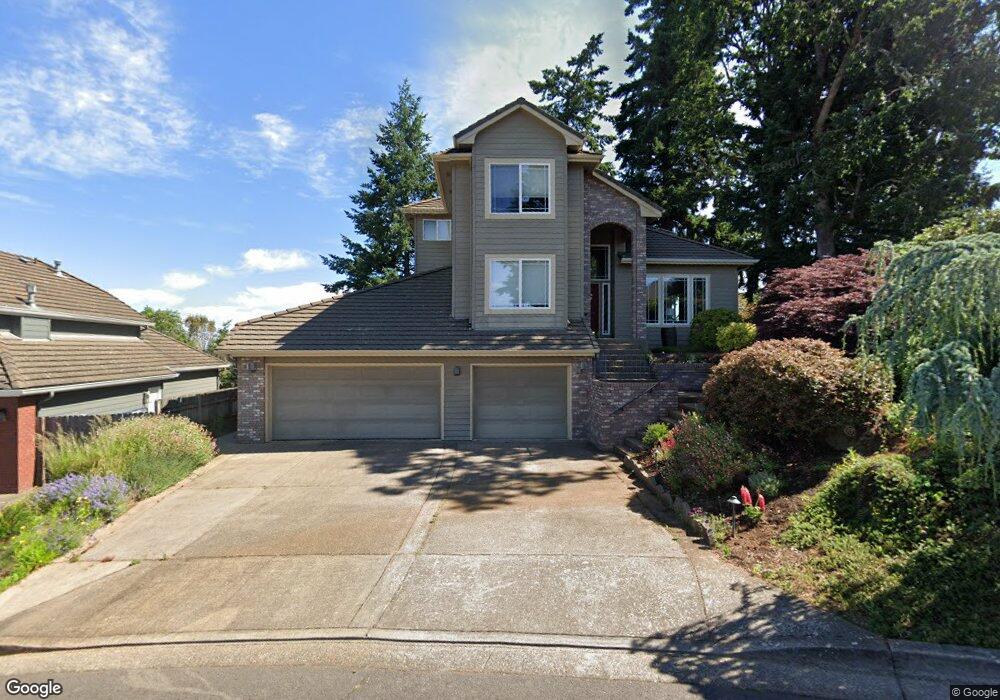
1833 Boulder Ridge Ct NW Salem, OR 97304
West Salem NeighborhoodEstimated Value: $677,681 - $713,000
3
Beds
3
Baths
2,466
Sq Ft
$281/Sq Ft
Est. Value
About This Home
This home is located at 1833 Boulder Ridge Ct NW, Salem, OR 97304 and is currently estimated at $693,420, approximately $281 per square foot. 1833 Boulder Ridge Ct NW is a home located in Polk County with nearby schools including Chapman Hill Elementary School, Straub Middle School, and West Salem High School.
Ownership History
Date
Name
Owned For
Owner Type
Purchase Details
Closed on
Aug 10, 2023
Sold by
Lois E Schrenk Trust and John M Schrenk Trust
Bought by
Jones Alexander and Jones Kathryn M
Current Estimated Value
Home Financials for this Owner
Home Financials are based on the most recent Mortgage that was taken out on this home.
Original Mortgage
$475,000
Outstanding Balance
$463,973
Interest Rate
6.71%
Mortgage Type
New Conventional
Estimated Equity
$229,447
Purchase Details
Closed on
May 8, 2009
Sold by
Schrenk John M and Schrenk Lois E
Bought by
Schrenk John M and Schrenk Lois E
Home Financials for this Owner
Home Financials are based on the most recent Mortgage that was taken out on this home.
Original Mortgage
$195,000
Interest Rate
4.8%
Mortgage Type
New Conventional
Create a Home Valuation Report for This Property
The Home Valuation Report is an in-depth analysis detailing your home's value as well as a comparison with similar homes in the area
Home Values in the Area
Average Home Value in this Area
Purchase History
| Date | Buyer | Sale Price | Title Company |
|---|---|---|---|
| Jones Alexander | $675,000 | Fidelity National Title | |
| Schrenk John M | -- | Fiserv Lending Solutions |
Source: Public Records
Mortgage History
| Date | Status | Borrower | Loan Amount |
|---|---|---|---|
| Open | Jones Alexander | $475,000 | |
| Previous Owner | Schrenk John M | $195,000 |
Source: Public Records
Tax History Compared to Growth
Tax History
| Year | Tax Paid | Tax Assessment Tax Assessment Total Assessment is a certain percentage of the fair market value that is determined by local assessors to be the total taxable value of land and additions on the property. | Land | Improvement |
|---|---|---|---|---|
| 2025 | $8,145 | $445,180 | $69,090 | $376,090 |
| 2024 | $8,145 | $432,220 | $67,070 | $365,150 |
| 2023 | $7,909 | $419,640 | $65,120 | $354,520 |
| 2022 | $7,656 | $407,420 | $63,230 | $344,190 |
| 2021 | $7,437 | $395,560 | $61,390 | $334,170 |
| 2020 | $7,216 | $384,040 | $59,600 | $324,440 |
| 2019 | $6,964 | $372,860 | $57,860 | $315,000 |
| 2018 | $6,849 | $362,000 | $56,170 | $305,830 |
| 2017 | $6,172 | $351,460 | $54,540 | $296,920 |
| 2016 | $6,025 | $341,230 | $52,950 | $288,280 |
| 2015 | $6,076 | $331,300 | $51,410 | $279,890 |
| 2014 | $5,600 | $313,280 | $63,650 | $249,630 |
Source: Public Records
Map
Nearby Homes
- 1842 Boulder Ridge Ct NW
- 1656 Ashland Ct NW
- 1936 Orchard Heights Rd NW
- 1534 Gearhart Ave NW
- 2075 Opaque Ave NW
- 1674 Olympia Ct NW
- 1615 Sisters Ct NW
- 1380 Ranier Loop NW
- 1684 Doaks Ferry Rd NW
- 1929 Ptarmigan St NW
- 1321 Chapman Hill Dr NW
- Parcel 2 2832 Doaks Ferry Rd NW
- 1782 Sunburst Terrace NW
- 2114 Mousebird Ave NW
- 1274 Westbrook Dr NW
- 1735 Misty Place NW
- 0 NW 2nd St
- 1101 Satara Ct NW
- 1242 Goldcrest Ave NW
- 1510 Parkway Dr NW
- 1843 Boulder Ridge Ct NW
- 1651 Snowbird Dr NW
- 1695 Snowbird Dr NW
- 1715 Snowbird Dr NW
- 1675 Snowbird Dr NW
- 1853 Boulder Ridge Ct NW
- 1725 Snowbird Dr NW
- 1813 Boulder Ridge Ct NW
- 1812 Boulder Ridge Ct NW
- 1635 Snowbird Dr NW
- 1660 Mousebird Ave NW
- 1834 Wallowa Ave NW
- 1803 Boulder Ridge Ct NW
- 1620 Mousebird Ave NW
- 1743 Snowbird Ct NW
- 1615 Snowbird Dr NW
- 1740 Snowbird Ct NW
- 1736 Snowbird Dr NW
- 1666 Snowbird Dr NW
- 1593 Snowbird Dr NW