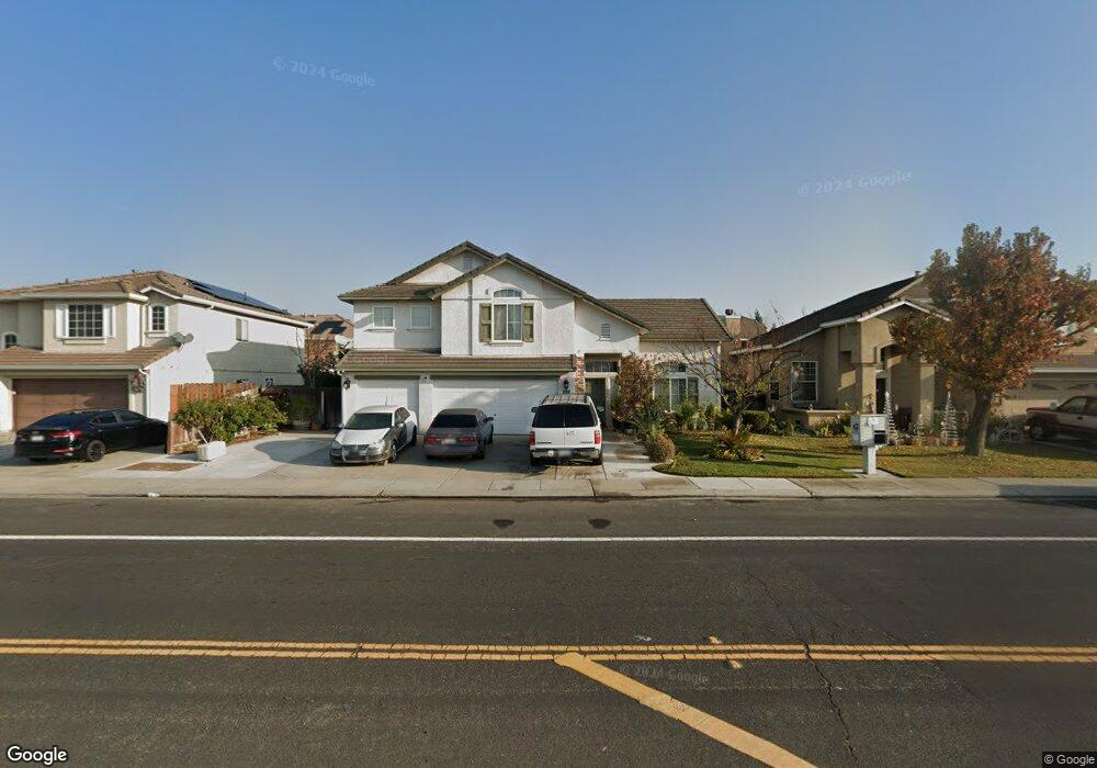
1833 Daniels St Manteca, CA 95337
Estimated Value: $602,000 - $686,000
5
Beds
3
Baths
2,700
Sq Ft
$241/Sq Ft
Est. Value
About This Home
This home is located at 1833 Daniels St, Manteca, CA 95337 and is currently estimated at $650,871, approximately $241 per square foot. 1833 Daniels St is a home located in San Joaquin County with nearby schools including Brock Elliott Elementary School and Sierra High School.
Ownership History
Date
Name
Owned For
Owner Type
Purchase Details
Closed on
Jan 11, 2003
Sold by
Castellanos Maria Delcarmen
Bought by
Delavega Salvador Castellanos
Current Estimated Value
Home Financials for this Owner
Home Financials are based on the most recent Mortgage that was taken out on this home.
Original Mortgage
$248,000
Outstanding Balance
$106,801
Interest Rate
6.15%
Estimated Equity
$544,070
Purchase Details
Closed on
Apr 19, 2001
Sold by
Lopez Diana E Godinez
Bought by
Lopez Miguel Godinez
Home Financials for this Owner
Home Financials are based on the most recent Mortgage that was taken out on this home.
Original Mortgage
$295,875
Interest Rate
6.92%
Mortgage Type
Stand Alone First
Create a Home Valuation Report for This Property
The Home Valuation Report is an in-depth analysis detailing your home's value as well as a comparison with similar homes in the area
Home Values in the Area
Average Home Value in this Area
Purchase History
| Date | Buyer | Sale Price | Title Company |
|---|---|---|---|
| Delavega Salvador Castellanos | -- | Chicago Title Co | |
| Delavega Salvador Castellanos | $310,000 | Chicago Title Co | |
| Lopez Miguel Godinez | -- | First American Title Co | |
| Lopez Miguel Godinez | $296,000 | First American Title Co |
Source: Public Records
Mortgage History
| Date | Status | Borrower | Loan Amount |
|---|---|---|---|
| Open | Delavega Salvador Castellanos | $248,000 | |
| Previous Owner | Lopez Miguel Godinez | $295,875 |
Source: Public Records
Tax History Compared to Growth
Tax History
| Year | Tax Paid | Tax Assessment Tax Assessment Total Assessment is a certain percentage of the fair market value that is determined by local assessors to be the total taxable value of land and additions on the property. | Land | Improvement |
|---|---|---|---|---|
| 2025 | $5,785 | $448,953 | $134,684 | $314,269 |
| 2024 | $5,645 | $440,151 | $132,044 | $308,107 |
| 2023 | $5,577 | $431,521 | $129,455 | $302,066 |
| 2022 | $5,505 | $423,061 | $126,917 | $296,144 |
| 2021 | $5,454 | $414,767 | $124,429 | $290,338 |
| 2020 | $5,264 | $410,515 | $123,154 | $287,361 |
| 2019 | $5,206 | $402,467 | $120,740 | $281,727 |
| 2018 | $5,147 | $394,576 | $118,373 | $276,203 |
| 2017 | $5,084 | $386,840 | $116,052 | $270,788 |
| 2016 | $4,980 | $379,257 | $113,777 | $265,480 |
| 2014 | $4,086 | $310,000 | $93,000 | $217,000 |
Source: Public Records
Map
Nearby Homes
- 1833 Rail St
- 794 S Airport Way
- 1565 Blue Lupine Ln
- 1653 Dairy Ln
- 1602 Oleander Ave
- 1957 W Woodward Ave
- 1676 Red Ribbons Ln
- 1432 Meridian St
- 889 Magrath Ave
- 1730 W Woodward Ave
- 2447 Capri Ct
- 2608 Greenleaf St
- 1444 Hearthsong Dr
- 1435 W Woodward Ave
- 2256 W Yosemite Ave
- Residence 4 Plan at Machado Ranch - Eastwood
- Residence 4 Plan at Machado Ranch - Heston
- Residence 1 Plan at Machado Ranch - Heston
- Residence 3 Plan at Machado Ranch - Eastwood
- Residence 2 Plan at Machado Ranch - Eastwood
- 1825 Daniels St
- 1839 Daniels St
- 1834 Mary Augusta St
- 1826 Mary Augusta St
- 1847 Daniels St
- 1819 Daniels St
- 1840 Mary Augusta St
- 1820 Mary Augusta St
- 1848 Mary Augusta St
- 1853 Daniels St
- 1811 Daniels St
- 1814 Mary Augusta St
- 1856 Mary Augusta St
- 1859 Daniels St
- 1805 Daniels St
- 1835 Mary Augusta St
- 1810 Daniels St
- 1827 Mary Augusta St
- 1806 Mary Augusta St
- 1841 Mary Augusta St