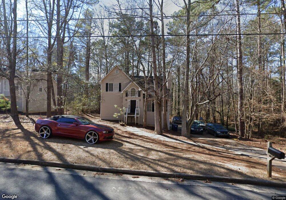
1833 Independence Dr Unit 1 Douglasville, GA 30134
Winston NeighborhoodEstimated Value: $251,000 - $317,000
3
Beds
3
Baths
1,750
Sq Ft
$162/Sq Ft
Est. Value
About This Home
This home is located at 1833 Independence Dr Unit 1, Douglasville, GA 30134 and is currently estimated at $284,029, approximately $162 per square foot. 1833 Independence Dr Unit 1 is a home located in Douglas County with nearby schools including Winston Elementary School, Mason Creek Middle School, and Douglas County High School.
Ownership History
Date
Name
Owned For
Owner Type
Purchase Details
Closed on
Oct 29, 2014
Sold by
Blue Fish Iv Llc
Bought by
Blue Fish Sub Llc
Current Estimated Value
Purchase Details
Closed on
Oct 7, 2014
Sold by
Jackson Michael
Bought by
Blue Fish Iv Llc
Purchase Details
Closed on
Feb 27, 2003
Sold by
Ays Prop Llc
Bought by
Jackson Michael and Jackson Michelle
Home Financials for this Owner
Home Financials are based on the most recent Mortgage that was taken out on this home.
Original Mortgage
$71,500
Interest Rate
5.62%
Mortgage Type
New Conventional
Purchase Details
Closed on
Jul 21, 2000
Sold by
Jackson Michael E and Jackson Michele L
Bought by
Ays Properties Inc
Purchase Details
Closed on
Jul 25, 1994
Sold by
Stanfrord Devel
Bought by
Jackson Michael E and Stanford Michele L
Home Financials for this Owner
Home Financials are based on the most recent Mortgage that was taken out on this home.
Original Mortgage
$86,673
Interest Rate
8.56%
Create a Home Valuation Report for This Property
The Home Valuation Report is an in-depth analysis detailing your home's value as well as a comparison with similar homes in the area
Home Values in the Area
Average Home Value in this Area
Purchase History
| Date | Buyer | Sale Price | Title Company |
|---|---|---|---|
| Blue Fish Sub Llc | -- | -- | |
| Blue Fish Iv Llc | $83,000 | -- | |
| Jackson Michael | -- | -- | |
| Ays Properties Inc | -- | -- | |
| Jackson Michael E | $85,900 | -- |
Source: Public Records
Mortgage History
| Date | Status | Borrower | Loan Amount |
|---|---|---|---|
| Previous Owner | Jackson Michael | $71,500 | |
| Previous Owner | Jackson Michael E | $86,673 |
Source: Public Records
Tax History Compared to Growth
Tax History
| Year | Tax Paid | Tax Assessment Tax Assessment Total Assessment is a certain percentage of the fair market value that is determined by local assessors to be the total taxable value of land and additions on the property. | Land | Improvement |
|---|---|---|---|---|
| 2024 | $3,342 | $104,160 | $19,360 | $84,800 |
| 2023 | $3,342 | $104,160 | $19,360 | $84,800 |
| 2022 | $2,948 | $104,160 | $19,360 | $84,800 |
| 2021 | $2,315 | $69,000 | $16,000 | $53,000 |
| 2020 | $2,308 | $67,920 | $14,040 | $53,880 |
| 2019 | $2,028 | $63,680 | $11,200 | $52,480 |
| 2018 | $1,534 | $55,880 | $10,080 | $45,800 |
| 2017 | $1,445 | $51,520 | $10,920 | $40,600 |
| 2016 | $1,447 | $43,120 | $9,400 | $33,720 |
| 2015 | $1,150 | $33,200 | $7,420 | $25,780 |
| 2014 | $1,024 | $28,800 | $7,000 | $21,800 |
| 2013 | -- | $25,920 | $6,320 | $19,600 |
Source: Public Records
Map
Nearby Homes
- 1837 Independence Dr
- 7683 Franklin Dr
- 1670 Harvest Hill Unit 2
- 1795 Hampton Pass
- 1668 Independence Dr
- 8265 High Point Rd
- 0 Richardson Rd Unit 6979235
- 7780 Poppy Dr
- 0 Brittain Rd Unit 10493602
- 0 Brittain Rd Unit 7552226
- 7911 Conners Rd
- 2771 Mann Rd
- 896 Winn Rd
- 534 Winn Rd
- 1517 Winn Rd
- 170 Sandstone Place
- 580 Bridge Landing
- 156 Brookridge Ct
- 1793 Ragan Rd
- 1785 Ragan Rd
- 1837 Independence Dr Unit 1
- 7729 Saint James Ct
- 7733 Saint James Ct
- 1841 Independence Dr
- 7732 Governors Ln
- 7728 Governors Ln
- 1838 Independence Dr
- 1842 Independence Dr
- 1832 Independence Dr
- 1845 Independence Dr
- 1846 Independence Dr
- 1828 Independence Dr Unit 1
- 1828 Independence Dr
- 0 Saint James Ct Unit 7270195
- 0 Saint James Ct Unit 7213393
- 0 Saint James Ct
- 7730 Saint James Ct
- 7724 Governors Ln Unit 1
- 7734 Saint James Ct
- 7735 Governors Ln Unit 1