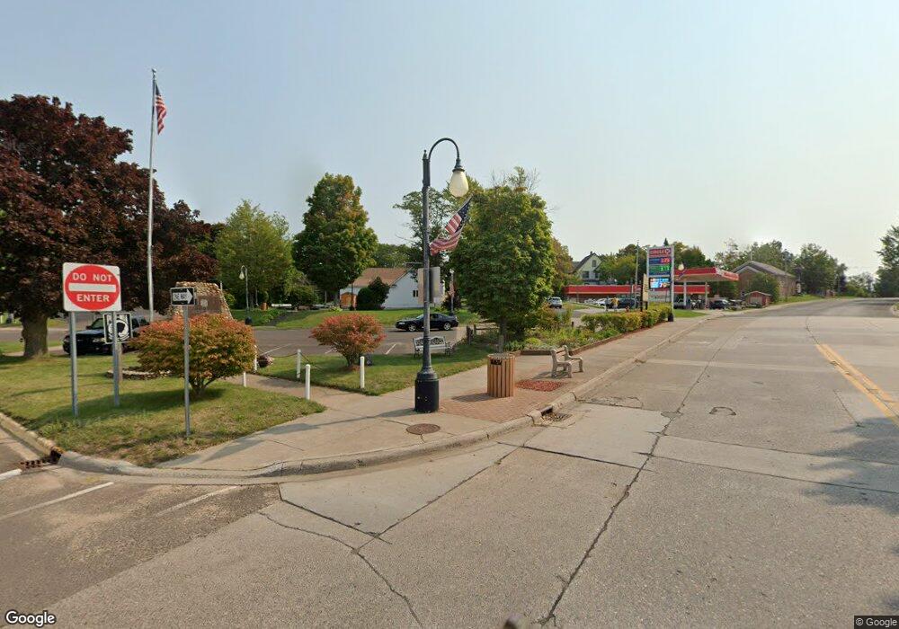
18334 State Highway M38 Ontonagon, MI 49953
--
Bed
--
Bath
3,990
Sq Ft
6.5
Acres
About This Home
This home is located at 18334 State Highway M38, Ontonagon, MI 49953. 18334 State Highway M38 is a home located in Ontonagon County with nearby schools including Ontonagon Area Junior/Senior High School.
Ownership History
Date
Name
Owned For
Owner Type
Purchase Details
Closed on
Aug 20, 2013
Sold by
County Of Ontonagon
Bought by
Smith Scott E and Corpolongo Andrea L
Purchase Details
Closed on
Jan 27, 2012
Sold by
A & E Rentals Llc
Purchase Details
Closed on
Jun 8, 2007
Sold by
Citizen State Bank
Purchase Details
Closed on
Dec 8, 2005
Sold by
Floyd Danny W and Floyd Candy L
Purchase Details
Closed on
Feb 13, 2004
Sold by
Citizens State Bank Of Ontonagon
Bought by
Floyd Danny W and Floyd Candy L
Purchase Details
Closed on
Apr 30, 2002
Sold by
Derke Gary L and Derke Maryam L
Purchase Details
Closed on
Aug 23, 2000
Sold by
Hill Genevieve
Bought by
Derke Gary L and Derke Maryam L
Purchase Details
Closed on
Dec 29, 1995
Sold by
Wirtanen B Evelyn Sur Phelix A
Bought by
Derke Gary L and Derke Maryam L
Create a Home Valuation Report for This Property
The Home Valuation Report is an in-depth analysis detailing your home's value as well as a comparison with similar homes in the area
Home Values in the Area
Average Home Value in this Area
Purchase History
| Date | Buyer | Sale Price | Title Company |
|---|---|---|---|
| Smith Scott E | $50,000 | -- | |
| -- | $103,700 | -- | |
| -- | -- | -- | |
| -- | $124,800 | -- | |
| Floyd Danny W | $25,000 | -- | |
| -- | $140,000 | -- | |
| Derke Gary L | $100 | -- | |
| Derke Gary L | $115,000 | -- |
Source: Public Records
Tax History Compared to Growth
Tax History
| Year | Tax Paid | Tax Assessment Tax Assessment Total Assessment is a certain percentage of the fair market value that is determined by local assessors to be the total taxable value of land and additions on the property. | Land | Improvement |
|---|---|---|---|---|
| 2025 | $713 | $17,800 | $0 | $0 |
| 2024 | $528 | $16,200 | $0 | $0 |
| 2023 | $503 | $15,050 | $0 | $0 |
| 2022 | $479 | $13,750 | $0 | $0 |
| 2021 | $630 | $12,750 | $0 | $0 |
| 2020 | $729 | $14,950 | $0 | $0 |
| 2019 | $736 | $14,950 | $0 | $0 |
| 2018 | -- | $16,350 | $0 | $0 |
| 2017 | -- | $20,450 | $0 | $0 |
| 2016 | -- | $20,200 | $0 | $0 |
| 2015 | -- | $20,200 | $0 | $0 |
| 2014 | -- | $20,200 | $0 | $0 |
| 2013 | -- | $0 | $0 | $0 |
Source: Public Records
Map
Nearby Homes
- 18418 Lakeshore Dr
- 619 N 7th St
- TBD 69 Lakeshore Dr
- 501 Minnesota Ave
- 505 Pennsylvania Ave
- 217 Mulock St
- 110 E River St
- Lot 13 Michigan 64
- 34770 Calumet Rd
- 33309 U S 45
- 40378 Superior Ln
- TBD2 Cedar Balsam Station
- 32432 U S 45
- TBDE10 Firesteel Rd
- TBDC20 Firesteel Rd
- TBDE20 Firesteel Rd
- TBD 67 Lakeshore Dr
- TBD Forest Road 690 Camp
- TBD 42 Lakeshore Dr Unit 42
- TBD 57 Lakeshore Dr Unit 57
- 18260 Firesteel Rd
- 18152 Firesteel Rd
- 18080 Firesteel Rd
- 18360 Firesteel Rd
- 17978 Firesteel Rd
- 18429 Firesteel Rd
- 18369 Firesteel Rd
- 18055 Firesteel Rd
- 18205 Ernest Rd
- 18107 Ernest Rd
- 37454 Strang Rd
- 17476 Firesteel Rd
- 37512 Strang Rd
- 17402 Firesteel Rd
- 19032 Firesteel Rd
- 19316 Firesteel Rd
- 17356 Firesteel Rd
- 36871 Daniels Rd
- 18228 Ernest Rd
- 18426 Ernest Rd
