Estimated Value: $358,000 - $438,000
4
Beds
3
Baths
1,492
Sq Ft
$256/Sq Ft
Est. Value
About This Home
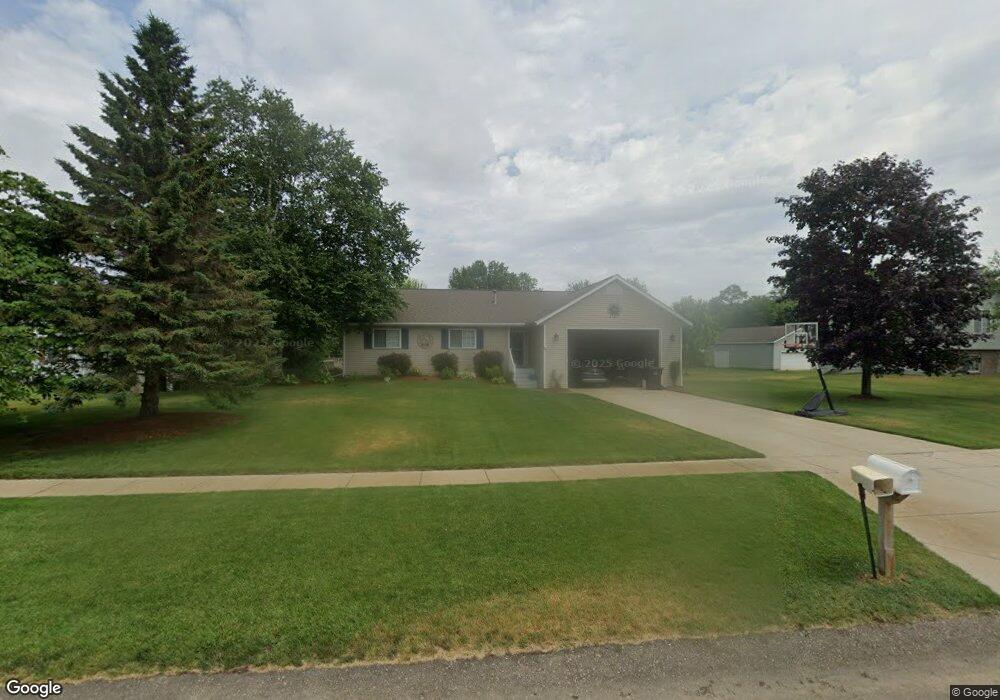
This home is located at 1835 Mercury Ct, Dorr, MI 49323 and is currently estimated at $382,632, approximately $256 per square foot. 1835 Mercury Ct is a home located in Allegan County with nearby schools including Wayland High School, Byron Center Charter School, and St. Stanislaus School.
Ownership History
Date
Name
Owned For
Owner Type
Purchase Details
Closed on
Apr 21, 2014
Sold by
Hudson James and Hudson Sarah
Bought by
Daley Cynthia
Current Estimated Value
Home Financials for this Owner
Home Financials are based on the most recent Mortgage that was taken out on this home.
Original Mortgage
$104,000
Outstanding Balance
$79,267
Interest Rate
4.41%
Mortgage Type
New Conventional
Estimated Equity
$303,365
Purchase Details
Closed on
Mar 11, 2011
Sold by
Judis Mark Allen and Judis Nora R
Bought by
Hudson Michael and Hudson James
Home Financials for this Owner
Home Financials are based on the most recent Mortgage that was taken out on this home.
Original Mortgage
$97,465
Interest Rate
4.87%
Mortgage Type
FHA
Purchase Details
Closed on
Mar 9, 1999
Bought by
Judis Mark Allen and Judis Nora R
Create a Home Valuation Report for This Property
The Home Valuation Report is an in-depth analysis detailing your home's value as well as a comparison with similar homes in the area
Home Values in the Area
Average Home Value in this Area
Purchase History
| Date | Buyer | Sale Price | Title Company |
|---|---|---|---|
| Daley Cynthia | $130,000 | None Available | |
| Hudson Michael | $100,000 | None Available | |
| Judis Mark Allen | $23,900 | -- |
Source: Public Records
Mortgage History
| Date | Status | Borrower | Loan Amount |
|---|---|---|---|
| Open | Daley Cynthia | $104,000 | |
| Previous Owner | Hudson Michael | $97,465 |
Source: Public Records
Tax History Compared to Growth
Tax History
| Year | Tax Paid | Tax Assessment Tax Assessment Total Assessment is a certain percentage of the fair market value that is determined by local assessors to be the total taxable value of land and additions on the property. | Land | Improvement |
|---|---|---|---|---|
| 2025 | $3,187 | $162,200 | $41,000 | $121,200 |
| 2024 | $2,898 | $152,600 | $35,600 | $117,000 |
| 2023 | $2,968 | $132,600 | $32,700 | $99,900 |
| 2022 | $2,898 | $114,700 | $27,900 | $86,800 |
| 2021 | $2,726 | $112,000 | $29,000 | $83,000 |
| 2020 | $2,595 | $108,600 | $26,700 | $81,900 |
| 2019 | $2,595 | $97,500 | $26,700 | $70,800 |
| 2018 | $2,536 | $91,100 | $14,500 | $76,600 |
| 2017 | $0 | $92,900 | $14,500 | $78,400 |
| 2016 | $0 | $77,500 | $14,500 | $63,000 |
| 2015 | -- | $77,500 | $14,500 | $63,000 |
| 2014 | -- | $72,300 | $14,800 | $57,500 |
| 2013 | -- | $65,700 | $14,800 | $50,900 |
Source: Public Records
Map
Nearby Homes
- 1722 144th Ave
- 1341 142nd Ave
- 4159 White Pine Dr
- 4087 Ronalds Rd
- 4101 White Pine Dr Unit 4
- 2081 142nd Ave
- 4312 Woodside Meadow Ct
- 1659 Creek Side Ct
- 10591 Byron Center Ave SW
- Lot 11 Walnut Dale Dr
- 10780 Windward Ave SW
- 10785 Windward Ave SW
- 10725 Windward Ave SW
- 1069 108th St SW
- 10711 Windward Ave SW
- 4351 Hickory View Ct
- 136 100th St SW
- 737 100th St SW
- 4335 Tavistock Dr
- V/L Ivanrest Ave SW
- 1839 Mercury Ct
- 1829 Mercury Ct
- 1834 Pheasant Ridge Dr
- 1830 Pheasant Ridge Dr
- 1838 Pheasant Ridge Dr
- 1845 Mercury Ct
- 1836 Mercury Ct
- 1832 Mercury Ct
- 1842 Pheasant Ridge Dr
- 1825 Mercury Ct
- 1840 Mercury Ct
- 1828 Mercury Ct
- 1849 Mercury Ct
- 1824 Mercury Ct
- 1820 Mercury Ct
- 4340 Saturn Dr
- 1837 Pheasant Ridge Dr
- 1821 Mercury Ct
- 1846 Pheasant Ridge Dr
- 1844 Mercury Ct