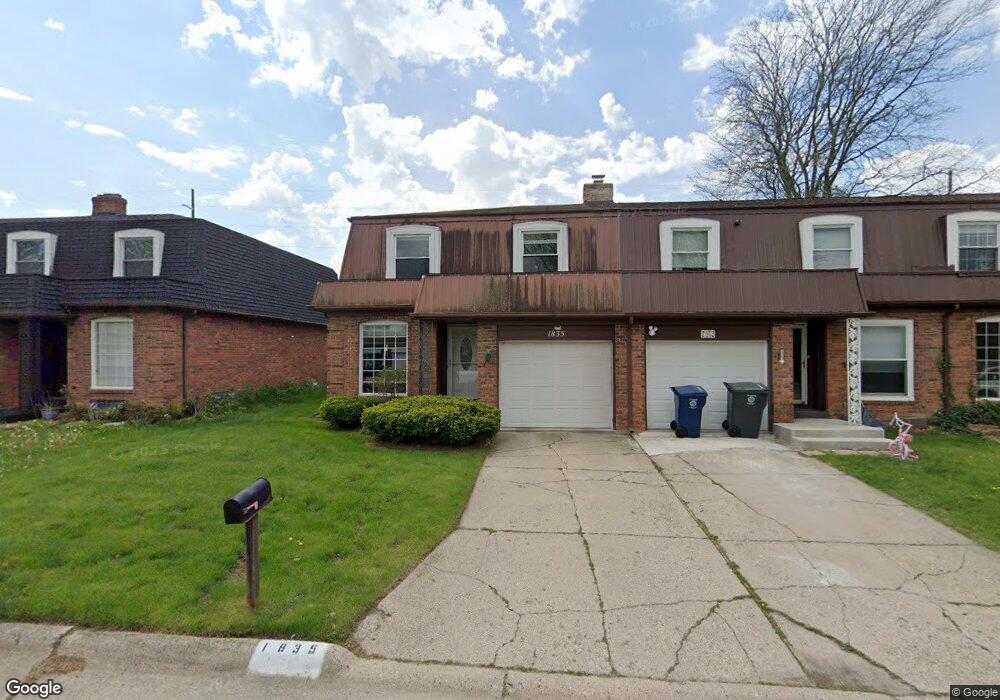
1835 Willowbrook Cir Flint, MI 48507
South Side NeighborhoodEstimated Value: $117,000 - $136,000
3
Beds
3
Baths
1,941
Sq Ft
$65/Sq Ft
Est. Value
About This Home
This home is located at 1835 Willowbrook Cir, Flint, MI 48507 and is currently estimated at $126,680, approximately $65 per square foot. 1835 Willowbrook Cir is a home located in Genesee County with nearby schools including Neithercut Elementary School, Flint Southwestern Classical Academy, and International Academy of Flint (K-12).
Ownership History
Date
Name
Owned For
Owner Type
Purchase Details
Closed on
Oct 3, 2017
Sold by
Hunt Thomas B
Bought by
Hunt Thomas B and Hunt Justin
Current Estimated Value
Purchase Details
Closed on
Mar 1, 2017
Sold by
Hunt Thomas B and Estate Of Peggy Lee Hunt
Bought by
Hunt Thomas S
Purchase Details
Closed on
May 15, 2001
Sold by
Mehl Paul J and The Estate Of Frances A Sherwi
Bought by
Root Peggy L
Home Financials for this Owner
Home Financials are based on the most recent Mortgage that was taken out on this home.
Original Mortgage
$42,000
Outstanding Balance
$15,671
Interest Rate
7.02%
Estimated Equity
$111,009
Create a Home Valuation Report for This Property
The Home Valuation Report is an in-depth analysis detailing your home's value as well as a comparison with similar homes in the area
Home Values in the Area
Average Home Value in this Area
Purchase History
| Date | Buyer | Sale Price | Title Company |
|---|---|---|---|
| Hunt Thomas B | -- | None Available | |
| Hunt Thomas S | -- | None Available | |
| Root Peggy L | $87,000 | First American Title Ins Co |
Source: Public Records
Mortgage History
| Date | Status | Borrower | Loan Amount |
|---|---|---|---|
| Open | Root Peggy L | $42,000 |
Source: Public Records
Tax History
| Year | Tax Paid | Tax Assessment Tax Assessment Total Assessment is a certain percentage of the fair market value that is determined by local assessors to be the total taxable value of land and additions on the property. | Land | Improvement |
|---|---|---|---|---|
| 2025 | $1,344 | $56,600 | $0 | $0 |
| 2024 | $1,205 | $53,400 | $0 | $0 |
| 2023 | $1,176 | $45,600 | $0 | $0 |
| 2022 | $0 | $34,900 | $0 | $0 |
| 2021 | $1,231 | $28,400 | $0 | $0 |
| 2020 | $1,098 | $25,700 | $0 | $0 |
| 2019 | $1,062 | $17,200 | $0 | $0 |
| 2018 | $1,130 | $17,600 | $0 | $0 |
| 2017 | $1,215 | $0 | $0 | $0 |
| 2016 | $1,332 | $0 | $0 | $0 |
| 2015 | -- | $0 | $0 | $0 |
| 2014 | -- | $0 | $0 | $0 |
| 2012 | -- | $28,000 | $0 | $0 |
Source: Public Records
Map
Nearby Homes
- 1741 Carmanbrook Pkwy
- 4101 Greenbrook Ln
- 1814 Carmanbrook Pkwy
- 1818 Rockcreek Ln
- 1902 Rockcreek Ln
- 1933 Greenbriar Ln
- 4202 Park Forest Dr
- 1727 Briarwood Dr
- 1506 Pettibone Ave
- 1826 Greenbrook Ln
- Lot 57 Walnut Creek Dr
- 1413 Lincoln Ave
- 4502 Huckleberry Ln
- 1410 Berrywood Ln
- 1627 Blackberry Ln
- 1225 Waldman Ave
- 1310 Huron St
- 1318 Ingleside Ave
- 1234 Huron St
- 1130 W Atherton Rd
- 1837 Willowbrook Cir
- 1839 Willowbrook Cir
- 1829 Willowbrook Cir
- 1841 Willowbrook Cir
- 1827 Willowbrook Cir
- 1843 Willowbrook Cir
- 1825 Willowbrook Cir
- 1845 Willowbrook Cir
- 1830 Willowbrook Cir
- 1834 Willowbrook Cir
- 1828 Willowbrook Cir
- 1826 Willowbrook Cir
- 1836 Willowbrook Cir
- 1824 Willowbrook Cir
- 1838 Willowbrook Cir
- 1840 Willowbrook Cir
- 1842 Willowbrook Cir
- 1902 Park Forest Dr
- 1844 Willowbrook Cir
- 1906 Park Forest Dr
Your Personal Tour Guide
Ask me questions while you tour the home.