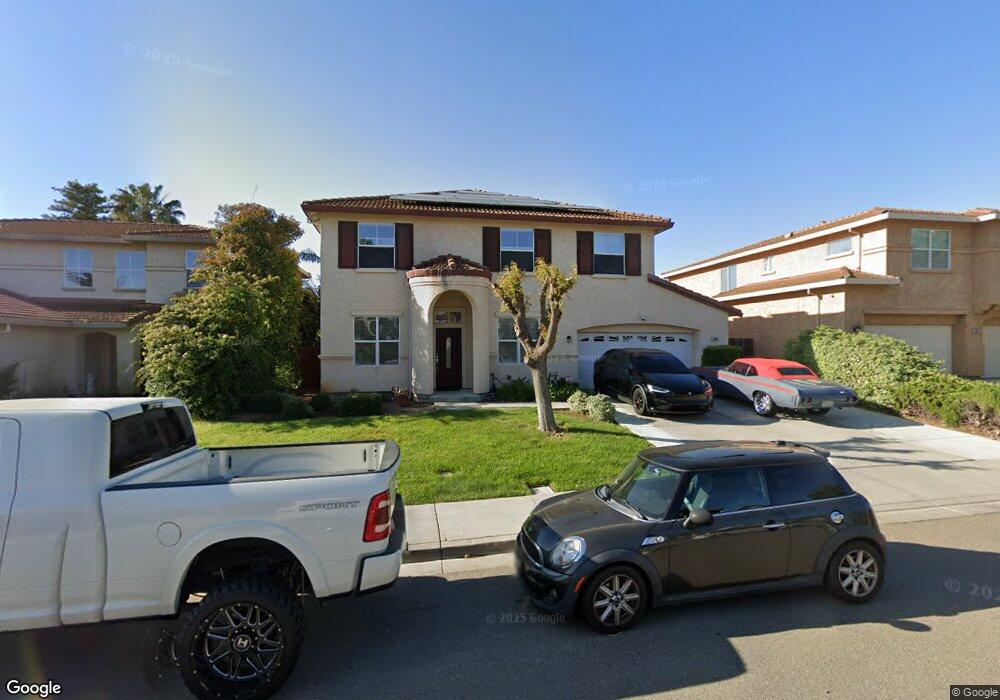
1836 Crown Peak Way Antioch, CA 94531
Lone Tree Valley NeighborhoodEstimated Value: $690,000 - $790,000
4
Beds
3
Baths
2,364
Sq Ft
$310/Sq Ft
Est. Value
About This Home
This home is located at 1836 Crown Peak Way, Antioch, CA 94531 and is currently estimated at $731,702, approximately $309 per square foot. 1836 Crown Peak Way is a home located in Contra Costa County with nearby schools including Lone Tree Elementary School, Dallas Ranch Middle School, and Deer Valley High School.
Ownership History
Date
Name
Owned For
Owner Type
Purchase Details
Closed on
Oct 31, 2019
Sold by
Mcdonald Alexander Ron and Mcdonald Irene
Bought by
Ammons Ceasar Rahsan and Carney Jasmine Nicole
Current Estimated Value
Home Financials for this Owner
Home Financials are based on the most recent Mortgage that was taken out on this home.
Original Mortgage
$484,350
Outstanding Balance
$425,250
Interest Rate
3.5%
Mortgage Type
New Conventional
Estimated Equity
$306,452
Purchase Details
Closed on
Dec 20, 2011
Sold by
Mcdonald Irene and Mcdonald Alexander Ron
Bought by
Mcdonald Alexander Ron and Mcdonald Irene
Home Financials for this Owner
Home Financials are based on the most recent Mortgage that was taken out on this home.
Original Mortgage
$184,000
Interest Rate
3.94%
Mortgage Type
New Conventional
Purchase Details
Closed on
Oct 25, 2010
Sold by
Mcdonald Alexander Ron and Mcdonald Irene
Bought by
Mcdonald Alexander Ron and Mcdonald Irene
Home Financials for this Owner
Home Financials are based on the most recent Mortgage that was taken out on this home.
Original Mortgage
$185,000
Interest Rate
4.33%
Mortgage Type
New Conventional
Purchase Details
Closed on
Dec 9, 2009
Sold by
Mcdonald Alexander and Mcdonald Irene
Bought by
Mcdonald Alexander Ron and Mcdonald Irene
Home Financials for this Owner
Home Financials are based on the most recent Mortgage that was taken out on this home.
Original Mortgage
$177,500
Interest Rate
4.91%
Mortgage Type
New Conventional
Purchase Details
Closed on
Sep 20, 2003
Sold by
Mcdonald Alexander and Mcdonald Irene
Bought by
Mcdonald Alexander Ron and Mcdonald Irene
Purchase Details
Closed on
Jan 21, 2000
Sold by
Black Diamond Knolls Limited
Bought by
Mcdonald Alexander and Mcdonald Irene
Home Financials for this Owner
Home Financials are based on the most recent Mortgage that was taken out on this home.
Original Mortgage
$184,700
Interest Rate
8%
Mortgage Type
Purchase Money Mortgage
Create a Home Valuation Report for This Property
The Home Valuation Report is an in-depth analysis detailing your home's value as well as a comparison with similar homes in the area
Home Values in the Area
Average Home Value in this Area
Purchase History
| Date | Buyer | Sale Price | Title Company |
|---|---|---|---|
| Ammons Ceasar Rahsan | $539,000 | Chicago Title Company | |
| Mcdonald Alexander Ron | -- | Accommodation | |
| Mcdonald Irene | -- | Lsi | |
| Mcdonald Alexander Ron | -- | None Available | |
| Mcdonald Alexander Ron | -- | None Available | |
| Mcdonald Alexander Ron | -- | None Available | |
| Mcdonald Alexander | -- | None Available | |
| Mcdonald Alexander Ron | -- | -- | |
| Mcdonald Alexander | $231,000 | Old Republic Title Company |
Source: Public Records
Mortgage History
| Date | Status | Borrower | Loan Amount |
|---|---|---|---|
| Open | Ammons Ceasar Rahsan | $484,350 | |
| Previous Owner | Mcdonald Irene | $184,000 | |
| Previous Owner | Mcdonald Alexander Ron | $185,000 | |
| Previous Owner | Mcdonald Alexander | $177,500 | |
| Previous Owner | Mcdonald Alexander | $184,700 |
Source: Public Records
Tax History Compared to Growth
Tax History
| Year | Tax Paid | Tax Assessment Tax Assessment Total Assessment is a certain percentage of the fair market value that is determined by local assessors to be the total taxable value of land and additions on the property. | Land | Improvement |
|---|---|---|---|---|
| 2025 | $9,220 | $620,683 | $164,045 | $456,638 |
| 2024 | $8,661 | $608,514 | $160,829 | $447,685 |
| 2023 | $8,661 | $566,583 | $157,676 | $408,907 |
| 2022 | $8,548 | $555,475 | $154,585 | $400,890 |
| 2021 | $8,361 | $544,584 | $151,554 | $393,030 |
| 2019 | $3,942 | $333,275 | $96,439 | $236,836 |
| 2018 | $3,793 | $326,742 | $94,549 | $232,193 |
| 2017 | $3,713 | $320,337 | $92,696 | $227,641 |
| 2016 | $3,619 | $314,057 | $90,879 | $223,178 |
| 2015 | $3,907 | $309,340 | $89,514 | $219,826 |
| 2014 | $4,621 | $303,281 | $87,761 | $215,520 |
Source: Public Records
Map
Nearby Homes
- 1879 Mount Conness Way
- 1928 Badger Pass Way
- 5243 Delta View Way
- 2401 Silveria Way
- 2344 Forty Niner Ct
- 1333 Mokelumne Dr
- 1525 Barkley Mountain Way
- 4604 Coal Hill Place
- 1157 Rockspring Way
- 5488 Southwood Ct
- 5448 Southwood Way
- 2133 Bamboo Way
- 4925 Cache Peak Dr
- 5023 Vesteny Ct
- 4836 Belford Peak Way
- 4528 Fallow Way
- 4959 Star Mine Ct
- 5106 Watkings Way
- 1256 Mokelumne Ct
- 4529 Pronghorn Way
- 1840 Crown Peak Way
- 1832 Crown Peak Way
- 1837 Kern Mountain Way
- 1844 Crown Peak Way
- 1828 Crown Peak Way
- 1841 Kern Mountain Way
- 1833 Kern Mountain Way
- 1829 Kern Mountain Way
- 1835 Crown Peak Way
- 1848 Crown Peak Way
- 1824 Crown Peak Way
- 1839 Crown Peak Way
- 1831 Crown Peak Way
- 1849 Kern Mountain Way
- 1843 Crown Peak Way
- 1827 Crown Peak Way
- 1825 Kern Mountain Way
- 1852 Crown Peak Way
- 1820 Crown Peak Way
- 1847 Crown Peak Way