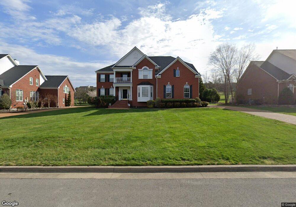
1836 Grey Pointe Dr Brentwood, TN 37027
Estimated Value: $1,478,013 - $1,689,000
--
Bed
5
Baths
4,336
Sq Ft
$372/Sq Ft
Est. Value
About This Home
This home is located at 1836 Grey Pointe Dr, Brentwood, TN 37027 and is currently estimated at $1,614,753, approximately $372 per square foot. 1836 Grey Pointe Dr is a home located in Williamson County with nearby schools including Kenrose Elementary School, Woodland Middle School, and Ravenwood High School.
Ownership History
Date
Name
Owned For
Owner Type
Purchase Details
Closed on
Dec 19, 2003
Sold by
Drees Premier Homes Inc
Bought by
Moore Ronald M and Moore Karen S
Current Estimated Value
Home Financials for this Owner
Home Financials are based on the most recent Mortgage that was taken out on this home.
Original Mortgage
$322,700
Outstanding Balance
$148,906
Interest Rate
5.82%
Mortgage Type
Purchase Money Mortgage
Estimated Equity
$1,465,847
Purchase Details
Closed on
Aug 8, 2003
Sold by
Jsp Properties Inc
Bought by
Drees Premier Homes Inc
Create a Home Valuation Report for This Property
The Home Valuation Report is an in-depth analysis detailing your home's value as well as a comparison with similar homes in the area
Home Values in the Area
Average Home Value in this Area
Purchase History
| Date | Buyer | Sale Price | Title Company |
|---|---|---|---|
| Moore Ronald M | $467,276 | Castleman Title & Escrow Inc | |
| Drees Premier Homes Inc | $1,113,000 | -- |
Source: Public Records
Mortgage History
| Date | Status | Borrower | Loan Amount |
|---|---|---|---|
| Open | Moore Ronald M | $322,700 |
Source: Public Records
Tax History Compared to Growth
Tax History
| Year | Tax Paid | Tax Assessment Tax Assessment Total Assessment is a certain percentage of the fair market value that is determined by local assessors to be the total taxable value of land and additions on the property. | Land | Improvement |
|---|---|---|---|---|
| 2024 | $4,260 | $196,325 | $40,000 | $156,325 |
| 2023 | $4,260 | $196,325 | $40,000 | $156,325 |
| 2022 | $4,199 | $193,500 | $40,000 | $153,500 |
| 2021 | $4,199 | $193,500 | $40,000 | $153,500 |
| 2020 | $4,142 | $160,550 | $33,750 | $126,800 |
| 2019 | $4,142 | $160,550 | $33,750 | $126,800 |
| 2018 | $4,030 | $160,550 | $33,750 | $126,800 |
| 2017 | $3,998 | $160,550 | $33,750 | $126,800 |
| 2016 | $3,950 | $160,550 | $33,750 | $126,800 |
| 2015 | -- | $148,475 | $33,750 | $114,725 |
| 2014 | $626 | $148,475 | $33,750 | $114,725 |
Source: Public Records
Map
Nearby Homes
- 9164 Sydney Ln
- 1931 Parade Dr
- 1852 Traditions Cir
- 1800 Grey Pointe Dr
- 1911 Parade Dr
- 9102 Raindrop Cir
- 1898 Traditions Cir
- 1868 Traditions Cir
- 9479 Helston Ct
- 1851 Barnstaple Ln
- 1885 Barnstaple Ln
- 1884 Barnstaple Ln
- 1824 Barnstaple Ln
- 1807 Morgan Farms Way
- 1761 Charity Dr
- 467 Canterbury Rise
- 1801 Morgan Farms Way
- 1832 Ivy Crest Dr
- 9503 Elgin Way
- 443 Canterbury Rise
- 0 Carnival Dr Unit 1867889
- 1838 Grey Pointe Dr
- 1834 Grey Pointe Dr
- 1840 Grey Pointe Dr
- 1832 Grey Pointe Dr
- 1835 Grey Pointe Dr
- 1833 Grey Pointe Dr
- 1837 Grey Pointe Dr
- 1833 Bronwyn Ct
- 1831 Bronwyn Ct
- 1830 Grey Pointe Dr
- 1831 Grey Pointe Dr
- 1842 Grey Pointe Dr
- 1839 Grey Pointe Dr
- 1836 Bronwyn Ct
- 1829 Bronwyn Ct
- 1841 Grey Pointe Dr
- 1826 Grey Pointe Dr
- 1829 Grey Pointe Dr
- 1827 Bronwyn Ct