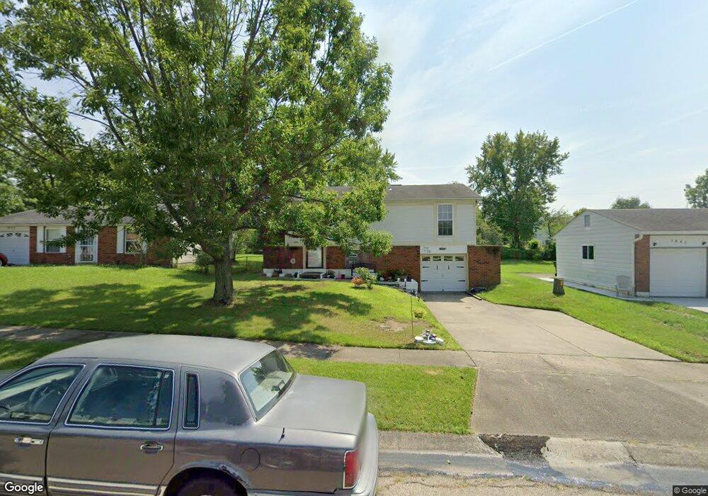
1837 Lincrest Dr Cincinnati, OH 45240
Estimated Value: $192,520 - $226,000
3
Beds
2
Baths
1,186
Sq Ft
$174/Sq Ft
Est. Value
About This Home
This home is located at 1837 Lincrest Dr, Cincinnati, OH 45240 and is currently estimated at $206,630, approximately $174 per square foot. 1837 Lincrest Dr is a home located in Hamilton County with nearby schools including Hamilton County Mathematics and Science Academy, Beautiful Savior Lutheran School, and Calvary Academy- The.
Ownership History
Date
Name
Owned For
Owner Type
Purchase Details
Closed on
Jul 26, 1996
Sold by
Cleary Beatrice A
Bought by
Williams Cynthia A
Current Estimated Value
Home Financials for this Owner
Home Financials are based on the most recent Mortgage that was taken out on this home.
Original Mortgage
$70,800
Outstanding Balance
$3,682
Interest Rate
8.43%
Estimated Equity
$202,948
Create a Home Valuation Report for This Property
The Home Valuation Report is an in-depth analysis detailing your home's value as well as a comparison with similar homes in the area
Home Values in the Area
Average Home Value in this Area
Purchase History
| Date | Buyer | Sale Price | Title Company |
|---|---|---|---|
| Williams Cynthia A | $73,000 | Longworth Title Agency Inc |
Source: Public Records
Mortgage History
| Date | Status | Borrower | Loan Amount |
|---|---|---|---|
| Open | Williams Cynthia A | $70,800 |
Source: Public Records
Tax History
| Year | Tax Paid | Tax Assessment Tax Assessment Total Assessment is a certain percentage of the fair market value that is determined by local assessors to be the total taxable value of land and additions on the property. | Land | Improvement |
|---|---|---|---|---|
| 2025 | $2,665 | $45,287 | $10,707 | $34,580 |
| 2023 | $2,630 | $45,287 | $10,707 | $34,580 |
| 2022 | $1,856 | $24,196 | $5,198 | $18,998 |
| 2021 | $1,813 | $24,196 | $5,198 | $18,998 |
| 2020 | $1,836 | $24,196 | $5,198 | $18,998 |
| 2019 | $2,091 | $24,196 | $5,198 | $18,998 |
| 2018 | $2,096 | $24,196 | $5,198 | $18,998 |
| 2017 | $2,016 | $24,196 | $5,198 | $18,998 |
| 2016 | $2,078 | $24,437 | $5,530 | $18,907 |
| 2015 | $1,968 | $24,437 | $5,530 | $18,907 |
| 2014 | $1,861 | $24,437 | $5,530 | $18,907 |
| 2013 | $1,834 | $25,722 | $5,821 | $19,901 |
Source: Public Records
Map
Nearby Homes
- 1944 Creswell Dr
- 2017 Broadhurst Ave
- 11955 Mill Rd
- 11505 Oxfordshire Ln
- 11537 Norbourne Dr
- 2171 Rangoon Ct
- 1632 Forester Dr
- 11440 Mill Rd
- 11484 Ravensburg Ct
- 1759 John Gray Rd
- 11717 Hamilton Ave
- 1352 Forester Dr
- 1407 Graymont Ct
- 2465 Owlcrest Dr
- 12080 Regency Run Ct Unit 4
- 11565 Regency Square Ct
- 12120 Regency Run Ct
- 1364 Karahill Dr
- 11995 Wincanton Dr
- 12181 Regency Run Ct
- 1833 Lincrest Dr
- 1841 Lincrest Dr
- 1840 Lewiston Ct
- 1845 Lincrest Dr
- 11771 Lassiter Dr
- 11767 Lassiter Dr
- 1836 Lewiston Ct
- 11761 Lassiter Dr
- 1844 Lewiston Ct
- 1849 Lincrest Dr
- 1838 Lincrest Dr
- 1842 Lincrest Dr
- 1834 Lincrest Dr
- 11763 Lassiter Dr
- 1846 Lincrest Dr
- 1848 Lewiston Ct
- 1830 Lincrest Dr
- 1853 Lincrest Dr
- 1833 Lewiston Ct
- 1850 Lincrest Dr
Your Personal Tour Guide
Ask me questions while you tour the home.