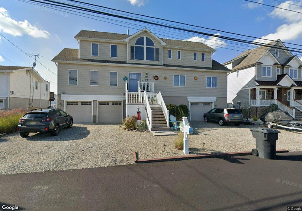
1838 Monitor Dr Toms River, NJ 08753
Estimated Value: $854,000 - $1,461,000
4
Beds
4
Baths
3,976
Sq Ft
$275/Sq Ft
Est. Value
About This Home
This home is located at 1838 Monitor Dr, Toms River, NJ 08753 and is currently estimated at $1,093,593, approximately $275 per square foot. 1838 Monitor Dr is a home located in Ocean County.
Ownership History
Date
Name
Owned For
Owner Type
Purchase Details
Closed on
Jun 16, 2003
Current Estimated Value
Purchase Details
Closed on
Jul 16, 2002
Sold by
Ruggiero Mary
Bought by
Pinto Andrew
Home Financials for this Owner
Home Financials are based on the most recent Mortgage that was taken out on this home.
Original Mortgage
$235,000
Interest Rate
6.58%
Create a Home Valuation Report for This Property
The Home Valuation Report is an in-depth analysis detailing your home's value as well as a comparison with similar homes in the area
Home Values in the Area
Average Home Value in this Area
Purchase History
| Date | Buyer | Sale Price | Title Company |
|---|---|---|---|
| -- | $300,000 | -- | |
| Pinto Andrew | $295,000 | -- |
Source: Public Records
Mortgage History
| Date | Status | Borrower | Loan Amount |
|---|---|---|---|
| Previous Owner | Pinto Andrew | $235,000 |
Source: Public Records
Tax History Compared to Growth
Tax History
| Year | Tax Paid | Tax Assessment Tax Assessment Total Assessment is a certain percentage of the fair market value that is determined by local assessors to be the total taxable value of land and additions on the property. | Land | Improvement |
|---|---|---|---|---|
| 2025 | $14,333 | $787,100 | $285,000 | $502,100 |
| 2024 | $13,625 | $787,100 | $285,000 | $502,100 |
| 2023 | $13,137 | $787,100 | $285,000 | $502,100 |
| 2022 | $13,137 | $787,100 | $285,000 | $502,100 |
| 2021 | $12,730 | $508,200 | $202,500 | $305,700 |
| 2020 | $12,675 | $508,200 | $202,500 | $305,700 |
| 2019 | $12,126 | $508,200 | $202,500 | $305,700 |
| 2018 | $11,963 | $508,200 | $202,500 | $305,700 |
| 2017 | $11,861 | $508,200 | $202,500 | $305,700 |
| 2016 | $11,551 | $508,200 | $202,500 | $305,700 |
| 2015 | $11,114 | $202,500 | $202,500 | $0 |
| 2014 | $4,541 | $218,100 | $202,500 | $15,600 |
Source: Public Records
Map
Nearby Homes
- 1836 Ensign Ct
- 1850 Ensign Ct
- 1145 Kenton Dr
- 8 Pumpshire Rd
- 890 Fairview Dr
- 1939 Ship Ct
- 1943 Pinta Ct
- 2517 Waters Edge Dr Unit 17
- 1916 Waters Edge Dr Unit 16
- 1813 Waters Edge Dr
- 1019 Waters Edge Dr
- 1083 Crystal Dr
- 1214 Waters Edge Dr Unit 14
- 141 Yellowbank Rd
- 169 S Shore Dr
- 5 Dublin Ct
- 1035 Tralee Dr
- 230 Christoffer Terrace
- 1072 Lake Placid Dr
- 1099 Fairview Dr
- 1834 Monitor Dr
- 1842 Monitor Dr
- 1833 Monitor Dr
- 1830 Monitor Dr
- 1846 Monitor Dr
- 1831 Monitor Dr
- 1843 Monitor Dr
- 1832 Capstan Dr
- 1827 Monitor Dr
- 1845 Monitor Dr
- 1825 Capstan Dr
- 1826 Monitor Dr
- 1847 Monitor Dr
- 1828 Capstan Dr
- 1821 Capstan Dr
- 1849 Monitor Dr
- 1823 Monitor Dr
- 1822 Monitor Dr
- 1854 Monitor Dr
- 1824 Capstan Dr